Search
You Searched For
Search Results
- Call Number:
- 1977 +379
- Collection Title:
- Geografia; cioe, Descrittione vniversale della terra. Partita in due volumi, nel primo de' quali si
- Image Count:
- 1
- Alternative Title:
- [Geographia. Italian]
- Subject (Geographic):
- Africa. and Guinea
- Subject (Topic):
- Geography
- Collection Created:
- In Padova, Appresso Paolo, & Francesco Galignani, fratelli, 1620-21 [v.1, 1621]
- Found in:
- Beinecke Rare Book and Manuscript Library > A new map of that part of Africacalled the coast of Guinea ...
- Call Number:
- 1977 Folio 78
- Collection Title:
- A New and accurate chart of the West-India Islands and coast, with the gulf passage through the New
- Image Count:
- 1
- Resource Type:
- Maps, Atlases & Globes
- Alternative Title:
- Petit Guave in the island of Hispaniola, pl. 32
- Subject (Geographic):
- Hispaniola
- Subject (Topic):
- Nautical charts
- Collection Created:
- London, Printed for Robert Sayer and John Bennett, Fleet-Street, 1779
- Found in:
- Beinecke Rare Book and Manuscript Library > A plan of Fort St. Louis harbour on the south side of Hispaniola, pl. 31.
- Call Number:
- 1977 Folio 78
- Collection Title:
- A New and accurate chart of the West-India Islands and coast, with the gulf passage through the New
- Image Count:
- 1
- Resource Type:
- Maps, Atlases & Globes
- Alternative Title:
- Plan of the bay and town of Bayaha or Port Dauphin in the island of Hispaniola, pl. 37.
- Collection Created:
- London, Printed for Robert Sayer and John Bennett, Fleet-Street, 1779
- Found in:
- Beinecke Rare Book and Manuscript Library > A plan of Monte-Christe Bay with the Seven Brothers on the north coast of St. Domingo, pl. 38
- Call Number:
- 1977 Folio 78
- Collection Title:
- A New and accurate chart of the West-India Islands and coast, with the gulf passage through the New
- Image Count:
- 1
- Resource Type:
- Maps, Atlases & Globes
- Alternative Title:
- A plan on the town and harbour of Cap Francois in the island of St. Domingo. pl. 36
- Collection Created:
- London, Printed for Robert Sayer and John Bennett, Fleet-Street, 1779
- Found in:
- Beinecke Rare Book and Manuscript Library > A plan of the road of Port Paix in the island of Hispaniola, pl. 35.
- Call Number:
- 1977 +392
- Collection Title:
- A survey of the cities of London and Westminster : containing the original, antiquity, increase
- Image Count:
- 1
- Description:
- Plate between p. 94-95.
- Subject (Geographic):
- London
- Collection Created:
- London : Printed for A. Churchill, J. Knapton, R. Knaplock, J. Walthoe [and 6 others],
- Found in:
- Beinecke Rare Book and Manuscript Library > Alders Gate Ward and St. Martins le grand liberty taken from the last survey with corrections
- Call Number:
- 1977 +392
- Collection Title:
- A survey of the cities of London and Westminster : containing the original, antiquity, increase
- Image Count:
- 1
- Resource Type:
- Maps, Atlases & Globes
- Description:
- Plate between p. 54-55.
- Subject (Geographic):
- London (England)--History
- Collection Created:
- London : Printed for A. Churchill, J. Knapton, R. Knaplock, J. Walthoe [and 6 others], 1720
- Found in:
- Beinecke Rare Book and Manuscript Library > Aldgate Ward with its division into parishes. Taken from the last survey, with corrections & additions
- Call Number:
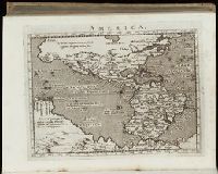
- 1977 1341
- Collection Title:
- Geographiae vniversae opvs habentur Cl. Ptolemaei ... Geographicae enarationis libri octo [tr. by W
- Image Count:
- 1
- Resource Type:
- Books, Journals & Pamphlets
- Subject (Topic):
- Geography--Early works to 1800
- Collection Created:
- Venetiis : Apud Haeredes Simonis Galignani de Karera, 1596
- Found in:
- Beinecke Rare Book and Manuscript Library > America
- Call Number:
- Gfp94 gf525j
- Collection Title:
- Geographiae vniversae ... opvs ... habentur Cl. Ptolemaei ... Geographicae enarrationis libri octo
- Image Count:
- 1
- Resource Type:
- Books, Journals & Pamphlets
- Subject (Topic):
- Geography--Early works to 1800
- Collection Created:
- Venetiis : Apud Haeredes Simonis Galignani de Karera, 1596
- Found in:
- Beinecke Rare Book and Manuscript Library > America
- Creator:
- Jefferys, Thomas, d. 1771
- Call Number:
- C6 033c
- Collection Title:
- The natural and civil history of the French dominions in North and South America : with an
- Image Count:
- 1
- Resource Type:
- Maps, Atlases & Globes
- Description:
- Plate between p. 68-9.
- Subject (Geographic):
- Atlantic Ocean--Charts, maps, etc., Atlantic Ocean--Maps--Early works to 1800, and Santo Domingo (Dominican Republic)
- Collection Created:
- London, Printed for T. Jeffreys, 1761
- Found in:
- Beinecke Rare Book and Manuscript Library > An authentic plan of the town and harbour of Cap Francois in the isle of St. Domingo. By Thomas Jefferys geographer to his Royal Highness the Prince of Wales
- Call Number:
- 1978 +73
- Collection Title:
- The ecclesiastical history of New-England from its first planting in the year 1620 unto the year of
- Image Count:
- 1
- Resource Type:
- Books, Journals & Pamphlets
- Description:
- Verso blank.
- Subject (Geographic):
- New England --Biography, New England --Church history, and New England --History --Colonial period, ca. 1600-1775
- Collection Created:
- London, Printed for Thomas Parkhurst, at the Bible and Three Crowns in Cheapside, 1702
- Found in:
- Beinecke Rare Book and Manuscript Library > An exact mapp of New England and New York