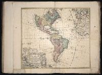
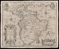
A re-engraved version of a map previously published for Henri Seile in 1652 under the title "Americae descriptio nova" and subsequently re-published from the same engraving as the 1652 map for Phillippi Chetwood in 1666., Appears, and Relief shown pictorially.
Publisher:
Anne Seile],
Subject (Geographic):
America--Maps--Early works to 1800
Subject (Name):
Heylyn, Peter, 1600-1662. Microcosmus, Seile, Anne, d. 1678, and Vaughan, Robert, 17th cent
Library's copy stamped on backing: Yale University Library, Karpinski-Von Wieser Map Collection., Relief shown pictorially., and State 5 (after 1645) with newly engraved sea around embellishments, especially in area found within 10⁰ and 20⁰ S, 240⁰ and 250⁰ lon
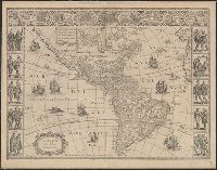
Americae tertia pars memorabilē provinciae Brasiliae historiam continēs ...
Container / Volume:
BRBL_00658
Image Count:
1
Resource Type:
Maps, Atlases & Globes
Description:
In cartouche in lower left: Chorographia nobilis & opulentæ Peruanæ Provinciæq, atque Brasiliae, quas à decimo ad quintum & quinquagesimum feré gradum ultra Aequatorem in longitudinem patere, diligenti observatione deprehensum est: ex Auctorum, qui eas Provincias perlustrarunt, scriptis recens à Theodoro de Bry concinata. Caesarae matis privilegio ad quadriennium MDXCII., In cartouche in lower right: Ex Geograph: calculo tres gradats confici lxxx leucas gallicas, five ccxl. miliaria Italica : singuli ergo gradus fere xxvvc gal., and Relief shown pictorially.
Publisher:
[T. de Bry],
Subject (Geographic):
America--Maps--Early works to 1800 and Western Hemisphere--Maps--Early works to 1800
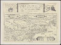
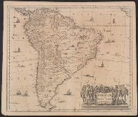
Cross Collection no. 322., From Jan Jansson's Nouvel atlas ou theatre du monde ... Amsterodami : Apud Ioannem Ianssonium, 1647., In French on verso, with caption title "L'Amerique Meridionale" and signature 4L., and Relief shown pictorially.
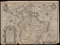
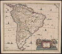
Cross Collection no. 321., From Gerardi Mercatoris atlantis novi ... Amsterodami : Sumptibus & typis aenis Henrici Hondij, 1638., In Latin on verso, with caption title "Descriptio Americae meridionalis" and signature 4Y., and Relief shown pictorially.
Publisher:
Sumptibus Henrici Hondy,
Subject (Geographic):
South America--Maps--Early works to 1800
Subject (Name):
Hondius, Hendrik, 1597-1651 and Mercator, Gerhard, 1512-1594. Atlas
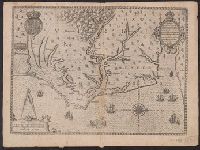
Covers coastal region from Cape Fear to Chesapeake Bay., From Thomas Hariot's A briefe and true report of the new found land of Virginia, 1590., Has watermark., Oriented with north to the right., Pictorial map., Relief shown pictorially and by hachures., and Sheet measures 34 x 46 cm. Cross Collection no. 208.
Publisher:
De Brÿ,
Subject (Geographic):
North Carolina--Maps--Early works to 1800, Roanoke Colony--Maps--Early works to 1800, and Virginia--Maps--Early works to 1800
Subject (Name):
Bry, Theodor de, 1528-1598 and Hariot, Thomas, 1560-1621. Briefe and true report of the new found land of Virginia