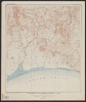
"The base is a copy of a part of chart T of the U.S. Coast and Geodetic Survey, edition of June 1897.", Insets: Trails from tide water to the headwaters of the Yukon River, Alaska--The Klondike gold region, Canada., Published January, 1898., and Relief shown by hachures and spot heights.
Subject (Geographic):
Alaska--Maps
Subject (Name):
U.S. Coast and Geodetic Survey
Subject (Topic):
Coal mines and mining--Alaska--Maps, Gold mines and mining--Alaska--Maps, Mail steamers--Alaska--Maps, and Trails--Alaska--Maps
In two sheets., Includes inset of The Hawaiian Islands., and Relief shown by contours and spot heights; contour interval 40 ft.
Publisher:
Dept. of the Interior, U.S. Geological Survey,
Subject (Geographic):
Hawaii--Oahu and Oahu (Hawaii)--Maps
Subject (Name):
Birdseye, C. H. (Claude Hale), 1878-1941, Davis, Geo. R. (George R.), Fowler, A. T, Hawaii. Territorial Survey., Marshall, R. B. (Robert Bradford), 1867-1949, and U.S. Coast and Geodetic Survey
"Surveyed in 1888-91, 1896, and 1906-1907." and On verso: Jamestown Exposition on Hampton Roads, Virginia : plan of exposition grounds and buildings : progress map, June 1st 1907 / made by W.R. Kelly ; copyright applied for by Jamestown Exposition Co. Scale [ca. 1:6,800]
Publisher:
U.S. Geological Survey,
Subject (Geographic):
Hampton Roads (Va. : Harbor)--Maps, Norfolk Metropolitan Area (Va.)--Maps, Norfolk Metropolitan Area (Va.)--Maps, Topographic, and Norfolk Region (Va.)--Maps, Topographic
Subject (Name):
Jamestown Exposition Co, Jamestown Ter-centennial Exposition--(1907)--Maps, Kelly, W. R. Jamestown Exposition on Hampton Roads, Virginia, and U.S. Coast and Geodetic Survey