
You Searched For
« Previous
| 1 - 10 of 23 |
Next »
Search Results
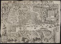

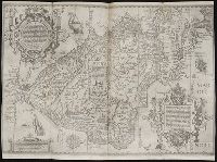
- Call Number:
- Taylor 125
- Collection Title:
- De i commentarii del viaggio in Persia di m. Caterino Zeno il K. & delle guerre fatte nell’ imperio
- Image Count:
- 1
- Alternative Title:
- Carta da navegar de Nicolo et Antonio Zeni furono III Tramontana lano MCCCLXXX
- Description:
- Following p. 58., Map is linen backed., Map paper mutilated at lower right edge of margin revealing linen backing with no loss of text., Scale not given., and Teaching resource: Professor John Mack Faragher, History 141: The American West.
- Subject (Geographic):
- America --Discovery and exploration --Italian --Early works to 1800 and Greenland --Discovery and exploration --Early works to 1800
- Subject (Name):
- Zeno, Antonio, d. ca. 1405, Zeno, Niccolo, 1515-1565, and Zeno, Niccolo, d. ca. 1395
- Collection Created:
- In Venetia : Per Francesco Marcolini,
- Found in:
- Beinecke Rare Book and Manuscript Library > Carta da navegar
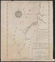
- Creator:
- Keulen, Gerard van
- Published / Created:
- [172-?]
- Call Number:
- 651 172X
- Container / Volume:
- BRBL_00342
- Image Count:
- 1
- Resource Type:
- Maps, Atlases & Globes
- Description:
- "Avec prívílege de nos seigneurs les etats de Holl[ande] et de Westfrise.", French and Dutch, with Portuguese place names., and Indexed.
- Publisher:
- Chez Pierre Mortier libraire sur le Vygen-dam,
- Subject (Geographic):
- Angola--Maps--Early works to 1800
- Subject (Name):
- Mortier, Pierre
- Subject (Topic):
- Coasts--Angola--Maps--Early works to 1800
- Found in:
- Beinecke Rare Book and Manuscript Library > Carte particuliere des costes de l'Afrique, qui comprend une partie de Congo / is nu te bekoomen bÿ Gerard van Keulen, aan ae niewe brugh met privilegie.
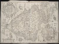
- Creator:
- Langren, Arnold Florent van, 1580-1644
- Published / Created:
- [ca. 1596]
- Call Number:
- Taylor 219
- Collection Title:
- Navigatio ac itinerarivm Iohannis Hvgonis Linscotani in Orientalem sive Lvsitanorvm Indiam
- Image Count:
- 1
- Description:
- [Scale ca. 1:19,000,000]., Bound in following page 36., and Map has significant tears at bottom right and left, as well as a tear along the bottom center fold.
- Subject (Geographic):
- Brazil --Maps --Early works to 1800, Chile --Maps --Early works to 1800, Peru --Maps, and South America --Maps --Early works to 1800
- Subject (Name):
- Claesz, Cornelis, ca. 1546-1609, Elzevier, Gillis, bookseller, and Hendricksz, Aelbrecht, fl. 1573-1605, printer
- Subject (Topic):
- Voyages and travels --Early works to 1800
- Collection Created:
- Hagae-Comitis : Ex officina Alberti Henrici, impensis authoris & Cornelii Nicolai, prostantque apud Aegidium Elseuirum, anno 1599
- Found in:
- Beinecke Rare Book and Manuscript Library > Delineatio omnium orarum totius Australis partis Americae, dictae Peruvianae, a R. de la Plata, Brasiliam, Pariam, & Castellam ...
- Creator:
- Langren, Arnold Florent van, 1580-1644
- Published / Created:
- [ca. 1596]
- Call Number:
- Pequot +L65
- Collection Title:
- Nauigatio ac itinerarium Iohannis Hugonis Linscotani in Orientalem siue Lusitanorum Indiam
- Image Count:
- 1
- Description:
- [Scale ca. 1:19,000,000]., Bound in following page 36., In pencil on bottom left panel of right verso: 36 sec(?) [upside down when unfolded; upright orientation when folded]., In pencil on middle right panel of right verso: 34-2., Map has several small tears now repaired on verso., and Map has two burn holes just to the right of the island of Cuba.
- Subject (Geographic):
- Brazil --Maps --Early works to 1800, Chile --Maps --Early works to 1800, Peru --Maps, and South America --Maps --Early works to 1800
- Subject (Name):
- Claesz, Cornelis, ca. 1546-1609, Elzevier, Gillis, bookseller, and Hendricksz, Aelbrecht, fl. 1573-1605, printer
- Subject (Topic):
- Voyages and travels --Early works to 1800
- Collection Created:
- Hagae-Comitis : Ex officina Alberti Henrici, impensis authoris & Cornelii Nicolai, prostantque apud Aegidium Elseuirum, anno
- Found in:
- Beinecke Rare Book and Manuscript Library > Delineatio omnium orarum totius Australis partis Americae, dictae Peruvianae, a R. de la Plata, Brasiliam, Pariam, & Castellam ...
- Creator:
- Langren, Arnold Florent van, 1580-1644
- Published / Created:
- [1596]
- Call Number:
- Z3 017
- Collection Title:
- ... Iohn Hvighen van Linschoten. his Discours of Voyages into ye Easte & West Indies. Deuided into
- Image Count:
- 1
- Description:
- [Scale ca. 1:19,000,000]., Bound in following p. 216., In ink on verso: "197" in upper left corner, which has also been crossed out in ink with three lines., Map has been repaired with tape on verso., Map has one vertical tear just left of center., Map has several small brown and yellow marks that can be seen mostly on verso., and Map properly belongs to the Dutch edition of 1596.
- Subject (Geographic):
- Brazil --Maps --Early works to 1800, Chile --Maps --Early works to 1800, Cuba --Maps --Early works to 1800, Florida --Maps --Early works to 1800, Peru --Maps --Early works to 1800, South America --Maps --Early works to 1800, Tierra del Fuego (Argentina) --Maps --Early works to 1800, and West Indies --Maps --Early works to 1800
- Subject (Topic):
- Voyages and travels --Early works to 1800
- Collection Created:
- Printed at London by Iohn Wolfe Printer to ye Honorable Cittie of London [1598]
- Found in:
- Beinecke Rare Book and Manuscript Library > Delineatio omnium orarum totius Australis partis Americae, dictae Peruvianae, a R. de la Plata, Brasiliam, Pariam, & Castellam ...
- Creator:
- Langren, Arnold Florent van, 1580-1644
- Published / Created:
- [1596]
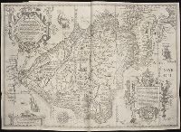
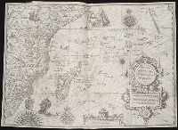
- Call Number:
- Taylor 219
- Collection Title:
- Navigatio ac itinerarivm Iohannis Hvgonis Linscotani in Orientalem sive Lvsitanorvm Indiam
- Image Count:
- 1
- Description:
- [Scale ca. 1:13,500,000]., Bound in following page 8., Map has several areas of staining, most noticeably on verso at top., and Map has small tear along bottom center fold and two tears at bottom left portion.
- Subject (Geographic):
- Africa --Maps --Early works to 1800, Africa, East --Maps, and Madagascar --Maps --Early works to 1800
- Subject (Name):
- Claesz, Cornelis, ca. 1546-1609, publisher, Elzevier, Gillis, bookseller, and Hendricksz, Aelbrecht, fl. 1573-1605, printer
- Subject (Topic):
- Voyages and travels --Early works to 1800
- Collection Created:
- Hagae-Comitis : Ex officina Alberti Henrici, impensis authoris & Cornelii Nicolai, prostantque apud Aegidium Elseuirum, anno 1599
- Found in:
- Beinecke Rare Book and Manuscript Library > Delineatio orarum maritimarum, terrae vulgo indigetatae terra do Natal ...
- Creator:
- Langren, Arnold Florent van, 1580-1644
- Published / Created:
- [1596]
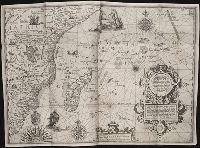
- Call Number:
- Pequot +L65
- Collection Title:
- Nauigatio ac itinerarium Iohannis Hugonis Linscotani in Orientalem siue Lusitanorum Indiam
- Image Count:
- 1
- Description:
- [Scale ca. 1:13,500,000]., Bound in following page 8., In pencil on bottom right panel of left verso: 8., In pencil on middle left panel of left verso: x., In pencil on middle right panel of left verso: 7-1., and Map has several tears along folds now repaired on verso.
- Subject (Geographic):
- Africa --Maps --Early works to 1800, Africa, East --Maps, and Madagascar --Maps --Early works to 1800
- Subject (Name):
- Claesz, Cornelis, ca. 1546-1609, publisher, Elzevier, Gillis, bookseller, and Hendricksz, Aelbrecht, fl. 1573-1605, printer
- Subject (Topic):
- Voyages and travels --Early works to 1800
- Collection Created:
- Hagae-Comitis : Ex officina Alberti Henrici, impensis authoris & Cornelii Nicolai, prostantque apud Aegidium Elseuirum, anno 1599
- Found in:
- Beinecke Rare Book and Manuscript Library > Delineatio orarum maritimarum, terrae vulgo indigetatae terra do Natal ...

- Creator:
- Linschoten, Jan Huygen van, 1563-1611
- Published / Created:
- 1596?]
- Call Number:
- 63 1596
- Container / Volume:
- BRBL_00334
- Image Count:
- 1
- Resource Type:
- Maps, Atlases & Globes
- Alternative Title:
- Affbeeldinghe der custen des landts genaempt terra do Natal, item van alle de custen van Coffala, Mozambique, Melinde and Typus orarum maritimarum Guineae, Manicongo, & Angôlae ultra promontorium Bonae Spei.
- Description:
- Appears in the author's Itinerario, voyage ofte schipvaert van Jan Huygen van Linschoten naer Oost ofte Portugaels Indien., Companion map to Typus orarum maritimarum Guineae, Manicongo, & Angôlae ultra promontorium Bonae Spei ..., and Includes decorative carto
- Publisher:
- Cornelis Claesz?,
- Subject (Geographic):
- Africa, Eastern--Maps--Early works to 1800
- Subject (Name):
- Claesz, Cornelis, approximately 1546-1609, Langren, Arnold Florent van, 1580-1644, and Linschoten, Jan Huygen van, 1563-1611. Itinerario, voyage ofte schipvaert van Jan Huygen van Linschoten naer Oost ofte Portugaels Indien
- Subject (Topic):
- Coasts--Africa, Eastern--Maps--Early works to 1800
- Found in:
- Beinecke Rare Book and Manuscript Library > Delineatio orarum maritimarum, terrae vulgo indigetatae terra do Natal item Sofalae, Mozambicae & Melindae ... [cartographic material] = Affbeeldinghe der custen des landts genaempt terra do Natal, item van alle de custen van Coffala, Mozambique, Melinde

- Creator:
- Linschoten, Jan Huygen van, 1563-1611
- Published / Created:
- 1596?]
- Call Number:
- 63 1596
- Container / Volume:
- BRBL_00334
- Image Count:
- 1
- Resource Type:
- Maps, Atlases & Globes
- Alternative Title:
- Affbeeldinghe der custen des landts genaempt terra do Natal, item van alle de custen van Coffala, Mozambique, Melinde and Typus orarum maritimarum Guineae, Manicongo, & Angôlae ultra promontorium Bonae Spei.
- Description:
- Appears in the author's Itinerario, voyage ofte schipvaert van Jan Huyge, Companion map to Typus orarum maritimarum Guineae, Manicongo, & Angôlae ultra promontorium Bonae Spei ..., Has watermark., and Includes decorative cartouche and compass rose and col. ill.
- Publisher:
- Cornelis Claesz?,
- Subject (Geographic):
- Africa, Eastern--Maps--Early works to 1800
- Subject (Name):
- Claesz, Cornelis, approximately 1546-1609, Langren, Arnold Florent van, 1580-1644, and Linschoten, Jan Huygen van, 1563-1611. Itinerario, voyage ofte schipvaert van Jan Huygen van Linschoten naer Oost ofte Portugaels Indien
- Subject (Topic):
- Coasts--Africa, Eastern--Maps--Early works to 1800
- Found in:
- Beinecke Rare Book and Manuscript Library > Delineatio orarum maritimarum, terrae vulgo indigetatae terra do Natal item Sofalae, Mozambicae & Melindae ... [cartographic material] = Affbeeldinghe der custen des landts genaempt terra do Natal, item van alle de custen van Coffala, Mozambique, Melinde