Search
You Searched For
Search Results
- Creator:
- United States. General Land Office
- Published / Created:
- 1866
- Call Number:
- 806gbc 1866
- Container / Volume:
- BRBL_00549
- Image Count:
- 1
- Resource Type:
- Maps, Atlases & Globes
- Found in:
- Beinecke Rare Book and Manuscript Library > Map of the state of Illinois [cartographic material].
- Creator:
- United States. General Land Office
- Published / Created:
- 1866
- Call Number:
- 837gbc 1866
- Container / Volume:
- BRBL_00594
- Image Count:
- 1
- Resource Type:
- Maps, Atlases & Globes
- Found in:
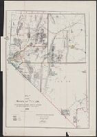
- Beinecke Rare Book and Manuscript Library > Map of the state of Nevada : to accompany the annual report of the Commr. Genl. Land Office.
- Creator:
- United States. General Land Office
- Published / Created:
- 1903
- Call Number:
- 822 1903
- Container / Volume:
- BRBL_00567
- Image Count:
- 1
- Resource Type:
- Maps, Atlases & Globes
- Found in:
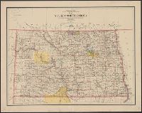
- Beinecke Rare Book and Manuscript Library > Map of the state of North Dakota / compiled from the official records of the General Land Office and other sources under the direction of Frank Bond ; compiled and drawn by M. Hendges ; lettered by Wm. Bauman, Jr.
- Creator:
- United States. General Land Office
- Published / Created:
- 1902
- Call Number:
- 836 1902
- Container / Volume:
- BRBL_00592
- Image Count:
- 1
- Resource Type:
- Maps, Atlases & Globes
- Found in:
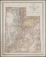
- Beinecke Rare Book and Manuscript Library > Map of the state of Utah / compiled from the official records of the General Land Office, under the direction of Harry King ; compiled and drawn by J. Ulke.
- Creator:
- United States. General Land Office
- Published / Created:
- 1897
- Call Number:
- 847 1897C
- Container / Volume:
- BRBL_00625
- Image Count:
- 1
- Resource Type:
- Maps, Atlases & Globes
- Found in:
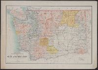
- Beinecke Rare Book and Manuscript Library > Map of the state of Washington / compiled from the official records of the General Land Office and other sources under the direction of Harry King, C.E., Chief of Drafting Division, G.L.O. ; revised and drawn by Daniel O'Hare ; compiled by Robt. H. Morton
- Creator:
- United States. General Land Office
- Published / Created:
- 1896
- Call Number:
- 812 1896
- Container / Volume:
- BRBL_00555A
- Image Count:
- 1
- Resource Type:
- Maps, Atlases & Globes
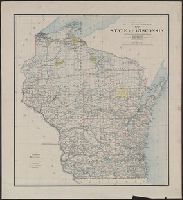
- Found in:
- Beinecke Rare Book and Manuscript Library > Map of the state of Wisconsin / Department of the Interior, General Land Office ; compiled from the official records of the General Land Office and other sources under the direction of Harry King, C.E., chief of Drafting Division G.L.O. ; compiled, drawn
- Creator:
- United States. General Land Office
- Published / Created:
- 1900
- Call Number:
- 833 1900
- Container / Volume:
- BRBL_00584
- Image Count:
- 1
- Resource Type:
- Maps, Atlases & Globes
- Found in:
- Beinecke Rare Book and Manuscript Library > Map of the state of Wyoming / compiled from the official records of the General Office and other sources, under the direction of Harry King, C.E., Chief of Drafting Division G.L.O. ; compiled, drawn, and lettered by I.P. Berthrong.
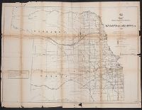
- Creator:
- United States. General Land Office
- Published / Created:
- 1866
- Call Number:
- 825fcm 1866
- Container / Volume:
- BRBL_00575
- Image Count:
- 1
- Resource Type:
- Maps, Atlases & Globes
- Found in:
- Beinecke Rare Book and Manuscript Library > Map showing the progress of the public surveys in Kansas and Nebraska / Surveyor General's Office ; Department of the Interior, General Land Office, Oct. 2nd, 1866.
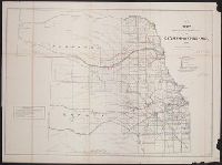
- Creator:
- United States. General Land Office
- Published / Created:
- 1860?
- Call Number:
- 825fcm 1860
- Container / Volume:
- BRBL_00575
- Image Count:
- 1
- Resource Type:
- Maps, Atlases & Globes
- Found in:
- Beinecke Rare Book and Manuscript Library > Map showing the progress of the public surveys in the territories of Kansas and Nebraska : to accompany annual report of the Surveyor General, 1860.