Skip to search
Skip to main content
Skip to first result
Search
You Searched For
Extent of Digitization
Unspecified
Format
cartographic
Genre
Illustrations
New Search
Search Results
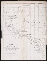
Call Number:
Zc10 846sa
Collection Title:
Scenes in the Rocky Mountains, and in Oregon, California, New Mexico, Texas, and the grand prairies
Image Count:
1
Description:
Preceding title page.
Publisher:
F. Michelin's Lith
Subject (Geographic):
Rocky Mountains --Description and travel and West (U.S.) --Description and travel
Subject (Topic):
Hunting --West (U.S.) and Indians of North America --West (U.S.)
Collection Created:
Philadelphia, Carey & Hart, 1846
Found in:
Beinecke Rare Book and Manuscript Library > Map of Oregon, California, New Mexico, N.W. Texas, & the proposed territory of Ne_Bras_Ka
Creator:
Call Number:
A52 030 1
Collection Title:
Ancient monuments of the Mississippi Valley: comprising the results of extensive original surveys
Image Count:
1
Description:
Facing p. 3.
Subject (Geographic):
Mississippi River Valley --Antiquities
Subject (Name):
Davis, E. H. (Edwin Hamilton), 1811-1888
Subject (Topic):
Mound-builders and Mounds --Mississippi River Valley
Collection Created:
[Washington, Smithsonian institution, 1848]
Found in:
Beinecke Rare Book and Manuscript Library > Map of a section of twelve miles of the Scioto Valley with its ancient monuments, Pl. II [2]
Creator:
Call Number:
Zc10 845fr
Collection Title:
Report of the exploring expedition to the Rocky Mountains in the year 1842, and to Oregon and north
Image Count:
1
Description:
Includes a profile of the route from the mouth of the Kansas to the Pacific by Capt. J. C. Fremont in 1843. and Inserted in back binding.
Subject (Geographic):
Pacific States, Rocky Mountains, United States --Exploring expeditions, United States. Army. Corps of Topographical Engineers, and West (U.S.) --Description and travel
Subject (Name):
Hall, James, 1811-1898 and Torrey, John, 1796-1873
Collection Created:
Washington : Gales and Seaton, Printers, 1845
Found in:
Beinecke Rare Book and Manuscript Library > Map of an exploring expedition to the Rocky Mountains in the year 1842, and to Oregon & North California in the years 1843-44
Call Number:
Za P752 ZzP17
Collection Title:
Incidents of travel in Central America, Chiapas, and Yucatan / by John L. Stephens
Image Count:
1
Description:
Facing p. [9].
Subject (Geographic):
Central America --Antiquities, Central America --Description and travel, Chiapas (Mexico) --Description and travel, Mexico --Antiquities, Mexico --Description and travel, and Yucatan (Mexico : State) --Description and travel
Subject (Topic):
Indian sculpture --Mexico, Indians of Central America, and Mayas --Antiquities
Collection Created:
New York : Harper & Brothers, 1841
Found in:
Beinecke Rare Book and Manuscript Library > Map of journey in Central America, Chiapas & Yucatan
Creator:
Published / Created:
1822 March
Call Number:
Egk30 Ed9 820W
Collection Title:
Two years' residence in the settlement on the English prairie, in the Illinois country ... : with
Image Count:
1
Description:
Following map facing p. 310.
Publisher:
Pub. Longman & Co
Subject (Geographic):
Edwards County (Ill.) and Illinois --Description and travel
Subject (Topic):
Frontier and pioneer life --Illinois
Collection Created:
London : Longman, Hurst, Rees, Orme, and Brown, 1822
Found in:
Beinecke Rare Book and Manuscript Library > Map of the allotments
Creator:
Published / Created:
1795 February 7
Call Number:
1986 102
Collection Title:
An historical, geographical, commercial, and philosophical view of the American United States, and
Image Count:
1
Description:
Engraved by Russell, Constitution R., Grays Inn La. and Facing p. 2.
Publisher:
Publish'd as the Act directs, by H.D. Symonds, No. 20 Pater Noster Row
Subject (Geographic):
America --Description and travel, America --History --To 1810, New England --Maps --Early works to 1800, United States --Description and travel, and United States --Maps --Early works to 1800
Collection Created:
London, Printed for the editor; J. Ridgway [etc.] 1795
Found in:
Beinecke Rare Book and Manuscript Library > Map of the northern, or, New England states of America. Comprehending Vermont, New Hampshire, District of Main, Massachusetts, Rhode-Island, and Connecticut
Creator:
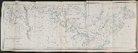
Call Number:
Zc58 +876uo
Collection Title:
Report of explorations across the great basin of the territory of Utah for a direct wagon-route
Image Count:
1
Subject (Geographic):
United States --Exploring expeditions and Utah --Surveys
Subject (Name):
Simpson, J. H. (James Hervey), 1813-1883
Subject (Topic):
Geology --Utah and Natural history --Utah
Collection Created:
Washington, Govt. Print. Off., 1876
Found in:
Beinecke Rare Book and Manuscript Library > Map of wagon routes in Utah Territory explored & opened by Capt. J. H. Simpson ...
Creator:
Call Number:
Zc90 859ka
Collection Title:
Wanderings of an artist among the Indians of North America : from Canada to Vancouver's Island and
Image Count:
1
Description:
Preceding p. 1.
Subject (Geographic):
Northwest, Canadian --Description and travel
Subject (Topic):
Indians of North America
Collection Created:
London : Longman, Brown, Green, Longmans, and Roberts, 1859
Found in:
Beinecke Rare Book and Manuscript Library > Map to illustrate Mr. Kane's travels in the territory of the Hudson's Bay Company
Creator:
Call Number:
Zc20 822cui
Collection Title:
The Western pilot : containing charts of the Ohio River and of the Mississippi, from the mouth of
Image Count:
1
Abstract:
A portion of the Mississippi River including Chickasaw Bluffs.
Description:
Facing p. 92.
Subject (Geographic):
Mississippi River --Description and travel, Mississippi River --Navigation, Ohio River --Description and travel, and Ohio River --Navigation
Subject (Name):
Conclin, George and Ross, Charles
Subject (Topic):
Inland navigation --United States
Collection Created:
Cincinnati : George Conclin, 1843
Found in:
Beinecke Rare Book and Manuscript Library > Mississippi
Creator:
Call Number:
Zc20 822cui
Collection Title:
The Western pilot : containing charts of the Ohio River and of the Mississippi, from the mouth of
Image Count:
1
Abstract:
A portion of the Mississippi River including Natchez.
Description:
Facing p. 115.
Subject (Geographic):
Mississippi River --Description and travel, Mississippi River --Navigation, Ohio River --Description and travel, and Ohio River --Navigation
Subject (Topic):
Inland navigation --United States
Collection Created:
Cincinnati : George Conclin, 1843
Found in:
Beinecke Rare Book and Manuscript Library > Mississippi
Branch:v1.61.6 ,Deployed:2024-06-12T09:55:31-04:00