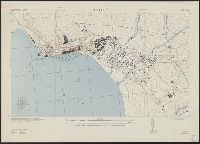
Great Britain. War Office. General Staff. Geographical Section
Published / Created:
1942
Call Number:
67 Ag13 1942
Container / Volume:
BRBL_00348
Image Count:
1
Resource Type:
Maps, Atlases & Globes
Alternative Title:
Morocco 10 000.
Description:
"Prepared under the direction of the chief of engineers, U. S. Army ... Compiled from base map of Ville d'Agadir, 1:10,000, Office of the military attache, Tangier, Morocco. Revised from U. S. H. O. chart no. 2239, R. A. F. aerial photos ... and Morocco,
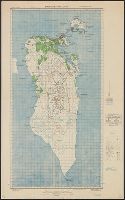
Great Britain. War Office. General Staff. Geographical Section
Published / Created:
1942
Call Number:
68 B64 1942
Container / Volume:
BRBL_00350
Image Count:
1
Resource Type:
Maps, Atlases & Globes
Alternative Title:
Geographical Section, General Staff ; no.4275 and GSGS (Series) ; 4275.
Description:
"Contours are shown at 20 metre vertical interval.", "Revised and copied from an intelligence plan dated 1935.", In upper margin: Algeria 1:10,000 ..., and Military grid.
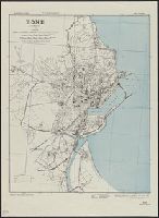
Great Britain. War Office. General Staff. Geographical Section
Published / Created:
1943
Call Number:
67 R11 1942
Container / Volume:
BRBL_00348
Image Count:
1
Resource Type:
Maps, Atlases & Globes
Alternative Title:
Geographical Section, General Staff ; no. 4241 and GSGS (Series) ; 4035.
Description:
"Contours at 2.5 metre interval.", "Copied from a French map dated 1933." Published in 1941 and 1942 by War Office., "Legend" gives key to points of interest; important streets of Rabat are named., and Military grid.
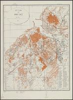
Great Britain. War Office. General Staff. Geographical Section
Published / Created:
1942
Call Number:
68 C76 1942
Container / Volume:
BRBL_00350
Image Count:
1
Resource Type:
Maps, Atlases & Globes
Alternative Title:
Geographical Section, General Staff ; no. 4275 and GSGS (Series) ; 4275.
Description:
"Copied from a French map dated 1895. (Revised).", In upper margin: Algeria 1:5,000 ..., Legend gives location of 59 important buildings, etc., Military grid., and Oriented with north toward the right.
Great Britain. War Office. General Staff. Geographical Section
Published / Created:
1943
Call Number:
4894 1943
Container / Volume:
BRBL_00267
Image Count:
1
Resource Type:
Maps, Atlases & Globes
Alternative Title:
Geographical Section, General Staff ; no. 4160 and GSGS (Series) ; 4160.
Description:
"Contours at 200 metres vertical interval.", "Drawn at the Ordnance Survey Office, 1941.", Military grid., and Three classes of roads or tracks are shown.
Great Britain. War Office. General Staff. Geographical Section
Published / Created:
1943
Call Number:
2121 1943
Container / Volume:
BRBL_00015
Image Count:
1
Resource Type:
Maps, Atlases & Globes
Alternative Title:
Geographical secton, General staff. ; no. 4313 and GSGS (Series) ; 4313.
Description:
"Copied from a Portuguese map dated 1934 with revision from intelligence reports.", Elevations shown by spot heights and contours at 25 meter intervals., Military grid., and Six classes of roads and tracks, and areas of cultivation and vegetation are indicated.
Great Britain. War Office. General Staff. Geographical Section
Published / Created:
1942
Call Number:
67 M72 1942
Container / Volume:
BRBL_00348
Image Count:
1
Resource Type:
Maps, Atlases & Globes
Alternative Title:
Geographical Section, General Staff ; no.4241, GSGS (Series) ; 4241., and Morocco 10 000.
Description:
"Contours at 2.5 metre interval.", "Copied from a French map.", "Legend" gives key to points of interest., In upper margin: Morocco 1:10,000 ..., and Military grid.
Great Britain. War Office. General Staff. Geographical Section
Published / Created:
1942
Call Number:
67 T21 1942
Container / Volume:
BRBL_00349
Image Count:
1
Resource Type:
Maps, Atlases & Globes
Alternative Title:
Geographical Section, General Staff ; no. 4241, GSGS (Series) ; 4241., and Morocco 10 000.
Description:
"Copied from a French map dated 1920. Revised ... by War office, 1941., Elevations shown by spot heights and form lines., In upper margin: Morocco 1:10,000 ..., and Military grid.