Search
You Searched For
Search Results
- Creator:
- Thomas, G. F
- Published / Created:
- [1864]
- Call Number:
- 75gme 1864
- Container / Volume:
- BRBL_00412
- Image Count:
- 2
- Resource Type:
- Maps, Atlases & Globes
- Found in:
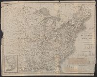
- Beinecke Rare Book and Manuscript Library > Appletons' railway map of the United States and the Canadas : representing railways in actual operation, and those in course of construction, also map of the territories, showing the Pacific Railroad, gold regions, &c. / carefully compiled by G. F. Thomas
- Creator:
- Thomas, G. F
- Published / Created:
- [1876]
- Call Number:
- 754gme 1876
- Container / Volume:
- BRBL_00420
- Image Count:
- 2
- Resource Type:
- Maps, Atlases & Globes
- Found in:
- Beinecke Rare Book and Manuscript Library > Appletons' railway map of the United States and the Canadas : representing railways in actual operation, and those in course of construction, also map of the territories, showing the Pacific Railroad, gold regions, &c. / carefully compiled by G. F. Thomas
- Creator:
- G.W. & C.B. Colton & Co
- Published / Created:
- 1864
- Call Number:
- 75 1864
- Container / Volume:
- BRBL_00403
- Image Count:
- 1
- Resource Type:
- Maps, Atlases & Globes
- Found in:
- Beinecke Rare Book and Manuscript Library > Coltons' rail-road and military map of the United States, Mexico, the West Indies &c.
- Creator:
- Burr, Henry A
- Published / Created:
- 1853
- Call Number:
- 75GM 1853
- Container / Volume:
- BRBL_00410
- Image Count:
- 1
- Resource Type:
- Maps, Atlases & Globes
- Found in:
- Beinecke Rare Book and Manuscript Library > Disturnell's new map of the United States and Canada : showing all the canals, rail roads, telegraph lines and principal stage routes / Drawn by Henry A. Burr.
- Creator:
- Burr, Henry A
- Published / Created:
- 1850
- Call Number:
- 75 1850
- Container / Volume:
- BRBL_00400
- Image Count:
- 2
- Resource Type:
- Maps, Atlases & Globes
- Found in:
- Beinecke Rare Book and Manuscript Library > Disturnell's new map of the United States and Canada : showing all the canals, rail roads, telegraph lines and principal stage routes / drawn by Henry A. Burr, topographer to the Post Office Dep't., Washington, D.C. ; engraved by J.M. Atwood, N.Y.
- Creator:
- Goldthwait, J. H
- Published / Created:
- 1861
- Call Number:
- 75 1861D
- Container / Volume:
- BRBL_00402
- Image Count:
- 1
- Resource Type:
- Maps, Atlases & Globes
- Found in:
- Beinecke Rare Book and Manuscript Library > Goldthwait's map of the United States & Canada : exhibiting the railroads with their distances, single and double tracks and width of gauge, and the time compared with noon at Washington & Greenwich / by J.H. Goldthwait.
- Published / Created:
- 1853
- Call Number:
- 754gme 1853
- Container / Volume:
- BRBL_00419
- Image Count:
- 1
- Resource Type:
- Maps, Atlases & Globes
- Found in:
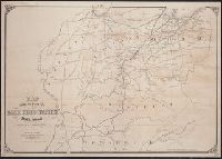
- Beinecke Rare Book and Manuscript Library > Map of the Delaware, Lackawanna & Western railroad : with its principal connections.
- Creator:
- J.H. Colton & Co.
- Published / Created:
- 1858
- Call Number:
- 754gme 1858
- Container / Volume:
- BRBL_00420
- Image Count:
- 1
- Resource Type:
- Maps, Atlases & Globes
- Found in:
- Beinecke Rare Book and Manuscript Library > Map of the Mississippi and Missouri Railroad : and its connections.
- Creator:
- Tanner, Henry Schenck, 1786-1858
- Published / Created:
- 1840
- Call Number:
- 75gm 1840B
- Container / Volume:
- BRBL_00410
- Image Count:
- 1
- Resource Type:
- Maps, Atlases & Globes
- Found in:
- Beinecke Rare Book and Manuscript Library > Map of the canals & rail roads of the United States / reduced from the large map of the U.S. by H.S. Tanner ; engraved by J. Knight.
- Published / Created:
- [1857?]
- Call Number:
- 754gme 1857
- Container / Volume:
- BRBL_00419
- Image Count:
- 1
- Resource Type:
- Maps, Atlases & Globes
- Found in:
- Beinecke Rare Book and Manuscript Library > Map showing position of the Lake Erie and Pacific rail road : and its connections / [by] Chas. E. Hore, mechanical and topographical draftsman, 308 Broadway, N.Y.