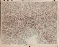
Appears in: Isolario, descrittione geografico-historica, sacro-profana...di tutte l'isole...del globo terracqueo / del P. maestro Vincenzo Coronelli, 1696. Parte II, p. 113., Appears to have, At head of page: Isolario del P. Coronelli., and In upper right: 113.
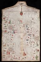
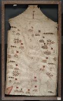
Colors: red, greens, and blues., Crucifix at top of map., Inset: The world., Joan Riezo figlo de mastro dominico [Olives] in missina año 1590., and Notes: gold ribbon along borders of map, missing from far right hand side.
Subject (Geographic):
Europe--Maps--Early works to 1800 and Mediterranean Sea--Maps--Early works to 1800
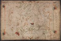
Contains seven compass roses., Decoration: city views with banners; Jesus Christ on a cross at left edge., Label on verso: Vend. del 4.VI.32-X., Pen-and-ink in black, red, blue and green., Portolan chart with seaport names given for all coastlines., and Title devised by cataloger.
Subject (Geographic):
Black Sea--Maps--Early works to 1800. and Mediterranean Sea--Maps--Early works to 1800.
Subject (Topic):
Nautical charts--Black Sea--Early works to 1800. and Nautical charts--Mediterranean Sea--Early works to 1800.