Search
You Searched For
Search Results
- Published / Created:
- [1833?]
- Call Number:
- 764 AM47 1833
- Container / Volume:
- BRBL_00453
- Image Count:
- 1
- Resource Type:
- Maps, Atlases & Globes
- Found in:
- Beinecke Rare Book and Manuscript Library > A Map of Amherst with a view of the College ... by Alonzo Gray & Charles B. Adams ... 1833.
- Published / Created:
- [1830?]
- Call Number:
- 764 H59 1830
- Container / Volume:
- BRBL_00457
- Image Count:
- 1
- Resource Type:
- Maps, Atlases & Globes
- Found in:
- Beinecke Rare Book and Manuscript Library > A Map of Hingham surveyed by Jedediah Lincon and Reuben hersey Jr. in 1830.
- Published / Created:
- 1831
- Call Number:
- 764 M52 1831
- Container / Volume:
- BRBL_00458
- Image Count:
- 1
- Resource Type:
- Maps, Atlases & Globes
- Found in:
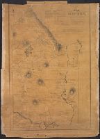
- Beinecke Rare Book and Manuscript Library > A Map of Mendon, Worcester County, Mass. By John Geo. Metcalf, M.D. Newell nelson, Surveyor.
- Published / Created:
- [1831?]
- Call Number:
- 764 B63 1831
- Container / Volume:
- BRBL_00454
- Image Count:
- 1
- Resource Type:
- Maps, Atlases & Globes
- Found in:
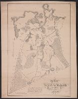
- Beinecke Rare Book and Manuscript Library > A Map of the Town of Bolton in the County of Worcester and the Commonwealth of Massachusetts. Surveyed by Silas Holman in the Year 1831.
- Published / Created:
- [1831?]
- Call Number:
- 764 B63 1831
- Container / Volume:
- BRBL_00454
- Image Count:
- 1
- Resource Type:
- Maps, Atlases & Globes
- Found in:
- Beinecke Rare Book and Manuscript Library > A Map of the Town of Bolton in the County of Worcester and the Commonwealth of Massachusetts. Surveyed by Silas Holman in the Year 1831.
- Published / Created:
- 1791
- Call Number:
- 7645cea 1791
- Container / Volume:
- BRBL_00463
- Image Count:
- 1
- Resource Type:
- Maps, Atlases & Globes
- Found in:
- Beinecke Rare Book and Manuscript Library > A chart of Nantucket Shoals by Capt. Paul Pinkham.
- Published / Created:
- [1840.]
- Call Number:
- 765CA 1840
- Container / Volume:
- BRBL_00464
- Image Count:
- 1
- Resource Type:
- Maps, Atlases & Globes
- Found in:
- Beinecke Rare Book and Manuscript Library > A geological map of Rhode-Island. By Charles T. Jackson. 1840.
- Creator:
- Burwell, Elliot Noël
- Published / Created:
- c1907.
- Call Number:
- 762 W73 1907
- Container / Volume:
- BRBL_00451
- Image Count:
- 1
- Resource Type:
- Maps, Atlases & Globes
- Found in:
- Beinecke Rare Book and Manuscript Library > A map of Lake Winnipesaukee, New Hampshire / author, Elliot Noël Burwell.
- Creator:
- Carleton, Osgood, 1742-1816
Doolittle, Amos, 1754-1832, engraver
Sullivan, James, 1744-1808. History of the district of Maine
Thomas & Andrews
- Published / Created:
- 1795
- Call Number:
- 1977 Folio 177
- Image Count:
- 2
- Resource Type:
- Maps, Atlases & Globes
- Found in:
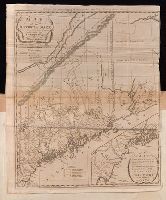
- Beinecke Rare Book and Manuscript Library > A map of the district of Maine : drawn from the latest surveys and other best authorities / by Osgood Carleton ; Doolittle, sc., Newhaven.
- Published / Created:
- [1794?]
- Call Number:
- 764 1794
- Container / Volume:
- BRBL_00452
- Image Count:
- 1
- Resource Type:
- Maps, Atlases & Globes
- Found in:
- Beinecke Rare Book and Manuscript Library > A new map of Massachusetts State including Rhode Island and Connecticut .. revised by Osgood Carelton ... Boston.