Search
You Searched For
Search Results
- Creator:
- Great Britain. Hydrographic Department, author
- Call Number:
- 254cea 1886
- Container / Volume:
- BRBL_00021
- Image Count:
- 1
- Resource Type:
- Maps, Atlases & Globes
- Found in:
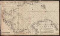
- Beinecke Rare Book and Manuscript Library > Australia, Coral Sea and Great Barrier Reefs, showing the Inner and Outer routes to Torres Strait. Sheet 2 / engraved by Edwd. Weller.
- Creator:
- Keulen, Gerard van
Keulen, Johannes van, fl. 1726-1753. Nieuwe groote lichtende zee-fakkel
- Call Number:
- 303cea 1680
- Container / Volume:
- BRBL_00033
- Image Count:
- 1
- Resource Type:
- Maps, Atlases & Globes
- Found in:
- Beinecke Rare Book and Manuscript Library > Nieuwe groote paskaart van de geheele Noord-Zee : vertoonende in sig alle de rivieren, havens, baye, dieptens daar in geleegen = The new sea map of the whole North Sea : sheuwing all the rivers,, harbours, bays et havens et dephts, et showles = Nouvelle c
- Creator:
- Imray, James F. (James Frederick), 1829?-1891, author
James Imray and Son, publisher
- Call Number:
- 23cea 1884
- Container / Volume:
- BRBL_00021
- Image Count:
- 2
- Resource Type:
- Maps, Atlases & Globes
- Found in:
- Beinecke Rare Book and Manuscript Library > South and east coasts of Australia [in four charts]. Chart no. 2, Cape Northumberland to Cape Howe / compiled by James F. Imray F.R.G.S.
- Creator:
- Vidal, A. T. E. (Alexander Thomas Emeric), 1792-1863, author
- Call Number:
- 655 1827
- Container / Volume:
- BRBL_00345
- Image Count:
- 1
- Resource Type:
- Maps, Atlases & Globes
- Found in:
- Beinecke Rare Book and Manuscript Library > The west coast of Africa : from latitude 1°, 35ʹ N. to 5°, 50ʹ N. and from longitude 4, 55 E. to 10, 45 E. / by Captn. A.T.E. Vidal & the officers of H.M. Sloop Barracouta under the orders of Captn. W.F.W. Owen, 1826 ; J. & C. Walker, sculpt.
- Creator:
- Imray, James F. (James Frederick), 1829?-1891, cartographer
James Imray and Son, issuing body
- Call Number:
- 23cea 1886
- Container / Volume:
- BRBL_00021
- Image Count:
- 2
- Resource Type:
- Maps, Atlases & Globes
- Found in:
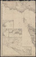
- Beinecke Rare Book and Manuscript Library > Western Pacific. Chart No. 2 / compiled by James F. Imray F.R.G.S.
- Creator:
- Månsson, Johan, -1659
- Call Number:
- Double Covers 303cea +1645
- Image Count:
- 7
- Resource Type:
- Maps, Atlases & Globes
- Found in:
- Beinecke Rare Book and Manuscript Library > [Chart of the Baltic Sea] / Siegismuntlus von Vogell fecit.