At head of map: Asia distinguished into its principall parts viz. Turky in Asia, Arabia, Persia, India, China, Tartaria, the islands of Japan, of the Philippines, of the Moluckes, of the Sundaes, of Ceylan, and of the Maldivies, where are set down the empires, monarchies, kingdoms, and states which are found there at present., Dedication in cartouche: To the most serene and most sacred majesty of Charles II by the grace of God, King of Great Brittain, France and Ireland. This map of Asia is humbly dedicated, and presented by your majesties loyal subject, and servant William Berry., Map of Asia from Saudi Arabia, Russia, India, China, Japan to Southeast Asia. Relief shown pictorially., No. 49 of 69 maps bound together in composite atlas., and Scale [ca. 1:12 165 120].
Publisher:
Sold by William Berry at the signe of the Globe between Charing-Cross and White-Hall
Subject (Geographic):
Asia --Maps --Early works to 1800, Asia, Central --Maps --Early works to 1800, South Asia --Maps --Early works to 1800, and Southeast Asia --Maps --Early works to 1800
Ferro meridian., From Bleau's Atlas major (German ed.). Zu Amsterdam : Bey Johannem Blaeu, [ca. 1670]., No. 58 of 69 maps bound together in composite atlas., Relief shown pictorially., and Scale [ca. 1:4 000 000].
[Atlas factice of 42 maps, produced by the Homann Erben firm]
Image Count:
1
Resource Type:
Maps, Atlases & Globes
Alternative Title:
Belgium Catholicum seu decem provinciae Germaniae inferioris and Carte des Pais Bas catholiques ou des X provinces de l’Allegmagne inferieure, etc. dessinee au juste selon les exactes observations astronomiques et operations geometriques des Messur. Cassini, Snellius, Muschenbrok, etc. dressee par Sr. Tobias Maier, mathematicien; aux depens des Heritiers de Homann
Publisher:
Edentibus Homannianis heredib
Subject (Geographic):
Belgium --Maps --Early works to 1800 and Luxembourg --Maps --Early works to 1800
Bar scales in Milliaria Germanica Communia and Milliaria Gallica Communia., Ferro meridian., No. 37 of 69 maps bound together in composite atlas., Relief shown pictorially., and Scale [ca. 1:775 000].
Publisher:
[Frederik de Wit]
Subject (Geographic):
Prussia, east (Poland and Russia) --Maps --Early works to 1800
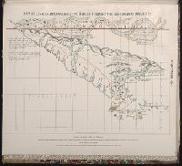
Maps of the Orinoco-Essequibo region, South America. Compiled for the Commission appointed by the
Image Count:
1
Resource Type:
Maps, Atlases & Globes
Subject (Geographic):
Amazon River--Discovery and exploration--Spanish, Amazon River--Maps, Caribbean Area--Maps--Early works to 1800, Colombia --Maps, Guyana --Maps, Orinoco River Valley (Venezuela and Colombia) --Maps, and Venezuela --Maps
Europe divided into its principall parts viz. the Brittish [sic] Islands, Scandinavia, Moscovia, France, Germany, Poland, Spain, Italy, Turky [sic] in Europe ... described by Sanson, corrected and amended by William Berry
Description:
Dedicated To the most serene and most sacred majesty of Charles II ... by William Berry., Includes coat of arms and decorative cartouche containing dedication., No. 2 of 69 maps bound together in composite atlas., Prime meridian: Ferro., Relief shown pictorially., and Scale [ca. 1:75 000 000].
Publisher:
Sold by William Berry at ye sign of the globe between Charing-Cross and White-Hall
Subject (Geographic):
Europe --Maps --Early works to 1800, Russia --Maps --Early works to 1800, and Turkey --Maps --Early works to 1800