Search
You Searched For
Search Results
- Call Number:
- Egf 789
- Collection Title:
- The American geography; or, A view of the present situation of the United States of America
- Image Count:
- 1
- Found in:
- Beinecke Rare Book and Manuscript Library > A Map of the northern and middle states; comprehending the western Territory and the British dominions in North America. Compiled from the best authorities
- Creator:
- Doolittle, Amos, 1754-1832
Purcell, Joseph
- Published / Created:
- 1788
- Call Number:
- Egf 789
- Collection Title:
- The American geography; or, A view of the present situation of the United States of America
- Image Count:
- 1
- Found in:
- Beinecke Rare Book and Manuscript Library > A Map of the states of Virginia, North Carolina South Carolina and Georgia comprehending the Spanish provinces of east and west Florida exhibiting the boundaries as fixed by the late Treaty of Peace between the United States and the Spanish dominions comp
- Call Number:
- Taylor 376
- Collection Title:
- The discoveries of John Lederer : in three several marches from Virginia, to the west of Carolina
- Image Count:
- 1
- Found in:
- Beinecke Rare Book and Manuscript Library > A Map of the whole territory traversed by John Lederer in his three marches
- Call Number:
- CE143 A28
- Collection Title:
- An account of the Spanish settlements in America. In four parts ... To which is annexed, a succinct
- Image Count:
- 1
- Found in:
- Beinecke Rare Book and Manuscript Library > A New general map of America drawn from several accurate particular maps and charts and regulated by astronomical observations
- Published / Created:
- [1823?]
- Call Number:
- 1978 Folio 104
- Collection Title:
- A new and elegant imperial atlas: comprehending general and particular maps of every part of the
- Image Count:
- 1
- Found in:
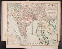
- Beinecke Rare Book and Manuscript Library > A New general map of the East Indies, exhibiting in the Peninsula on this side of the Ganges or Hindoostan, the several partitions of the Mogul's Empire ...
- Published / Created:
- 1784]
- Call Number:
- 784.00.00.78+
- Image Count:
- 1
- Found in:
- Lewis Walpole Library > A Representation, of the sea fight, on the 5th of Sepr. 1781, between Rear Admiral Graves and the Count de Grasse
- Creator:
- Brasier, William
- Published / Created:
- 1776
- Call Number:
- Cb23 27
- Collection Title:
- The American military pocket atlas : being an approved collection of correct maps, both general and
- Image Count:
- 1
- Found in:
- Beinecke Rare Book and Manuscript Library > A Survey of Lake Champlain, including Lake George, Crown Point and St. John. Surveyed by order of His Excellency Major General Sr. Jeffery Amherst, knight of the most honble. Order of the Bath, Commander in Chief of His Majesty's forces in North America (now Lord Amherst) by William Brassier, draughtsman, 1762
- Creator:
- Cook, James, 1728-1779, creator
Larken, sculpt
- Published / Created:
- 1766. NB. With a book of directions
- Call Number:
- 2003 Folio 85
- Image Count:
- 1
- Found in:
- Beinecke Rare Book and Manuscript Library > A chart of part of the south coast of Newfoundland: including the islands St. Peters and Miquelon : from an actual survey taken by order of Commodore Pallisser, Governor of Newfoundland, Labrador, &c
- Creator:
- Delarochette, L. (Louis), 1731-1802, creator
Faden, William, 1749-1836
Palmer, William, 1750-1836
- Published / Created:
- 1784 March 1
- Call Number:
- 1982 Folio 10
- Image Count:
- 1
- Found in:
- Beinecke Rare Book and Manuscript Library > A chart of the Antilles, or, Charibbee, or, Caribs Islands, with the Virgin Isles
- Creator:
- Delarochette, L. (Louis), 1731-1802
Dicquemare, (Jacques-Francois), M. l'abbe, 1733-1789, creator
Faden, William, 1749-1836
- Published / Created:
- 1780 June 17
- Call Number:
- 1982 Folio 10
- Image Count:
- 1
- Found in:
- Beinecke Rare Book and Manuscript Library > A chart of the British Channel and the Bay of Biscay with a part of the North Sea, and the entrance of St. George's Channel