Skip to search
Skip to main content
Skip to first result
Search
You Searched For
%22Austria--Maps%22
New Search
Search Results
Creator:
Published / Created:
MDCXIII [1613]. Avec privilege dv Roy.
Call Number:
Taylor 257
Image Count:
1
Resource Type:
Books, Journals & Pamphlets
Description:
22 x 26 cm.) bound in after p. 22 (first
Subject (Geographic):
New France--Maps .
Found in:
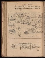
Beinecke Rare Book and Manuscript Library > Les voyages dv sievr de Champlain Xaintongeois, capitaine ordinaire pour le Roy, en la marine : divisez en devx livres, ou, iovrnal tres-fidele des observations faites es descouuertures de la Nouuelle France : tant en la descriptiõ des terres, costes, riuieres, ports, haures, leurs hauteurs, & plusieurs declinaisons de la guide-aymant : qu'en la crẽace des peuples, leur superstition, façon de viure & de guerroyer : enrichi de quantité de figures : Ensemble deux cartes geografiques : la premiere seruant à la nauigation, dressée selon les compas qui nordestent, sur lesquels les mariniers nauigent : l'autre en son vray Meridien, auec ses longitudes & latitudes : à laquelle est adiousté le voyage du destroict qu'ont trouué les Anglois, au dessus de Labrador, depuis le 53e. degré de latitude, iusques au 63e. en l'an 1612, cerchans vn chemin par le Nord, pour aller à la Chine.
Creator:
Published / Created:
1625]
Call Number:
343 1610
Container / Volume:
BRBL_00683
Image Count:
2
Resource Type:
Maps , Atlases & Globes
Alternative Title:
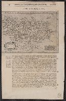
Chap. 22 , Discipline, honour, Island
Description:
Paginated 643-644; map on p. 644.
Subject (Geographic):
Iceland--Maps --Early works to 1800
Found in:
Beinecke Rare Book and Manuscript Library > Island [cartographic material].
Creator:
Map Company, issuing body
Published / Created:
1925
Call Number:
766 M59 1925
Image Count:
31
Resource Type:
Maps , Atlases & Globes
Abstract:
Sanborn fire insurance maps are a rich
Description:
Partial cadastral map .
Subject (Geographic):
Milford (Conn.)--Maps
Subject (Topic):
--Milford--Maps
Found in:
Beinecke Rare Book and Manuscript Library > Insurance maps of Milford, New Haven County, Connecticut, including Woodmont, Merwin's Point, Bay View, Fort Trumbull Beach, Silver Sands, Seaside, Myrtle Beach, Meadows End, Walnut Beach, Wildmere Beach, Laurel Beach, Cedar Beach, Devon and Rivercliff.
Creator:
Map Company, issuing body
Published / Created:
1924
Call Number:
766 D444 1924
Image Count:
30
Resource Type:
Maps , Atlases & Globes
Abstract:
Sanborn fire insurance maps are a rich
Description:
Partial cadastral map .
Subject (Geographic):
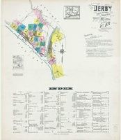
Derby (Conn.)--Maps
Subject (Topic):
--Derby--Maps
Found in:
Beinecke Rare Book and Manuscript Library > Derby, including East Derby, New Haven County, Connecticut.
Creator:
Map Company, issuing body
Published / Created:
1927
Call Number:
766 Ea76 1927
Image Count:
30
Resource Type:
Maps , Atlases & Globes
Abstract:
Sanborn fire insurance maps are a rich
Description:
Partial cadastral map .
Subject (Geographic):
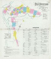
East Hartford (Conn.)--Maps
Subject (Topic):
Hartford--Maps
Found in:
Beinecke Rare Book and Manuscript Library > East Hartford, Hartford County, Connecticut.
Creator:
Map Company, issuing body
Published / Created:
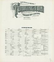
1915
Call Number:
766 T63 1915
Image Count:
32
Resource Type:
Maps , Atlases & Globes
Abstract:
Sanborn fire insurance maps are a rich
Description:
Partial cadastral map .
Subject (Geographic):
Torrington (Conn.)--Maps
Subject (Topic):
--Torrington--Maps
Found in:
Beinecke Rare Book and Manuscript Library > Insurance maps of Torrington, Litchfield Co., Connecticut.
Creator:
Map Co., issuing body
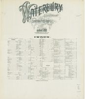
Published / Created:
1890
Call Number:
766 W29 1890
Image Count:
31
Resource Type:
Maps , Atlases & Globes
Abstract:
Sanborn fire insurance maps are a rich
Description:
Partial cadastral map .
Subject (Geographic):
Waterbury (Conn.)--Maps
Subject (Topic):
--Waterbury--Maps
Found in:
Beinecke Rare Book and Manuscript Library > Waterbury, New Haven County, Connecticut.
Creator:
Map Company, issuing body
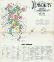
Published / Created:
1909
Call Number:
766 D19 1909
Image Count:
33
Resource Type:
Maps , Atlases & Globes
Abstract:
Sanborn fire insurance maps are a rich
Description:
Partial cadastral map .
Subject (Geographic):
Danbury (Conn.)--Maps
Subject (Topic):
--Danbury--Maps
Found in:
Beinecke Rare Book and Manuscript Library > Insurance maps of Danbury, Fairfield County, Connecticut.
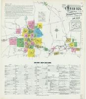
Creator:
Map Co., issuing body
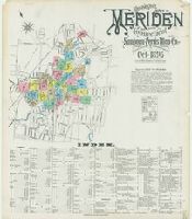
Published / Created:
1896
Call Number:
766 M54 1896
Image Count:
32
Resource Type:
Maps , Atlases & Globes
Abstract:
Sanborn fire insurance maps are a rich
Description:
Partial cadastral map .
Subject (Geographic):
Meriden (Conn.)--Maps
Subject (Topic):
--Meriden--Maps
Found in:
Beinecke Rare Book and Manuscript Library > Insurance maps of Meriden, New Haven Co., Connecticut.
Creator:
Map Company, issuing body
Published / Created:
1907
Call Number:
766 M584 1907
Image Count:
32
Resource Type:
Maps , Atlases & Globes
Abstract:
Sanborn fire insurance maps are a rich
Description:
Partial cadastral map .
Subject (Geographic):
Middletown (Conn.)--Maps
Subject (Name):
Library of Congress. Map Division Stamp
Subject (Topic):
--Middletown--Maps
Found in:
Beinecke Rare Book and Manuscript Library > Insurance maps of Middletown, Middlesex County, Connecticut.
Creator:
Map Company, issuing body
Published / Created:
1916
Call Number:
766 B77 1916
Image Count:
32
Resource Type:
Maps , Atlases & Globes
Abstract:
Sanborn fire insurance maps are a rich
Description:
Partial cadastral map .
Subject (Geographic):
Bristol (Conn.)--Maps
Subject (Topic):
--Bristol--Maps
Found in:
Beinecke Rare Book and Manuscript Library > Insurance maps of Bristol, Hartford County, Connecticut.
Creator:
Map Company, issuing body
Published / Created:
1914
Call Number:
766 N835 1914
Image Count:
33
Resource Type:
Maps , Atlases & Globes
Abstract:
Sanborn fire insurance maps are a rich
Description:
Partial cadastral map .
Subject (Geographic):
Norwich (Conn.)--Maps
Subject (Topic):
--Norwich--Maps
Found in:
Beinecke Rare Book and Manuscript Library > Insurance maps of Norwich, New London Co., Connecticut.
Creator:
Published / Created:
1850
Call Number:
2003 1141
Container / Volume:
3
Image Count:
257
Found in:
Beinecke Rare Book and Manuscript Library > Mémoires d'un voyageur qui se repose : with illustrations : in four parts
Creator:
Published / Created:
[1925]
Call Number:
847 Se18 1922
Container / Volume:
BRBL_00627
Image Count:
2
Resource Type:
Maps , Atlases & Globes
Alternative Title:
City map of Seattle
Description:
Text and map of "Business section of
Subject (Geographic):
Seattle (Wash.)--Maps
Subject (Topic):
(State)--Seattle--Maps
Found in:
Beinecke Rare Book and Manuscript Library > Route map of Seattle / compiled and published by Automobile Club of Washington ; drawn by S.E. Brokaw, 6-15-22, cor. 4-27-25.
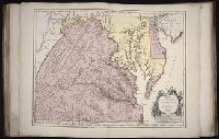
Creator:
Published / Created:
1755
Call Number:
2003 Folio 85
Image Count:
1
Description:
BEIN 2003 Folio 85: No. 22 of 45 maps
Subject (Geographic):
Maryland -- Maps -- 1755
Found in:
Beinecke Rare Book and Manuscript Library > Carte de la Virginie et du Maryland
Creator:
Map Company, issuing body
Published / Created:
1926
Call Number:
766 M31 1926
Image Count:
36
Resource Type:
Maps , Atlases & Globes
Abstract:
Sanborn fire insurance maps are a rich
Description:
Partial cadastral map .
Subject (Geographic):
Manchester--Maps
Subject (Topic):
--Manchester--Maps
Found in:
Beinecke Rare Book and Manuscript Library > Insurance maps of Manchester, including part of Highland Park and Manchester Green, Hartford Co., Connecticut.
Creator:
Map Co., issuing body
Published / Created:
1901
Call Number:
766 N42 1901
Image Count:
35
Resource Type:
Maps , Atlases & Globes
Abstract:
Sanborn fire insurance maps are a rich
Description:
Partial cadastral map .
Subject (Geographic):
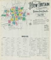
New Britain (Conn.)--Maps
Subject (Topic):
Britain--Maps
Found in:
Beinecke Rare Book and Manuscript Library > Insurance maps of New Britain, Hartford County, Connecticut.
Creator:
Map & Publishing Co., issuing body
Published / Created:
1889
Call Number:
766 B76 1889
Image Count:
37
Resource Type:
Maps , Atlases & Globes
Abstract:
Sanborn fire insurance maps are a rich
Description:
Partial cadastral map .
Subject (Geographic):
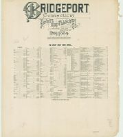
Bridgeport (Conn.)--Maps
Subject (Topic):
--Bridgeport--Maps
Found in:
Beinecke Rare Book and Manuscript Library > Bridgeport, Connecticut.
Creator:
Published / Created:
[1741]
Call Number:
741.00.00.06.1+
Image Count:
1
Resource Type:
still image
Description:
-- Maps : capture of Porto Bello, November 22
Found in:
Lewis Walpole Library > A skit on Britain [graphic]
Published / Created:
MDXCIX [1599]
Call Number:
E159 +B794 1-3
Image Count:
1
Resource Type:
Books, Journals & Pamphlets
Description:
; 2 maps (Nova tabula insularum Iavae
Found in:
Beinecke Rare Book and Manuscript Library > II. pars Indiae Orientalis : in qua Iohan. Hugonis Lintscotani nauigatio in Orientem, item regna, littora, portus, flumina, apparentiae, habitus moresq́ue Indorum & Lusitanorum pariter in Oriente degentium : praeterea merces monentae, mensurae, & pondera, quae quibus in locis, quóve compendio prostent, accurate proponuntur / ea Lintscotus ipse spectator atq[ue] autor primùm vernaculo sibi idiomate Belgice in publicum dedit ; deinde superioribus Germanis Germanice & nunc Latnis item auribus Latine vtcunq[ue] reddita enunciauit Teucrides Annaeus Lonicerus priuatus ciuis Francfordiensis Opus & nauigantibus & mercatoribus historiarumque studiosis apprime vtile ; additae sunt passim D. Paludani annotationes:, item icones in artificiose in are factae per Ioh. Theodorum, & Ioh. Israëlem de Bry fratres quorum sumptibus opus ipsum recens iterum foras datum.
Branch:v1.60.98 ,Deployed:2024-04-24T10:14:36-04:00