Search
You Searched For
Search Results
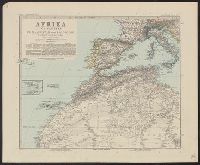
- Creator:
- Lüddecke, Richard
- Published / Created:
- [1891]
- Call Number:
- 60 1891
- Container / Volume:
- BRBL_00328
- Image Count:
- 6
- Resource Type:
- Maps, Atlases & Globes
- Found in:
- Beinecke Rare Book and Manuscript Library > Afrika in 6 Blättern, im Massstab von 1:10,000,000 / bearbeitet von R. Lüddecke (Blatt 2 von B. Domann).
- Creator:
- Survey of India
- Published / Created:
- 1904
- Call Number:
- 59gm 1903
- Container / Volume:
- BRBL_00318
- Image Count:
- 6
- Resource Type:
- Maps, Atlases & Globes
- Found in:
- Beinecke Rare Book and Manuscript Library > Military map of India : Corrected to 1903.
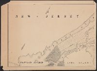
- Creator:
- Walling, Henry Francis, 1825-1888
- Published / Created:
- 1858
- Call Number:
- 764 N76 1858
- Container / Volume:
- BRBL_00458
- Image Count:
- 6
- Resource Type:
- Maps, Atlases & Globes
- Found in:
- Beinecke Rare Book and Manuscript Library > Map of the county of Norfolk, Massachusetts / based upon the details of the trigonometrical survey of the state; the details from actual surveys under the direction of Henry F. Walling. Supt. of the state map.
- Creator:
- Clason Map Co
- Published / Created:
- 1909
- Call Number:
- 831 H36 1909
- Container / Volume:
- BRBL_00580
- Image Count:
- 6
- Resource Type:
- Maps, Atlases & Globes
- Found in:
- Beinecke Rare Book and Manuscript Library > Map of city of Helena, Montana / Copyrighted 1909 by Geo. S. Clason.
- Published / Created:
- [1913]
- Call Number:
- WA MSS S-2162
- Collection Title:
- Frank Richard Oastler collection
- Container / Volume:
- Box 69 | Folder 69
- Image Count:
- 6
- Found in:
- Beinecke Rare Book and Manuscript Library > Typescript description of trip, printed maps, photographic postcard of the Glacier Park Hotel removed from Box 3, 1913 Glacier National Park, Album I
- Creator:
- McGee, W. J., 1853-1912
- Published / Created:
- [1893?]
- Call Number:
- 75CA 1893
- Container / Volume:
- BRBL_00408
- Image Count:
- 10
- Resource Type:
- Maps, Atlases & Globes
- Found in:
- Beinecke Rare Book and Manuscript Library > Reconnoissance map of the United States showing the distribution of the geologic system so far as known / compiled from data in possession of the U.S. Geological Survey by W.J. McGee, 1893.
- Creator:
- United States. Army. Engineer Aviation Topographic Battalion, 942nd
- Published / Created:
- 1945
- Call Number:
- 57gfb 1945
- Container / Volume:
- BRBL_00306
- Image Count:
- 10
- Resource Type:
- Maps, Atlases & Globes
- Found in:
- Beinecke Rare Book and Manuscript Library > Japan electric power / drawn and reproduced by Co B, 942nd Engr. Avn. Topo. Bn, 325th Ric., US Army.
- Creator:
- Mitchell, John, 1711-1768
- Published / Created:
- 1776]
- Call Number:
- 71 1776D
- Container / Volume:
- BRBL_00365
- Image Count:
- 8
- Resource Type:
- Maps, Atlases & Globes
- Found in:
- Beinecke Rare Book and Manuscript Library > Amérique septentrionale avec les routes : distances en miles, villages, et etablissements françois et anglois / par le docteur Mitchel ; traduit de l'Anglois à Paris par Le Rouge, ingr. géographe du roy, Rue des Grands Augustins 1756.
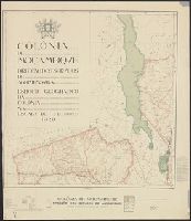
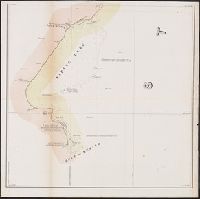
- Creator:
- Mozambique. Direcção dos Serviços de Agrimensura
- Published / Created:
- 1929
- Call Number:
- 636 1929
- Container / Volume:
- BRBL_00337
- Image Count:
- 8
- Resource Type:
- Maps, Atlases & Globes
- Found in:
- Beinecke Rare Book and Manuscript Library > Colónia de Moçambiqve : esboço geografico da colonía na escala de 1/1.000.000 / Direcção dos Serviços de Agrimensura ; comp., B.A. Lourinho ; des., R.J. Ximénes.
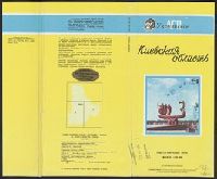
- Creator:
- Ukraïnsʹke aeroheodezychne pidpryi︠e︡mstvo
- Published / Created:
- 1992
- Call Number:
- 3531 1992
- Container / Volume:
- BRBL_00111
- Image Count:
- 8
- Resource Type:
- Maps, Atlases & Globes
- Found in:
- Beinecke Rare Book and Manuscript Library > Kievskai︠a︡ oblastʹ, obshchegeograficheskai︠a︡ karta : masshtab 1:200 000 / Ukrainskoe AGP ; karta sostavlena i podgotovlena k pechati Ukrainskim aėrogeodezicheskim predprii︠a︡tiem v 1992 g.
- Published / Created:
- 1879
- Call Number:
- 40 R66 1879
- Container / Volume:
- BRBL_00218
- Image Count:
- 8
- Resource Type:
- Maps, Atlases & Globes
- Found in:
- Beinecke Rare Book and Manuscript Library > Carta Topografica dell'agro Romano Territori Limitrofi.
- Published / Created:
- 1919
- Call Number:
- 11hcf 1919C-11
- Image Count:
- 8
- Resource Type:
- Maps, Atlases & Globes
- Found in:
- Beinecke Rare Book and Manuscript Library > Base Map of Vosges Department: Taken from File No. 74-A-3 / American Commision to Negotiate Peace, War Damages in Allied Countries.
- Published / Created:
- 1919
- Call Number:
- 11hcf 1919C-9
- Container / Volume:
- BRBL_00010V
- Image Count:
- 5
- Resource Type:
- Maps, Atlases & Globes
- Found in:
- Beinecke Rare Book and Manuscript Library > Base Map of Marne Department : Taken from File 74-A-3 / American Commision to Negotiate Peace, War Damages in Allied Countries.
- Creator:
- Russia. Armii︠a︡. Glavnyi shtab. Voennotopograficheskii otdiel
- Published / Created:
- 1889-.
- Call Number:
- 547 1892
- Container / Volume:
- BRBL_00291
- Image Count:
- 5
- Resource Type:
- Maps, Atlases & Globes
- Found in:
- Beinecke Rare Book and Manuscript Library > Karta iuzhnoī pogranichnoī polosy Asiatskoī Rossīi. Pod redaktsieī General-Maīora Bol' sheva.
- Creator:
- Lee, Thomas Jefferson, 1808-1891
- Published / Created:
- 1842?]
- Call Number:
- 796fab Sa13 1842H
- Container / Volume:
- BRBL_00530
- Image Count:
- 5
- Resource Type:
- Maps, Atlases & Globes
- Found in:
- Beinecke Rare Book and Manuscript Library > Map of the river Sabine from its mouth on the Gulf of Mexico in the sea to Logan's Ferry in latitude 31⁰, 58', 24" north, shewing the boundary between the United States and the Republic of Texas between said points, as marked and laid down by survey in 18
- Creator:
- Anderson, P., civil engr
- Published / Created:
- 1845
- Call Number:
- 766gme 1845N
- Container / Volume:
- BRBL_00475A
- Image Count:
- 5
- Resource Type:
- Maps, Atlases & Globes
- Found in:
- Beinecke Rare Book and Manuscript Library > Map exhibiting the experimental and located lines for the New-York and New-Haven Rail-Road. Projected and drawn by P. Anderson, civil engr.
- Published / Created:
- 1857
- Call Number:
- 764 P74 1857
- Container / Volume:
- BRBL_00459
- Image Count:
- 5
- Resource Type:
- Maps, Atlases & Globes
- Found in:
- Beinecke Rare Book and Manuscript Library > Map of the county of Plymouth, Massachusetts. From actual survey under the direcction of Henry F. Walling ... 1857.
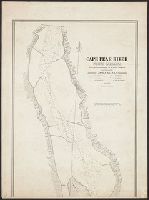
- Published / Created:
- 1839
- Call Number:
- 785cea C17 1839A
- Container / Volume:
- BRBL_00514
- Image Count:
- 5
- Resource Type:
- Maps, Atlases & Globes
- Found in:
- Beinecke Rare Book and Manuscript Library > Cape Fear River ... by Lieutenant James Glynn ... Continuation of the Survey of Cape Fear River ... by Lieut. James Glynn.
- Published / Created:
- [1760?]
- Call Number:
- 428 1760
- Container / Volume:
- BRBL_00247
- Image Count:
- 5
- Resource Type:
- Maps, Atlases & Globes
- Found in:
- Beinecke Rare Book and Manuscript Library > Atlas Tyrolensis.
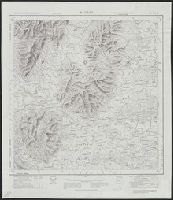
- Creator:
- Survey of India
- Published / Created:
- 19--]
- Call Number:
- 59 M26 1917
- Container / Volume:
- BRBL_00318
- Image Count:
- 5
- Resource Type:
- Maps, Atlases & Globes
- Found in:
- Beinecke Rare Book and Manuscript Library > Madras / published under the direction of Colonel Sir S.G. Burrard, K.S.C.I., R.E., F.R.S., Surveyor General of India, 1917.