Humble, George, d. 1640 Speed, John, 1552?-1629 Sudbury, John
Published / Created:
1610
Call Number:
32 H421 1610
Container / Volume:
BRBL_00047A
Image Count:
2
Resource Type:
Maps, Atlases & Globes
Alternative Title:
Herefordshire described with the true plot of the citie Hereford as alsoe the armes of thos nobles that have bene intituled with that dignitye
Description:
"Cum privilegio"., Coats of arms., Depictions of Mercator and Ortelius., Inset map: Hereford., Pg. nos. on verso: 49-50., Pictorial view of the Battle of Mortimer's Cross (1461)., Signature on, Text on verso: Book I ... Chap. 25., and Title on verso: Hereford-shire.
Publisher:
To be solde in the Popes head alley against the Exchange by Iohn Sudbury and Georg Humbell ...,
Subject (Geographic):
Great Britain--History--Wars of the Roses, 1455-1485--Campaigns and Herefordshire (England)--Maps--Early works to 1800
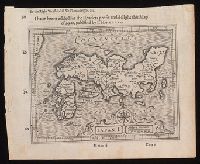
I haue heere added for the readers profit and delight this map of Iapan, published by I. Hondivs, I have heere added for the readers profit and delight this map of Iapan, published by I. Hondius, and Japan I.
Description:
Relief shown pictorially., Removed from Samuel Purchas's Purchas his Pilgrimage (1625)., and Text in English on verso with signature 3M3 at foot of map.
Publisher:
[Printed by William Stansby for Henrie Fetherstone],
Subject (Geographic):
Japan--Maps--Early works to 1800.
Subject (Name):
Featherstone, Henry, -1647, bookseller., Purchas, Samuel, 1577?-1626. Purchas his Pilgrimage. 1625., and Stansby, William, active 1597-1638, printer.
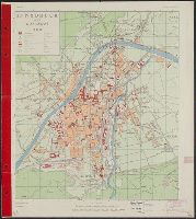
Great Britain. War Office. General Staff. Geographical Section
Published / Created:
1944
Call Number:
428 IN7 1944
Container / Volume:
BRBL_00248
Image Count:
2
Resource Type:
Maps, Atlases & Globes
Alternative Title:
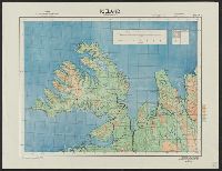
G.S.G.S. ; 4483 and GSGS (Series) ; 4483.
Description:
"Copied from an Austrian plan. Drafting and reproduction by 654th Engineers, U.S. Army.", Alpha-numeric grid overlay., and Index to public buildings and streets on verso.
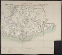
G.S.G.S. no. 2555, G.S.G.S. no. 2555., and International Map Europe 1,000,000
Description:
"Drawn and printed at the War offi, Include notes, adjoining-sheet index diagram, coverage map, pronunciation glossary, list of source-materials, and "Agents for the sale of maps.", and Shows "Line claimed by M. Venizelos" and "Line of Franco-British Proposal."
Publisher:
G.S.G.S.,
Subject (Geographic):
Balkan Peninsula--Maps
Subject (Topic):
World War, 1914-1918--Balkan Peninsula--Treaties--Maps and World War, 1914-1918--Territorial questions--Balkan Peninsula--Maps