Search
You Searched For
Search Results
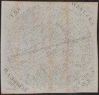
- Published / Created:
- December 1st, 1757.
- Call Number:
- 5 1757
- Container / Volume:
- BRBL_00271
- Image Count:
- 5
- Resource Type:
- Maps, Atlases & Globes
- Found in:
- Beinecke Rare Book and Manuscript Library > [Hemispherical maps and astronomical charts.]
- Creator:
- Des Barres, Joseph F. W. (Joseph Frederick Wallet), 1722-1824
- Published / Created:
- Augt. 1st, 1781.
- Call Number:
- 734 S46 1781
- Container / Volume:
- BRBL_00380
- Image Count:
- 1
- Resource Type:
- Maps, Atlases & Globes
- Found in:
- Beinecke Rare Book and Manuscript Library > [Bay of Seven Islands, Québec].
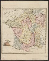
- Published / Created:
- 1790
- Call Number:
- 380 No. 4
- Container / Volume:
- BRBL_00173
- Image Count:
- 1
- Resource Type:
- Maps, Atlases & Globes
- Found in:
- Beinecke Rare Book and Manuscript Library > [Ancient France] Gallia Antiqua. Engraved by S. J. Neele.
- Published / Created:
- 1781
- Call Number:
- 764cea C17 1781
- Container / Volume:
- BRBL_00461
- Image Count:
- 1
- Resource Type:
- Maps, Atlases & Globes
- Found in:
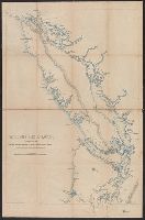
- Beinecke Rare Book and Manuscript Library > [A chart of the harbours of Hampton, Newbury, Ipswick, Jebeka, Squam, Cape Ann, Manchester, Beverly, Salem, Marblehead &c. Surveyed by Samuel Holland.
- Creator:
- Speed, John, 1552?-1629
- Published / Created:
- [1616]
- Call Number:
- 3223 1616
- Container / Volume:
- BRBL_00076
- Image Count:
- 2
- Resource Type:
- Maps, Atlases & Globes
- Found in:
- Beinecke Rare Book and Manuscript Library > Wilshire [cartographic material].
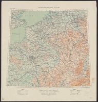
- Creator:
- Great Britain. War Office. General Staff. Geographical Section
- Published / Created:
- 1915
- Call Number:
- 11hc 1915E
- Image Count:
- 1
- Resource Type:
- Maps, Atlases & Globes
- Found in:
- Beinecke Rare Book and Manuscript Library > Western theatre of war.
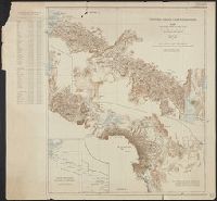
- Creator:
- Anglo-German Boundary Commission
- Published / Created:
- 1907
- Call Number:
- 633 1907
- Container / Volume:
- BRBL_00336
- Image Count:
- 1
- Resource Type:
- Maps, Atlases & Globes
- Found in:
- Beinecke Rare Book and Manuscript Library > Victoria Nyanza to Mt. Kilimanjaro. Map of the country north and south of the Anglo German boundary reduced from the surveys of the British and German sections of the Commissions during the years 1904-1906.
- Creator:
- Clarke, W. B
- Published / Created:
- [1849?]
- Call Number:
- 40 V55 1849
- Image Count:
- 1
- Resource Type:
- Maps, Atlases & Globes
- Found in:
- Beinecke Rare Book and Manuscript Library > Venice = Venèzia = Venèdig / drawn by W.B. Clarke ; engraved by B.R. Davies.
- Published / Created:
- [1843?]
- Call Number:
- 7391 1843
- Container / Volume:
- BRBL_00394
- Image Count:
- 1
- Resource Type:
- Maps, Atlases & Globes
- Found in:
- Beinecke Rare Book and Manuscript Library > Vancouver's Island.
- Creator:
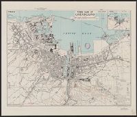
- Great Britain. War Office. General Staff. Geographical Section
- Published / Created:
- 1943
- Call Number:
- 38 C42 1943
- Container / Volume:
- BRBL_00156
- Image Count:
- 1
- Resource Type:
- Maps, Atlases & Globes
- Found in:
- Beinecke Rare Book and Manuscript Library > Town plan of Cherbourg [cartographic material] : France / drawn and photolithographed by War Office, 1943.