Search
You Searched For
Search Results
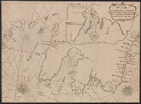
- Creator:
- Gaudy, John
- Published / Created:
- 1715?]
- Call Number:
- 72 1715
- Container / Volume:
- BRBL_00372
- Image Count:
- 1
- Resource Type:
- Maps, Atlases & Globes
- Found in:
- Beinecke Rare Book and Manuscript Library > A chart, shewing part of the sea coast of Newfoundland from the Bay of Bulls to Little Placentia / exactly and carefully lay'd down by John Gaudy, anno 1715.
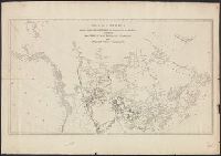
- Published / Created:
- 1860?]
- Call Number:
- 796gme 1860
- Container / Volume:
- BRBL_00531
- Image Count:
- 1
- Resource Type:
- Maps, Atlases & Globes
- Found in:
- Beinecke Rare Book and Manuscript Library > A geographically correct map of the Red River, Sabine & Western Railway (under construction) and connections : showing distribution of pine forests (compiled from maps of U.S. government), also location of coal, iron, and oil deposits.
- Published / Created:
- 178-?]
- Call Number:
- 71 1780C
- Container / Volume:
- BRBL_00366
- Image Count:
- 1
- Resource Type:
- Maps, Atlases & Globes
- Found in:
- Beinecke Rare Book and Manuscript Library > A map of America between latitudes 40 and 70 north, and longitudes 45 and 180 west : exhibiting the principal trading stations of the North West Company.
- Creator:
- Anville, Jean Baptiste Bourguignon d', 1697-1782
- Published / Created:
- 17--?]
- Call Number:
- 71 1769A
- Container / Volume:
- BRBL_00364
- Image Count:
- 1
- Resource Type:
- Maps, Atlases & Globes
- Found in:
- Beinecke Rare Book and Manuscript Library > A map of North America : from D'Anville, 1769.
- Published / Created:
- ca 1810]
- Call Number:
- 773 J487 1810
- Container / Volume:
- BRBL_00496
- Image Count:
- 1
- Resource Type:
- Maps, Atlases & Globes
- Found in:
- Beinecke Rare Book and Manuscript Library > A map of that part of the town of Jersey, commonly called Aharsimus.
- Creator:
- Parker, John Henry, 1806-1884
- Published / Created:
- 1882]
- Call Number:
- 40 R66 1882
- Container / Volume:
- BRBL_00219
- Image Count:
- 1
- Resource Type:
- Maps, Atlases & Globes
- Found in:
- Beinecke Rare Book and Manuscript Library > A plan of Rome, ancient and modern [cartographic material] : with indications of the ancient walls, streets and gates according to Pliny / by John Henry Parker.
- Creator:
- Featherstonhaugh, George William, 1780-1866
- Published / Created:
- 1835]
- Call Number:
- 814 M667 1835
- Container / Volume:
- BRBL_00558
- Image Count:
- 1
- Resource Type:
- Maps, Atlases & Globes
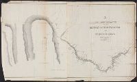
- Found in:
- Beinecke Rare Book and Manuscript Library > A reconnoissance of the Minnay Sotor Watapāh; or St. Peter's River to its sources / made in the year 1835 by G.W. Featherstonhaugh, U.S. geologist.
- Published / Created:
- 1919?]
- Call Number:
- 11hcf 1919B-29
- Container / Volume:
- BRBL_00010Q
- Image Count:
- 1
- Resource Type:
- Maps, Atlases & Globes
- Found in:
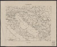
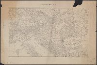
- Beinecke Rare Book and Manuscript Library > Adriatic.
- Published / Created:
- 1919?]
- Call Number:
- 11hcf 1919B-45
- Container / Volume:
- BRBL_00010R
- Image Count:
- 1
- Resource Type:
- Maps, Atlases & Globes
- Found in:
- Beinecke Rare Book and Manuscript Library > Albania.
- Published / Created:
- 1900?]
- Call Number:
- 475CBD 1900
- Container / Volume:
- BRBL_00262
- Image Count:
- 1
- Resource Type:
- Maps, Atlases & Globes
- Found in:
- Beinecke Rare Book and Manuscript Library > Albania.
- Published / Created:
- 1919?]
- Call Number:
- 11hcf 1919B-40
- Image Count:
- 1
- Resource Type:
- Maps, Atlases & Globes
- Found in:
- Beinecke Rare Book and Manuscript Library > Anatolia and Armenia.
- Published / Created:
- 1919?]
- Call Number:
- 11hcf 1919B-43
- Image Count:
- 1
- Resource Type:
- Maps, Atlases & Globes
- Found in:
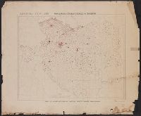
- Beinecke Rare Book and Manuscript Library > Areas and population of Dalmatian Islands in 1900 : Official Austrian census.
- Creator:
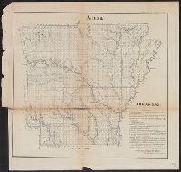
- Arkansas. Surveyor's Office
- Published / Created:
- 1855]
- Call Number:
- 818 1855B
- Container / Volume:
- BRBL_00565
- Image Count:
- 1
- Resource Type:
- Maps, Atlases & Globes
- Found in:
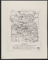
- Beinecke Rare Book and Manuscript Library > Arkansas / Surveyor's Office Little Rock Oct. 18th 1855. Henry M. Rector, Sur. Genl. of Arks.
- Published / Created:
- 1919?]
- Call Number:
- 11hcf 1919B-41
- Container / Volume:
- BRBL_00010R
- Image Count:
- 1
- Resource Type:
- Maps, Atlases & Globes
- Found in:
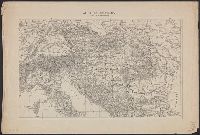
- Beinecke Rare Book and Manuscript Library > Asia.
- Published / Created:
- 1910?]
- Call Number:
- 41fac 1910
- Container / Volume:
- BRBL_00243
- Image Count:
- 2
- Resource Type:
- Maps, Atlases & Globes
- Found in:
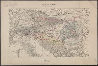
- Beinecke Rare Book and Manuscript Library > Austria Hungary ... Hungary by Administrative divisions of 1910.
- Published / Created:
- 1919?]
- Call Number:
- 11hcf 1919C-3-1
- Container / Volume:
- BRBL_00010U
- Image Count:
- 1
- Resource Type:
- Maps, Atlases & Globes
- Found in:
- Beinecke Rare Book and Manuscript Library > Austria Hungary, Scale 1:3,000,000.
- Published / Created:
- 1919?]
- Call Number:
- 11hcf 1919C-3-1
- Container / Volume:
- BRBL_00010U
- Image Count:
- 1
- Resource Type:
- Maps, Atlases & Globes
- Found in:
- Beinecke Rare Book and Manuscript Library > Austria Hungary, Scale 1:3,000,000.
- Published / Created:
- 1919?]
- Call Number:
- 11hcf 1919C-3-1
- Container / Volume:
- BRBL_00010U
- Image Count:
- 1
- Resource Type:
- Maps, Atlases & Globes
- Found in:
- Beinecke Rare Book and Manuscript Library > Austria Hungary, Scale 1:3,000,000.
- Creator:
- Atkins, Paul M. (Paul Moody), 1892-
- Published / Created:
- 1910]
- Call Number:
- 41gc 1910
- Container / Volume:
- BRBL_00243
- Image Count:
- 1
- Resource Type:
- Maps, Atlases & Globes
- Found in:
- Beinecke Rare Book and Manuscript Library > Austria-Hungary : Population actively engaged in Agriculture Paul M. Atkins.
- Creator:
- Atkins, Paul M. (Paul Moody), 1892-
- Published / Created:
- 1910]
- Call Number:
- 41gf 1910
- Container / Volume:
- BRBL_00243
- Image Count:
- 1
- Resource Type:
- Maps, Atlases & Globes
- Found in:
- Beinecke Rare Book and Manuscript Library > Austria-Hungary : Population actively engaged in Industry Paul M. Atkins.
- Published / Created:
- 1919]
- Call Number:
- 11hcf 1919B-5
- Container / Volume:
- BRBL_00010S
- Image Count:
- 1
- Resource Type:
- Maps, Atlases & Globes
- Found in:
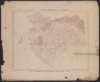
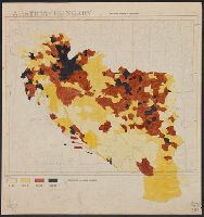
- Beinecke Rare Book and Manuscript Library > Austria-Hungary : Population density of Jugo-slavia.
- Published / Created:
- 1910?]
- Call Number:
- 41 1910A
- Container / Volume:
- BRBL_00241
- Image Count:
- 1
- Resource Type:
- Maps, Atlases & Globes
- Found in:
- Beinecke Rare Book and Manuscript Library > Austria-Hungary.
- Published / Created:
- 1910?]
- Call Number:
- 11hcf 1919C-14
- Image Count:
- 1
- Resource Type:
- Maps, Atlases & Globes
- Found in:
- Beinecke Rare Book and Manuscript Library > Austria-Hungary.
- Published / Created:
- 1919?].
- Call Number:
- 11hcf 1919C-3-14
- Container / Volume:
- BRBL_00010U
- Image Count:
- 1
- Resource Type:
- Maps, Atlases & Globes
- Found in:
- Beinecke Rare Book and Manuscript Library > Austria-Hungary.
- Published / Created:
- 1919?]
- Call Number:
- 11hcf 1919C-3-17
- Container / Volume:
- BRBL_00010U
- Image Count:
- 1
- Resource Type:
- Maps, Atlases & Globes
- Found in:
- Beinecke Rare Book and Manuscript Library > Austria-Hungary.
- Published / Created:
- 1919?]
- Call Number:
- 11hcf 1919C-3-16
- Container / Volume:
- BRBL_00010U
- Image Count:
- 1
- Resource Type:
- Maps, Atlases & Globes
- Found in:
- Beinecke Rare Book and Manuscript Library > Austria-Hungary.
- Published / Created:
- 1919?]
- Call Number:
- 11hcf 1919C-3-8
- Container / Volume:
- BRBL_00010U
- Image Count:
- 1
- Resource Type:
- Maps, Atlases & Globes
- Found in:
- Beinecke Rare Book and Manuscript Library > Austria-Hungary.
- Published / Created:
- 1919]
- Call Number:
- 11hcf 1919B-33
- Container / Volume:
- BRBL_00010Q
- Image Count:
- 1
- Resource Type:
- Maps, Atlases & Globes
- Found in:
- Beinecke Rare Book and Manuscript Library > Baltic provinces.
- Creator:
- Peseux, M
- Published / Created:
- 1864
- Call Number:
- 801hc N17 1864
- Container / Volume:
- BRBL_00541
- Image Count:
- 1
- Resource Type:
- Maps, Atlases & Globes
- Found in:
- Beinecke Rare Book and Manuscript Library > Battlefields in front of Nashville where the United States forces commanded by Major General Geo. H. Thomas defeated and routed the Rebel army under General Hood, December 15th & 16th 1864 / surveyed and drawn under the direction of Gen: Tower by M. Peseu
- Creator:
- Jensen, M. K
- Published / Created:
- c1939.
- Call Number:
- 827 B284 1939
- Container / Volume:
- BRBL_00577
- Image Count:
- 1
- Resource Type:
- Maps, Atlases & Globes
- Found in:
- Beinecke Rare Book and Manuscript Library > City of Bartlesville, Oklahoma / compiled and drawn by M.K. Jensen.
- Creator:
- Shepard, Edwin
- Published / Created:
- 1877]
- Call Number:
- 844 Sa593 1877
- Container / Volume:
- BRBL_00610
- Image Count:
- 1
- Resource Type:
- Maps, Atlases & Globes
- Found in:
- Beinecke Rare Book and Manuscript Library > City of Santa Cruz, California, 1877 / compiled by Edwin Shepard.
- Creator:
- Thompson, David, 1770-1857
- Published / Created:
- 19--?]
- Call Number:
- 73 1814
- Container / Volume:
- BRBL_00374
- Image Count:
- 1
- Resource Type:
- Maps, Atlases & Globes
- Found in:
- Beinecke Rare Book and Manuscript Library > Copy of a portion of map of the North-West territory of the Province of Canada : from actual survey during the years 1798 to 1812 / by David Thompson.
- Published / Created:
- 186-?]
- Call Number:
- 815ad C832 1860
- Container / Volume:
- BRBL_00561
- Image Count:
- 1
- Resource Type:
- Maps, Atlases & Globes
- Found in:
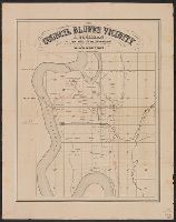
- Beinecke Rare Book and Manuscript Library > Council Bluffs vicinity / A. Cochran, dealer in lands, lots and land warrants.
- Published / Created:
- 186-?]
- Call Number:
- 815ad C832 1860
- Container / Volume:
- BRBL_00561
- Image Count:
- 1
- Resource Type:
- Maps, Atlases & Globes
- Found in:
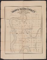
- Beinecke Rare Book and Manuscript Library > Council Bluffs vicinity / A. Cochran, dealer in lands, lots and land warrants.
- Published / Created:
- 1847 or 1848?]
- Call Number:
- 816fcm 1847
- Container / Volume:
- BRBL_00563
- Image Count:
- 1
- Resource Type:
- Maps, Atlases & Globes
- Found in:
- Beinecke Rare Book and Manuscript Library > Diagram of the state of Missouri.
- Published / Created:
- 1874]
- Call Number:
- 75eha 1873
- Image Count:
- 1
- Resource Type:
- Maps, Atlases & Globes
- Found in:
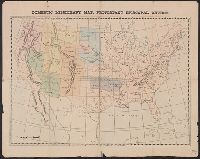
- Beinecke Rare Book and Manuscript Library > Domestic missionary map, Protestant Episcopal Church.
- Published / Created:
- 1945?]
- Call Number:
- 48g 1945
- Container / Volume:
- BRBL_00264
- Image Count:
- 1
- Resource Type:
- Maps, Atlases & Globes
- Found in:
- Beinecke Rare Book and Manuscript Library > Economic map of Greece.
- Published / Created:
- 1910?]
- Call Number:
- 11hcf 1919B-6
- Container / Volume:
- BRBL_00010S
- Image Count:
- 1
- Resource Type:
- Maps, Atlases & Globes
- Found in:
- Beinecke Rare Book and Manuscript Library > Ethnography [of Caucasus Region].
- Published / Created:
- 19--?]
- Call Number:
- 11hcf 1919B-17
- Container / Volume:
- BRBL_00010O
- Image Count:
- 2
- Resource Type:
- Maps, Atlases & Globes
- Found in:
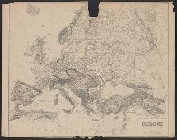
- Beinecke Rare Book and Manuscript Library > Europe.
- Published / Created:
- 19--?]
- Call Number:
- 11hcf 1919B-17
- Container / Volume:
- BRBL_00010O
- Image Count:
- 1
- Resource Type:
- Maps, Atlases & Globes
- Found in:
- Beinecke Rare Book and Manuscript Library > Europe.
- Published / Created:
- 1944?]
- Call Number:
- 11hd 1944M-3
- Container / Volume:
- BRBL_00010ZE
- Image Count:
- 2
- Resource Type:
- Maps, Atlases & Globes
- Found in:
- Beinecke Rare Book and Manuscript Library > France, 1:12,500. Sheet no. 73, Foucarville.
- Published / Created:
- 1944?]
- Call Number:
- 11hd 1944M-2
- Container / Volume:
- BRBL_00010ZE
- Image Count:
- 2
- Resource Type:
- Maps, Atlases & Globes
- Found in:
- Beinecke Rare Book and Manuscript Library > France, 1:25,000. Sheet no. 31/18 N.E., Ste. Mère Église.
- Published / Created:
- 1944?]
- Call Number:
- 11hd 1944M-1
- Container / Volume:
- BRBL_00010ZE
- Image Count:
- 2
- Resource Type:
- Maps, Atlases & Globes
- Found in:
- Beinecke Rare Book and Manuscript Library > France, 1:25,000. Sheet no. 31/20 S.E., Montebourg.
- Published / Created:
- 1919]
- Call Number:
- 11hcf 1919B-21
- Container / Volume:
- BRBL_00010P
- Image Count:
- 1
- Resource Type:
- Maps, Atlases & Globes
- Found in:
- Beinecke Rare Book and Manuscript Library > France.
- Creator:
- Ferrer, Fermin
- Published / Created:
- 1855
- Call Number:
- 895 1855
- Container / Volume:
- BRBL_00659
- Image Count:
- 1
- Resource Type:
- Maps, Atlases & Globes
- Found in:
- Beinecke Rare Book and Manuscript Library > Geographical map of the Republic of Nicaragua : with three plans and views / by Fermin Ferrer, Governor of the Western Dept.
- Published / Created:
- 1919]
- Call Number:
- 11hcf 1919B-16
- Container / Volume:
- BRBL_00010O
- Image Count:
- 1
- Resource Type:
- Maps, Atlases & Globes
- Found in:
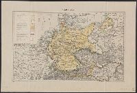
- Beinecke Rare Book and Manuscript Library > Germany.
- Published / Created:
- 1919]
- Call Number:
- 11hcf 1919B-22
- Container / Volume:
- BRBL_00010P
- Image Count:
- 1
- Resource Type:
- Maps, Atlases & Globes
- Found in:
- Beinecke Rare Book and Manuscript Library > Germany.
- Published / Created:
- 1889
- Call Number:
- 827 1889
- Container / Volume:
- BRBL_00577
- Image Count:
- 1
- Resource Type:
- Maps, Atlases & Globes
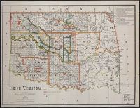
- Found in:
- Beinecke Rare Book and Manuscript Library > Indian territory / compiled under the direction of the Hon. John H. Oberly, Commissioner of Indian Affairs, by C.A. Maxwell ; John Olberg, draftsman.
- Published / Created:
- 1942?]
- Call Number:
- 11hd 1942-3
- Image Count:
- 1
- Resource Type:
- Maps, Atlases & Globes
- Found in:
- Beinecke Rare Book and Manuscript Library > Indo-Burma Front.
- Published / Created:
- 183-?]
- Call Number:
- 816 Ir6 1837A
- Container / Volume:
- BRBL_00562
- Image Count:
- 1
- Resource Type:
- Maps, Atlases & Globes
- Found in:
- Beinecke Rare Book and Manuscript Library > Iron Mountain City.
- Published / Created:
- 1945]
- Call Number:
- 11hd 1945H
- Container / Volume:
- BRBL_00010ZF
- Image Count:
- 2
- Resource Type:
- Maps, Atlases & Globes
- Found in:
- Beinecke Rare Book and Manuscript Library > Japan, Honshu - South Coast : Iseno Umi or Ise Wan and Mikawa Wan with approaches, from Japanese surveys to 1927, with additions to 1935.
- Published / Created:
- 1944
- Call Number:
- 38hc L16 1944
- Container / Volume:
- BRBL_00173
- Image Count:
- 1
- Resource Type:
- Maps, Atlases & Globes
- Found in:
- Beinecke Rare Book and Manuscript Library > La Madeleine (Utah Beach-South).
- Published / Created:
- c1949.
- Call Number:
- 846 Os9 1949
- Container / Volume:
- BRBL_00622
- Image Count:
- 1
- Resource Type:
- Maps, Atlases & Globes
- Found in:
- Beinecke Rare Book and Manuscript Library > Lake Oswego and vicinity.
- Published / Created:
- 1881?]
- Call Number:
- 836gme 1881
- Container / Volume:
- BRBL_00593
- Image Count:
- 1
- Resource Type:
- Maps, Atlases & Globes
- Found in:
- Beinecke Rare Book and Manuscript Library > Map and profile of the line of the Utah & Wyoming Railway, Granger to Corinne.
- Creator:
- Hardee, T. S
- Published / Created:
- 1880?]
- Call Number:
- 795 N47 1880
- Container / Volume:
- BRBL_00522
- Image Count:
- 1
- Resource Type:
- Maps, Atlases & Globes
- Found in:
- Beinecke Rare Book and Manuscript Library > Map illustrating the topography of New Orleans and of the coast of Louisiana and Mississippi / prepared for Joseph Jones, M.D., by T.S. Hardee, civil engineer.
- Published / Created:
- 19--?]
- Call Number:
- 574 1930
- Container / Volume:
- BRBL_00311
- Image Count:
- 1
- Resource Type:
- Maps, Atlases & Globes
- Found in:
- Beinecke Rare Book and Manuscript Library > Map of Chosen (Korea).
- Published / Created:
- 1943
- Call Number:
- 56 C47 1943
- Container / Volume:
- BRBL_00296
- Image Count:
- 1
- Resource Type:
- Maps, Atlases & Globes
- Found in:
- Beinecke Rare Book and Manuscript Library > Map of Chungking City/ Drafted and reproduced by 653rd Engr. Bn. under direction of chief engineer, China Theater.
- Creator:
- Habersham, R. A
- Published / Created:
- 1888
- Call Number:
- 847 C65 1888
- Container / Volume:
- BRBL_00626
- Image Count:
- 1
- Resource Type:
- Maps, Atlases & Globes
- Found in:
- Beinecke Rare Book and Manuscript Library > Map of Clarke County, Washington Territory : compiled from the county records, rail road surveys, and other authentic data / compiled by R.A. Habersham.
- Creator:
- Russel, Andrew F
- Published / Created:
- 185-?]
- Call Number:
- 815 D273 1850
- Container / Volume:
- BRBL_00560
- Image Count:
- 1
- Resource Type:
- Maps, Atlases & Globes
- Found in:
- Beinecke Rare Book and Manuscript Library > Map of Davenport and its vicinity, Iowa / by Andrew F. Rufsel.
- Published / Created:
- 1890?]
- Call Number:
- 834 D437 1890B
- Container / Volume:
- BRBL_00589
- Image Count:
- 1
- Resource Type:
- Maps, Atlases & Globes
- Found in:
- Beinecke Rare Book and Manuscript Library > Map of Denver-Colorado and the town of Montclair.
- Published / Created:
- 1840 ?]
- Call Number:
- 486 1840
- Container / Volume:
- BRBL_00265
- Image Count:
- 1
- Resource Type:
- Maps, Atlases & Globes
- Found in:
- Beinecke Rare Book and Manuscript Library > Map of Extra-Peloponnesian Greece : as it stood at the beginning of the Peloponnesian war / by K. O. Muller.
- Creator:
- Hincks, Edmund S
- Published / Created:
- 189-?]
- Call Number:
- 847 B45 189X
- Container / Volume:
- BRBL_00626
- Image Count:
- 1
- Resource Type:
- Maps, Atlases & Globes
- Found in:
- Beinecke Rare Book and Manuscript Library > Map of Fairhaven and vicinity, Washington / Edmund S. Hincks, draughtsman ; compliments of Fairhaven Land Co., Fairhaven, Washington.
- Published / Created:
- 1920
- Call Number:
- 766 W15 1920
- Container / Volume:
- BRBL_00474
- Image Count:
- 1
- Resource Type:
- Maps, Atlases & Globes
- Found in:
- Beinecke Rare Book and Manuscript Library > Map of Gaylord Farm, Wallingford, Conn. / surveyed by H.E. Phelps.
- Published / Created:
- 1882
- Call Number:
- 831 J89 1882
- Container / Volume:
- BRBL_00580
- Image Count:
- 1
- Resource Type:
- Maps, Atlases & Globes
- Found in:
- Beinecke Rare Book and Manuscript Library > Map of Judith Basin, Montana Ter. / Northern Transcontinental Survey, Raphael Pumpelly, director ; Department of Topography, A.D. Wilson, chief topographer ; lettering by F.D. Owen.
- Published / Created:
- 1882
- Call Number:
- 831 J89 1882A
- Container / Volume:
- BRBL_00580
- Image Count:
- 2
- Resource Type:
- Maps, Atlases & Globes
- Found in:
- Beinecke Rare Book and Manuscript Library > Map of Judith Basin, Montana Ter. / Northern Transcontinental Survey, Raphael Pumpelly, director ; Department of Topography, A.D. Wilson, chief topographer.
- Published / Created:
- 189-?]
- Call Number:
- 825 K134 189X
- Container / Volume:
- BRBL_00574
- Image Count:
- 1
- Resource Type:
- Maps, Atlases & Globes
- Found in:
- Beinecke Rare Book and Manuscript Library > Map of Kansas City, Kan. : showing terminals of the K.C., W. and N.W.R.R. Co.
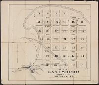
- Published / Created:
- 187-?]
- Call Number:
- 814 L248 1875
- Container / Volume:
- BRBL_00558
- Image Count:
- 1
- Resource Type:
- Maps, Atlases & Globes
- Found in:
- Beinecke Rare Book and Manuscript Library > Map of Lanesboro, county of Fillmore, Minnesota : first addition to the village of Lanesboro.
- Published / Created:
- 1868?]
- Call Number:
- 814 L248 1868
- Container / Volume:
- BRBL_00558
- Image Count:
- 1
- Resource Type:
- Maps, Atlases & Globes
- Found in:
- Beinecke Rare Book and Manuscript Library > Map of Lanesboro, county of Fillmore, Minnesota.
- Published / Created:
- 1912
- Call Number:
- 534cbf 1912
- Container / Volume:
- BRBL_00289
- Image Count:
- 1
- Resource Type:
- Maps, Atlases & Globes
- Found in:
- Beinecke Rare Book and Manuscript Library > Map of Persia.
- Creator:
- George B. Cadwell & Co
- Published / Created:
- 1892
- Call Number:
- 811 T227 1892
- Container / Volume:
- BRBL_00553
- Image Count:
- 1
- Resource Type:
- Maps, Atlases & Globes
- Found in:
- Beinecke Rare Book and Manuscript Library > Map of Tecumseh : compiled for Geo. B. Cadwell & Co's. atlas of Lenawee County, Mich.
- Creator:
- United States. Post Office Dept
- Published / Created:
- 1910
- Call Number:
- 766gmd T57 1912
- Container / Volume:
- BRBL_00475A
- Image Count:
- 1
- Resource Type:
- Maps, Atlases & Globes
- Found in:
- Beinecke Rare Book and Manuscript Library > Map of Tolland County, Connecticut, showing rural delivery service / Post Office Department.
- Creator:
- De Werthern, H
- Published / Created:
- 1869]
- Call Number:
- 836 1869
- Container / Volume:
- BRBL_00592
- Image Count:
- 1
- Resource Type:
- Maps, Atlases & Globes
- Found in:
- Beinecke Rare Book and Manuscript Library > Map of Utah and Colorado / prepared by order of Lieut. Genl. W.T. Sherman ; drawn by H. De Werthern.
- Published / Created:
- 187-?]
- Call Number:
- 825gme 1870
- Container / Volume:
- BRBL_00576
- Image Count:
- 1
- Resource Type:
- Maps, Atlases & Globes
- Found in:
- Beinecke Rare Book and Manuscript Library > Map of eastern Kansas : showing the lines of the Mo.R.F.S. & G.R.R. and connections.
- Published / Created:
- 1917]
- Call Number:
- 11hcf 1919B-27
- Container / Volume:
- BRBL_00010Q
- Image Count:
- 1
- Resource Type:
- Maps, Atlases & Globes
- Found in:
- Beinecke Rare Book and Manuscript Library > Map of the Russian Empire.
- Published / Created:
- 1882]
- Call Number:
- 834 C719 1882
- Container / Volume:
- BRBL_00589
- Image Count:
- 1
- Resource Type:
- Maps, Atlases & Globes
- Found in:
- Beinecke Rare Book and Manuscript Library > Map of the city of Colorado Springs, Colorado / W.P. Jewett, civil engineer, May 1882.
- Creator:
- Peters, W. G., draughtsman
- Published / Created:
- 188-?]
- Call Number:
- 847 T119 188X
- Container / Volume:
- BRBL_00627
- Image Count:
- 1
- Resource Type:
- Maps, Atlases & Globes
- Found in:
- Beinecke Rare Book and Manuscript Library > Map of the city of Tacoma, W.T. and vicinity : Pacific Terminus N.P.R.R. / compiled and drawn by W.G. Peters, draughtsman ; A. Anderson & Co., map engravers.
- Creator:
- Knight, E. H. (Edward H.)
- Published / Created:
- 1871]
- Call Number:
- 80gme 1871A
- Container / Volume:
- BRBL_00538
- Image Count:
- 2
- Resource Type:
- Maps, Atlases & Globes
- Found in:
- Beinecke Rare Book and Manuscript Library > Map of the country tributary to the Northern Pacific Railroad / compiled from English, Canadian, and American official sources and original surveys by Edward H. Knight, Jan. 1st 1871.
- Published / Created:
- 1845?]
- Call Number:
- 818fb 1845
- Container / Volume:
- BRBL_00565
- Image Count:
- 1
- Resource Type:
- Maps, Atlases & Globes
- Found in:
- Beinecke Rare Book and Manuscript Library > Map of the south western district, Louisiana ; South eastern district, Louisiana ; Map of the district north of Red River and part of N.W. District, LA. / Surveyor Generals Office, Donaldson, Oct. 29th 1845, P.T. Landry, Sur. Genl. La. Arkansas / Wm. Pel
- Published / Created:
- 1880?]
- Call Number:
- 796gme 1880
- Container / Volume:
- BRBL_00531
- Image Count:
- 1
- Resource Type:
- Maps, Atlases & Globes
- Found in:
- Beinecke Rare Book and Manuscript Library > Map of the the Texas & Pacific Railway and connections.
- Creator:
- Walling, Henry Francis, 1825-1888
- Published / Created:
- 1856
- Call Number:
- 764 D255 1856
- Container / Volume:
- BRBL_00457
- Image Count:
- 1
- Resource Type:
- Maps, Atlases & Globes
- Found in:
- Beinecke Rare Book and Manuscript Library > Map of the town of Dartmouth, Bristol County Mass. : made by order of the town / under the direction of H.F. Walling, sup. of the state map.
- Creator:
- Cornwall, Pierre Barlow, 1821-1904
- Published / Created:
- 1883
- Call Number:
- 847 B45 1883
- Container / Volume:
- BRBL_00626
- Image Count:
- 1
- Resource Type:
- Maps, Atlases & Globes
- Found in:
- Beinecke Rare Book and Manuscript Library > Map of the town of New Whatcom, Whatcom Co. Wash. Terr./ E.C. Prather engr. ; I.A. Lefevre del.
- Creator:
- Smith, M. L., Lieut
- Published / Created:
- 184-?]
- Call Number:
- 88 184X
- Container / Volume:
- BRBL_00645
- Image Count:
- 1
- Resource Type:
- Maps, Atlases & Globes
- Found in:
- Beinecke Rare Book and Manuscript Library > Map of the valley of Mexico, with a plan of the defences of the capital and the line of operations of the United States Army under Major General Scott in August and September 1847 / surveyed and drawn by Lieut. M.L. Smith and Brevt. Capt. E.L.F. Hardcastl
- Published / Created:
- 188-?]
- Call Number:
- 825 K134 188X
- Container / Volume:
- BRBL_00574
- Image Count:
- 1
- Resource Type:
- Maps, Atlases & Globes
- Found in:
- Beinecke Rare Book and Manuscript Library > Map of the vicinity of Kansas City in Kansas and Missouri / compliments of H.C. Lloyd & Co., real estate brokers and builders ... Kansas City, Mo. ; MacCormac eng. Phila.
- Published / Created:
- 1840?]
- Call Number:
- 7715FB AS88 1840
- Container / Volume:
- BRBL_00493
- Image Count:
- 1
- Resource Type:
- Maps, Atlases & Globes
- Found in:
- Beinecke Rare Book and Manuscript Library > Map of the village of Astoria, Late Hallett's Cove & Ravenswood, Long Island, 1840.
- Creator:
- Woodruff, Thomas Mayhew, d. 1899
- Published / Created:
- 187-?]
- Call Number:
- 831 1878B
- Container / Volume:
- BRBL_00579
- Image Count:
- 1
- Resource Type:
- Maps, Atlases & Globes
- Found in:
- Beinecke Rare Book and Manuscript Library > Map showing a portion of the marches of troops under Genl. N.A. Miles command 1876-1878 / drawn by Thom. M. Woodruff, Lt. 5th Inftry A.A.D.C., March 1st 1878.
- Published / Created:
- 1891]
- Call Number:
- 814gme 1891
- Container / Volume:
- BRBL_00559
- Image Count:
- 1
- Resource Type:
- Maps, Atlases & Globes
- Found in:
- Beinecke Rare Book and Manuscript Library > Map showing lands belonging to the St. Paul and Duluth Railroad Company, June 30th 1891 / Ralph Martin, del.
- Published / Created:
- 1900]
- Call Number:
- 814ad 1900
- Container / Volume:
- BRBL_00559
- Image Count:
- 2
- Resource Type:
- Maps, Atlases & Globes
- Found in:
- Beinecke Rare Book and Manuscript Library > Map showing lands for sale by the land department of the Northern Pacific Railway Co. in Hubbard, Wadena, Todd, Aitkin, Cass, Crow-Wing, Mille Lacs, and Itasca counties, Minnesota.
- Published / Created:
- 1885?]
- Call Number:
- 832gma Sn13 1885
- Container / Volume:
- BRBL_00583
- Image Count:
- 1
- Resource Type:
- Maps, Atlases & Globes
- Found in:
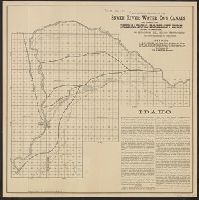
- Beinecke Rare Book and Manuscript Library > Map showing location of the Snake River Water Co.'s canals and lands of the International Immigrant Union capable of irrigation, in Bingham Co., Idaho Territory / Matthews, Northrup & Co., engravers and printers.
- Creator:
- Smith, M.L
- Published / Created:
- 1853, 1854.
- Call Number:
- 792 1855C
- Container / Volume:
- BRBL_00518
- Image Count:
- 1
- Resource Type:
- Maps, Atlases & Globes
- Found in:
- Beinecke Rare Book and Manuscript Library > Map showing the different lines of survey across Florida for a canal between Espiritu Santo Bay and the St. Johns and Ocklawaha Rivers / by Lieut. M. L. Smith, Topog. Engrs., Lieut. F. T. Bryan, Topog. Engrs. and A. E. Drake, C. Engr.
- Creator:
- Union Pacific Railroad Company
- Published / Created:
- 1867?]
- Call Number:
- 824 Om1 1867
- Container / Volume:
- BRBL_00571
- Image Count:
- 1
- Resource Type:
- Maps, Atlases & Globes
- Found in:
- Beinecke Rare Book and Manuscript Library > Map to accompany report of J.L. Williams on the bridging of the Missouri River / Union Pacific Rail Road.
- Published / Created:
- 1942?]
- Call Number:
- 11hd 1942R-1
- Container / Volume:
- BRBL_00010ZE
- Image Count:
- 1
- Resource Type:
- Maps, Atlases & Globes
- Found in:
- Beinecke Rare Book and Manuscript Library > Mediterranean - Four Phases of War [cartographic material].
- Creator:
- Carey, Mathew, 1760-1839
- Published / Created:
- 1814]
- Call Number:
- 80 1814D
- Container / Volume:
- BRBL_00532
- Image Count:
- 1
- Resource Type:
- Maps, Atlases & Globes
- Found in:
- Beinecke Rare Book and Manuscript Library > Missouri Territory formerly Louisiana / Lewis, del. ; Bower, sc.
- Creator:
- Medary, Jacob
- Published / Created:
- 1882
- Call Number:
- 831gme 1882
- Container / Volume:
- BRBL_00581
- Image Count:
- 1
- Resource Type:
- Maps, Atlases & Globes
- Found in:
- Beinecke Rare Book and Manuscript Library > Montana / compiled from the latest official records and other sources by Jacob Medary.
- Creator:
- J.H. Colton & Co
- Published / Created:
- 19--?]
- Call Number:
- 824 1854B
- Container / Volume:
- BRBL_00570
- Image Count:
- 1
- Resource Type:
- Maps, Atlases & Globes
- Found in:
- Beinecke Rare Book and Manuscript Library > Nebraska and Kansas.
- Creator:
- Charles H. Baker & Co
- Published / Created:
- 1899
- Call Number:
- 847 P964 1899
- Container / Volume:
- BRBL_00626
- Image Count:
- 1
- Resource Type:
- Maps, Atlases & Globes
- Found in:
- Beinecke Rare Book and Manuscript Library > New map of Puget Sound country / Chas. H. Baker & Co., compilers ; compliments of The Fairhaven Land Co., Fairhaven, Washington.
- Creator:
- Charles H. Baker & Co
- Published / Created:
- 1891
- Call Number:
- 847 P964 1891
- Container / Volume:
- BRBL_00626
- Image Count:
- 1
- Resource Type:
- Maps, Atlases & Globes
- Found in:
- Beinecke Rare Book and Manuscript Library > New map of Puget Sound country / Chas. H. Baker & Co., compilers ; compliments of the Fairhaven Land Co., Fairhaven, Wash.
- Creator:
- Kitchin, Thomas, d. 1784
- Published / Created:
- 178-?]
- Call Number:
- 71 1784B
- Container / Volume:
- BRBL_00366
- Image Count:
- 1
- Resource Type:
- Maps, Atlases & Globes
- Found in:
- Beinecke Rare Book and Manuscript Library > North America / drawn from the latest & best authorities by Thos. Kitchin.
- Published / Created:
- 1919?]
- Call Number:
- 11hcf 1919B-44
- Image Count:
- 1
- Resource Type:
- Maps, Atlases & Globes
- Found in:
- Beinecke Rare Book and Manuscript Library > Numbers speaking various languages in Istrian-Dalmatian Islands.
- Creator:
- United States Coast Survey
- Published / Created:
- 1864
- Call Number:
- 803cea 1864
- Container / Volume:
- BRBL_00542
- Image Count:
- 1
- Resource Type:
- Maps, Atlases & Globes
- Found in:
- Beinecke Rare Book and Manuscript Library > Ohio River between Mound City and Cairo / surveyed by the party of F.H. Gerdes, asst. assigned by A.D. Bache, Supdt. U.S. Coast Survey to act under orders of Rear Admiral D.D. Porter, U.S.N., commanding Mississippi Squadron.
- Published / Created:
- 1944?]
- Call Number:
- 11hd 1944L
- Container / Volume:
- BRBL_00010ZE
- Image Count:
- 1
- Resource Type:
- Maps, Atlases & Globes
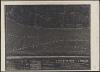
- Found in:
- Beinecke Rare Book and Manuscript Library > Para-Map No. X-C (night map), St. Marie-du-Mont (Holdy) / Compilation by 663rd Engineers, Reproduction by 654th Engineers.