Search
You Searched For
Search Results
- Creator:
- Medary, Samuel A
- Published / Created:
- 1858
- Call Number:
- 8101 1858
- Container / Volume:
- BRBL_00552
- Image Count:
- 1
- Resource Type:
- Maps, Atlases & Globes
- Found in:
- Beinecke Rare Book and Manuscript Library > Map of the Fort Ridgely & South Pass road / by Samuel A. Medary ; drawn by John R. Key.
- Creator:
- United States. General Land Office
- Published / Created:
- 1866
- Call Number:
- 806gbc 1866
- Container / Volume:
- BRBL_00549
- Image Count:
- 1
- Resource Type:
- Maps, Atlases & Globes
- Found in:
- Beinecke Rare Book and Manuscript Library > Map of the state of Illinois [cartographic material].
- Creator:
- United States. Census Office
- Published / Created:
- 1890
- Call Number:
- 826 1890
- Container / Volume:
- BRBL_00577
- Image Count:
- 1
- Resource Type:
- Maps, Atlases & Globes
- Found in:
- Beinecke Rare Book and Manuscript Library > Map of Indian Territory and Oklahoma.
- Creator:
- United States. General Land Office
- Published / Created:
- c1939.
- Call Number:
- 832cbf 1939
- Container / Volume:
- BRBL_00583
- Image Count:
- 1
- Resource Type:
- Maps, Atlases & Globes
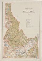
- Found in:
- Beinecke Rare Book and Manuscript Library > State of Idaho / compiled from the official records of the General Land Office and other sources ; compiled and drawn by H. Ruh ; revised by T.W. Gales ; relief by D.E. Walker.
- Creator:
- United States. General Land Office
- Published / Created:
- 1879
- Call Number:
- 831 1879
- Container / Volume:
- BRBL_00579
- Image Count:
- 1
- Resource Type:
- Maps, Atlases & Globes
- Found in:
- Beinecke Rare Book and Manuscript Library > Montana Territory / compiled from the official records of the General Land Office and other sources by C. Roeser, principal draughtsman G.L.O.
- Creator:
- Renshawe, John H
- Published / Created:
- [1930?]
- Call Number:
- 844am Y83 1930
- Container / Volume:
- BRBL_00612
- Image Count:
- 1
- Resource Type:
- Maps, Atlases & Globes
- Found in:
- Beinecke Rare Book and Manuscript Library > Panoramic view of the Yosemite National Park, California.
- Creator:
- United States. General Land Office
- Published / Created:
- 1866
- Call Number:
- 844fcm 1866
- Container / Volume:
- BRBL_00615
- Image Count:
- 1
- Resource Type:
- Maps, Atlases & Globes
- Found in:
- Beinecke Rare Book and Manuscript Library > Map of public surveys in California & Nevada : to accompany report of Commissioner of the General Land Office, 1866.
- Creator:
- Geological Survey (U.S.)
- Published / Created:
- [1918]
- Call Number:
- 844fcm Y83 1918
- Container / Volume:
- BRBL_00615
- Image Count:
- 1
- Resource Type:
- Maps, Atlases & Globes
- Found in:
- Beinecke Rare Book and Manuscript Library > Map of Yosemite Valley, Yosemite National Park, California, Mariposa County / U.S. Geological Survey ; State of California ; E.M. Douglas, geographer ; R.B. Marshall, in charge of section ; topography by F.E. Matthes ; triangulation by C.F. Urquhart.
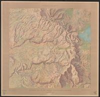
- Creator:
- Geological and Geographical Survey of the Territories (U.S.)
- Published / Created:
- [1877]
- Call Number:
- 833ca 1878AB
- Container / Volume:
- BRBL_00585
- Image Count:
- 1
- Resource Type:
- Maps, Atlases & Globes
- Found in:
- Beinecke Rare Book and Manuscript Library > Parts of western Wyoming, southeastern Idaho and northeastern Utah [cartographic material] / F.V. Hayden, U.S. geologist in charge ; Harry Gannett, M.E., topographical assistant ; Julius Bien, lith., New York.
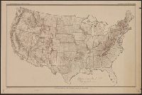
- Creator:
- United States. Department of Agriculture. Division of Publications
- Published / Created:
- 1910
- Call Number:
- 75fb 1910
- Container / Volume:
- BRBL_00410
- Image Count:
- 1
- Resource Type:
- Maps, Atlases & Globes
- Found in:
- Beinecke Rare Book and Manuscript Library > Outline map of the United States by counties / engraved and printed by the U.S. Geological Survey.
- Creator:
- Geological Survey (U.S.)
- Published / Created:
- 1921
- Call Number:
- 766gfb 1921
- Container / Volume:
- BRBL_00475
- Image Count:
- 1
- Resource Type:
- Maps, Atlases & Globes
- Found in:
- Beinecke Rare Book and Manuscript Library > Stations and transmission lines used in public service : [Massachusetts, Rhode Island and Connecticut] / Department of the Interior, U.S. Geological Survey ; compiled by G.D. Thomas.
- Creator:
- Geological Survey (U.S.)
- Published / Created:
- 1911
- Call Number:
- 75cbf 1911S
- Container / Volume:
- BRBL_00408
- Image Count:
- 1
- Resource Type:
- Maps, Atlases & Globes
- Found in:
- Beinecke Rare Book and Manuscript Library > United States relief map / U.S. Geological Survey, Department of the Interior ; compiled by Henry Gannett.
- Creator:
- Geological Survey (U.S.)
- Published / Created:
- 1913
- Call Number:
- 75ed 1913
- Container / Volume:
- BRBL_00410
- Image Count:
- 1
- Resource Type:
- Maps, Atlases & Globes
- Found in:
- Beinecke Rare Book and Manuscript Library > Map showing Indian Reservations within the Limits of the United States, 1913 / engraved and printed by the U.S. Geological Survey.
- Creator:
- Geological Survey (U.S.)
- Published / Created:
- 1910
- Call Number:
- BrSides Double Folio 2019 84
- Image Count:
- 1
- Resource Type:
- Maps, Atlases & Globes
- Found in:
- Beinecke Rare Book and Manuscript Library > Colorado (Lake County), Leadville special map [cartographic material] / triangulation and topography by A.D. Wilson, chief topographer.
- Creator:
- Geological Survey (U.S.)
- Published / Created:
- 1906
- Call Number:
- BrSides Folio 2019 61
- Image Count:
- 1
- Resource Type:
- Maps, Atlases & Globes
- Found in:
- Beinecke Rare Book and Manuscript Library > Colorado, Central City special map [cartographic material] / U.S. Geological Survey ; E.M. Douglas, geographer ; Frank Tweedy, in charge of section ; topography by Pearson Chapman and D.F. Moor ; triangulation by Frank Tweedy.
- Published / Created:
- 1878
- Call Number:
- 75GM 1878
- Container / Volume:
- BRBL_00410
- Image Count:
- 1
- Resource Type:
- Maps, Atlases & Globes
- Found in:
- Beinecke Rare Book and Manuscript Library > Map of the United States : exhibiting the grants of lands made by the General government to aid the construction of railroads and wagon roads / Dept. of the Interior. U.S. Geographical and Geological Survey of the Rocky Mountain Region J.W. Powell, in Cha
- Creator:
- Geological Survey (U.S.)
- Published / Created:
- [1897]
- Call Number:
- 831cbf B98 1897
- Container / Volume:
- BRBL_00581
- Image Count:
- 1
- Resource Type:
- Maps, Atlases & Globes
- Found in:
- Beinecke Rare Book and Manuscript Library > Topographic sheet, Montana (Silver Bow Co.) : Butte special map / Henry Gannett, chief topographer ; E.M. Douglas, topographer in charge ; triangulation and topography by R.H. Chapman.
- Creator:
- United States. General Land Office
- Published / Created:
- 1876
- Call Number:
- 833 1876
- Container / Volume:
- BRBL_00584
- Image Count:
- 1
- Resource Type:
- Maps, Atlases & Globes
- Found in:
- Beinecke Rare Book and Manuscript Library > Territory of Wyoming / compiled from the official records of the General Land Office and other sources by C. Roeser, Principal Draughtsman, G.L.O.
- Creator:
- United States. General Land Office
- Published / Created:
- 1900
- Call Number:
- 833 1900
- Container / Volume:
- BRBL_00584
- Image Count:
- 1
- Resource Type:
- Maps, Atlases & Globes
- Found in:
- Beinecke Rare Book and Manuscript Library > Map of the state of Wyoming / compiled from the official records of the General Office and other sources, under the direction of Harry King, C.E., Chief of Drafting Division G.L.O. ; compiled, drawn, and lettered by I.P. Berthrong.
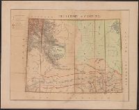
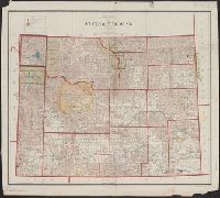
- Creator:
- United States. General Land Office
- Published / Created:
- 1876
- Call Number:
- 832 1876
- Container / Volume:
- BRBL_00582
- Image Count:
- 1
- Resource Type:
- Maps, Atlases & Globes
- Found in:
- Beinecke Rare Book and Manuscript Library > Territory of Idaho, 1876 / compiled from the official records of the General Land Office and other sources by C. Roeser, Principal Draughtsman, General Land Office.