Search
You Searched For
Search Results
- Creator:
- United States. Army Map Service
- Published / Created:
- 1945
- Call Number:
- 273 T171 1945
- Container / Volume:
- BRBL_00023B
- Image Count:
- 1
- Resource Type:
- Maps, Atlases & Globes
- Found in:
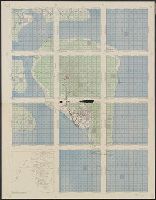
- Beinecke Rare Book and Manuscript Library > [Air support charts, Tarakan] / prepared and reproduced by Army Map Service.
- Creator:
- United States. Army Map Service
- Published / Created:
- 1943
- Call Number:
- 38 V66 1943
- Container / Volume:
- BRBL_00167
- Image Count:
- 1
- Resource Type:
- Maps, Atlases & Globes
- Found in:
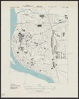
- Beinecke Rare Book and Manuscript Library > Vichy [cartographic material] : City plan.
- Creator:
- Berthrong, I. P
- Published / Created:
- 1908
- Call Number:
- 75gmb 1908
- Container / Volume:
- BRBL_00411
- Image Count:
- 1
- Resource Type:
- Maps, Atlases & Globes
- Subject (Geographic):
- United States--Maps
- Subject (Topic):
- Explorers--United States--Maps
- Found in:
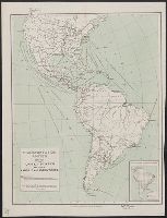
- Beinecke Rare Book and Manuscript Library > United States showing routes of principal explorers and early roads and highways [map] / from data prepared by Frank Bond ; by I. B. Berthrong.
- Creator:
- Berthrong, I. P
- Published / Created:
- 1908
- Call Number:
- 75j 1908
- Container / Volume:
- BRBL_00414A
- Image Count:
- 1
- Resource Type:
- Maps, Atlases & Globes
- Subject (Geographic):
- United States--Maps
- Subject (Topic):
- Explorers--United States--Maps
- Found in:
- Beinecke Rare Book and Manuscript Library > United States showing routes of principal explorers and early roads and highways [map] / from data prepared by Frank Bond ; by I. B. Berthrong.
- Creator:
- Geological Survey (U.S.)
- Published / Created:
- 1911
- Call Number:
- 75cbf 1911S
- Container / Volume:
- BRBL_00408
- Image Count:
- 1
- Resource Type:
- Maps, Atlases & Globes
- Subject (Geographic):
- United States--Maps
- Found in:
- Beinecke Rare Book and Manuscript Library > United States relief map / U.S. Geological Survey, Department of the Interior ; compiled by Henry Gannett.
- Creator:
- Gannett, Henry, 1846-1914
- Published / Created:
- [1904]
- Call Number:
- 754cbf 1904
- Container / Volume:
- BRBL_00417
- Image Count:
- 1
- Resource Type:
- Maps, Atlases & Globes
- Subject (Geographic):
- United States--Maps
- Found in:
- Beinecke Rare Book and Manuscript Library > United States contour map / U.S. Geological Survey ; compiled by Henry Gannett.
- Creator:
- United States. Dept. of the Treasury. Bureau of Statistics
- Published / Created:
- [190-?]
- Call Number:
- 70GM 1900
- Container / Volume:
- BRBL_00359
- Image Count:
- 1
- Resource Type:
- Maps, Atlases & Globes
- Subject (Geographic):
- Railroads--United States--Maps
- Found in:
- Beinecke Rare Book and Manuscript Library > Transportation routes between the United States and other American countries / U.S. Treasury Department, Bureau of Statistics ; [B.?] Olszewski.
- Creator:
- United States. Army Map Service
- Published / Created:
- 1943
- Call Number:
- 38 St81 1943
- Container / Volume:
- BRBL_00165
- Image Count:
- 1
- Resource Type:
- Maps, Atlases & Globes
- Found in:
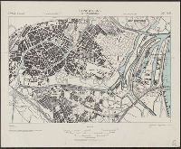
- Beinecke Rare Book and Manuscript Library > Strasbourg (Strassburg) [cartographic material] : city plan.
- Creator:
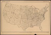
- United States. Department of Agriculture. Division of Publications
- Published / Created:
- 1915
- Call Number:
- 75eb 1910B
- Container / Volume:
- BRBL_00410
- Image Count:
- 1
- Resource Type:
- Maps, Atlases & Globes
- Subject (Geographic):
- United States--Maps
- Found in:
- Beinecke Rare Book and Manuscript Library > Outline map of the United States by counties / engraved and printed by the U.S. Geological Survey.