Search
You Searched For
Search Results
- Creator:
- Bowles, Carington, 1724-1793
Bowles, John, 1701-1779
Delarochette, L. (Louis), 1731-1802, creator
Palairet, Jean, 1697-1774
- Published / Created:
- 1765
- Call Number:
- 2003 Folio 85
- Image Count:
- 1
- Description:
- LC Maps of North America, 1750-1789,
- Subject (Geographic):
- North America -- Maps -- Early works to
- Found in:
- Beinecke Rare Book and Manuscript Library > A map of North America
- Creator:
- Bowen, Emanuel, d. 1767
Gibson, J. (John)
Overton, Henry, fl. 1706-1764
Sayer, Robert, 1725-1794
- Published / Created:
- [between 1755 and 1775?]
- Call Number:
- 2003 Folio 85
- Image Count:
- 1
- Subject (Geographic):
- North America -- Maps -- Early works to
- Found in:
- Beinecke Rare Book and Manuscript Library > An accurate map of North America: describing and distinguishing the British, Spanish and French dominions on this great continent; exhibiting the present seat of war, and the French encroachments. Also all the West India Islands belonging to, and possesse
- Creator:
- Brasier, William
- Published / Created:
- 1776
- Call Number:
- Cb23 27
- Collection Title:
- The American military pocket atlas : being an approved collection of correct maps, both general and
- Image Count:
- 1
- Subject (Geographic):
- North America --Maps --Early works to
- Found in:
- Beinecke Rare Book and Manuscript Library > A Survey of Lake Champlain, including Lake George, Crown Point and St. John. Surveyed by order of His Excellency Major General Sr. Jeffery Amherst, knight of the most honble. Order of the Bath, Commander in Chief of His Majesty's forces in North America (now Lord Amherst) by William Brassier, draughtsman, 1762
- Creator:
- Evans, Lewis, 1700?-1756
Gibson, J. (John), creator
Jefferys, Thomas, d. 1771
- Published / Created:
- 1758
- Call Number:
- 2003 Folio 85
- Image Count:
- 1
- Description:
- LC Maps of North America, 1750-1789,
- Subject (Geographic):
- North America -- Maps -- Early works to
- Found in:
- Beinecke Rare Book and Manuscript Library > A general map of the middle British colonies in America: viz. Virginia, Maryland, Delaware, Pensilvania, New-Jersey, New-York, Connecticut and Rhode-Island : of Aquanishuonigy the country of the confederate Indians comprehending Aquanishuonigy proper, the
- Creator:
- Dunn, Samuel
- Published / Created:
- 1774
- Call Number:
- Cb23 27
- Collection Title:
- The American military pocket atlas : being an approved collection of correct maps, both general and
- Image Count:
- 1
- Subject (Geographic):
- North America --Maps --Early works to
- Found in:
- Beinecke Rare Book and Manuscript Library > North America as divided amongst the European powers
- Published / Created:
- 1776
- Call Number:
- Cb23 27
- Collection Title:
- The American military pocket atlas : being an approved collection of correct maps, both general and
- Image Count:
- 1
- Subject (Geographic):
- North America --Maps --Early works to
- Found in:
- Beinecke Rare Book and Manuscript Library > A General map of the northern British colonies in America. which comprehends the province of Quebec, the government of Newfoundland, Nova-Scotia, New-England and New-York. From the maps published by the Admiralty and Board of Trade regulated by the astronomic and trigonometric observations of M. von Holland and corrected from Governor Pownall's late map 1776.
- Creator:
- Romans, B
- Published / Created:
- 1776
- Call Number:
- Cb23 27
- Collection Title:
- The American military pocket atlas : being an approved collection of correct maps, both general and
- Image Count:
- 1
- Subject (Geographic):
- North America --Maps --Early works to
- Found in:
- Beinecke Rare Book and Manuscript Library > A General map of the southern British colonies, in America, comprehending North and South Carolina, Georgia, east and west Florida, with the neighbouring Indian countries. From the modern surveys of engineer de Brahm, Capt. Collet, Mouzon & others; and from the large hydrographical survey of the coasts of east and west Florida
- Published / Created:
- 1776
- Call Number:
- Cb23 27
- Collection Title:
- The American military pocket atlas : being an approved collection of correct maps, both general and
- Image Count:
- 1
- Subject (Geographic):
- North America --Maps --Early works to
- Found in:
- Beinecke Rare Book and Manuscript Library > A general map of the middle British colonies in America. Containing Virginia, Maryland, the Delaware counties, Pennsylvania and New Jersey. With the addition of New York, and of the greatest part of New England, as also of the bordering parts of the province of Quebec, improved from several surveys made after the late war, and corrected from Governor Pownall's late map 1776.
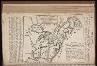
- Published / Created:
- 1763 April
- Call Number:
- Z17 299b
- Collection Title:
- Universal museum; or, Gentleman's and ladies polite magazine of history politicks and literature.
- Image Count:
- 1
- Resource Type:
- Books, Journals & Pamphlets
- Subject (Geographic):
- North America -- Maps -- Early works to
- Found in:
- Beinecke Rare Book and Manuscript Library > Theodolite's Pattern, shewing the advantages obtained by the peace to England, particularly in North America.