
You Searched For
1 - 5 of 5
Search Results

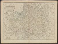
- Creator:
- Kitchin, Thomas, d. 1784
Kitchin, Thomas, d. 1784. General atlas describing the whole universe
Sayer, Robert, 1725-1794 - Published / Created:
- January 1st, 1787.
- Call Number:
- 356 1787
- Container / Volume:
- BRBL_00114
- Image Count:
- 1
- Resource Type:
- Maps, Atlases & Globes
- Description:
- Also appeared in Kitchin's General atlas describing the whole universe. London : Printed for Robert Sayer, [1780]., Relief shown pictorially., Sheet measures 54 x 70.7 cm., and Shows vegetation, marshes, etc.
- Publisher:
- Robert Sayer,
- Subject (Geographic):
- Europe, Eastern--Maps--Early works to 1800, Lithuania--Boundaries--Maps--Early works to 1800, Lithuania--Maps--Early works to 1800, Poland--Boundaries--Maps--Early works to 1800, and Poland--Maps--Early works to 180
- Subject (Name):
- Abbot, Charles,--Baron Colchester,--1757-1829--Bookplate
- Found in:
- Beinecke Rare Book and Manuscript Library > A new map of the Kingdom of Poland with its dismembered provinces / [by Thomas Kitchin].
3.
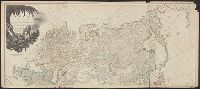
- Creator:
- Kitchin, Thomas, d. 1784
- Published / Created:
- 6 Jany. 1787.
- Call Number:
- 50 1787
- Container / Volume:
- BRBL_00271
- Image Count:
- 2
- Resource Type:
- Maps, Atlases & Globes
- Description:
- Also appeared in Kitchin's General atlas describing the whole universe. London : Printed for Robert Sayer, [1780]., Relief shown pictorially., Sheets m, Sheets mounted together to form 2 sheets., and Title cartouche depicts local produce, a palm tree and a camel.
- Publisher:
- Printed for Robert Sayer,
- Subject (Geographic):
- Asia--Maps--Early works to 1800
- Subject (Name):
- Abbot, Charles,--Baron Colchester,--1757-1829--Bookplate, Anville, Jean Baptiste Bourguignon d', 1697-1782, Cook, James, 1728-1779, Kitchin, Thomas, d. 1784. General atlas describing th, and Sayer, Robert, 1725-1794
- Found in:
- Beinecke Rare Book and Manuscript Library > Asia and its islands according to d'Anville : divided into empires, kingdoms, states, regions, & ca. with the European possessions and settlements in the East Indies and an exact delineation of all the discoveries made in the eastern parts by the English
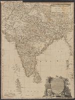
- Creator:
- Delarochette, L. (Louis), 1731-1802
- Published / Created:
- Jany. 1st, 1788.
- Call Number:
- 59 1788
- Container / Volume:
- BRBL_00316
- Image Count:
- 1
- Resource Type:
- Maps, Atlases & Globes
- Description:
- Relief shown pictorially. and Sheet measures 70 x 53 cm.
- Publisher:
- William Faden,
- Subject (Geographic):
- India--Maps--Early works to 1800
- Subject (Name):
- Abbot, Charles,--Baron Colchester,--1757-1829--Bookplate and Palmer, W. (William), 1739-1812
- Found in:
- Beinecke Rare Book and Manuscript Library > Hind, Hindoostan, or India / by L.S. de La Rochette ; Wm. Palmer sculp.

- Creator:
- Jefferys, Thomas, d. 1771
- Published / Created:
- 1st January 1789.
- Call Number:
- 655 1789
- Container / Volume:
- BRBL_00345
- Image Count:
- 1
- Resource Type:
- Maps, Atlases & Globes
- Description:
- "This map is copied from an original drawn by Monsr. D'Anv, Also appeared in Kitchin's General atlas describing the whole universe. London : Printed for Robert Sayer, [1780]., Prime meridians: Ferro and London., and Relief shown pictorially; depths by soundings.
- Publisher:
- Printed for Robert Sayer,
- Subject (Geographic):
- Africa, West--Maps--Early works to 1800
- Subject (Name):
- Abbot, Charles,--Baron Colchester,--1757-1829--Bookplate, Anville, Jean Baptiste Bourguignon d', 1697-1782, Kitchin, Thomas, d. 1784. General atlas describing the whole universe, and Robert Laurie and James Whittle
- Subject (Topic):
- Coasts--Africa, West--Maps--Early works to 1800
- Found in:
- Beinecke Rare Book and Manuscript Library > The western coast of Africa, from Cape Blanco to Cape Virga, exhibiting Senegambia proper / by T. Jefferys.