Skip to search
Skip to main content
Skip to first result
Search
You Searched For
Resource Type
Maps, Atlases & Globes
Publication Place
London :
New Search
Search Results
Creator:
Published / Created:
1801
Call Number:
73 1801
Container / Volume:
BRBL_00374
Image Count:
1
Resource Type:
Maps, Atlases & Globes
Found in:
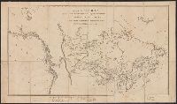
Beinecke Rare Book and Manuscript Library > A map of America between latitudes 40 and 70 north and longitudes 45 and 180 west exhibiting Mackenzie's track from Montreal to Fort Chipewyan & from thence to the north sea in 1789 & to the west Pacific Ocean in 1793.
Creator:
Published / Created:
Dec. 1st 1807.
Call Number:
73 1807
Container / Volume:
BRBL_00374
Image Count:
1
Resource Type:
Maps, Atlases & Globes
Found in:
Beinecke Rare Book and Manuscript Library > A new map of Upper & Lower Canada / from the latest authorities by John Cary, engraver.
Creator:
Published / Created:
1 Jan. 1788.
Call Number:
734 1788
Container / Volume:
BRBL_00379
Image Count:
1
Resource Type:
Maps, Atlases & Globes
Found in:
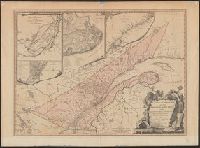
Beinecke Rare Book and Manuscript Library > A new and correct map of the Province of Quebec, with the adjacent states and provinces / from the French surveys connected with those made by Captain Carver, and other officers, in His Majesty's service.
Creator:
Published / Created:
1838
Call Number:
734 1834
Container / Volume:
BRBL_00379
Image Count:
1
Resource Type:
Maps, Atlases & Globes
Found in:
Beinecke Rare Book and Manuscript Library > Lower Canada : New Brunswick, Nova Scotia, Prince Edwards Id. Newfoundland, and a large portion of the United States / by J. Arrowsmith.
Creator:
Published / Created:
1829
Call Number:
734 Q31 1827
Container / Volume:
BRBL_00380
Image Count:
1
Resource Type:
Maps, Atlases & Globes
Found in:
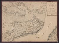
Beinecke Rare Book and Manuscript Library > Plan of the harbour and basin of Quebec / surveyed by order of H.R. Highness the Lord High Admiral by Commander H.W. Bayfield and his assistants Lieut. P.E. Collins & A.F.J. Bowen, Midn., Oct. 1827.
Creator:
Published / Created:
31st July 1785.
Call Number:
732 1785
Container / Volume:
BRBL_00376A
Image Count:
1
Resource Type:
Maps, Atlases & Globes
Found in:
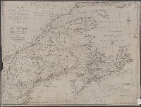
Beinecke Rare Book and Manuscript Library > A new map of Nova Scotia, and Cape Britain [cartographic material] : With the adjacent parts of New England and Canada, from the latest authorities / J. Lodge sc.
Creator:
Published / Created:
April 28 1811.
Call Number:
732 1811
Container / Volume:
BRBL_00376A
Image Count:
1
Resource Type:
Maps, Atlases & Globes
Found in:
Beinecke Rare Book and Manuscript Library > A new map of Nova Scotia, Newfoundland &c., from the latest authorities / by John Cary, engraver.
Creator:
Published / Created:
1759?]
Call Number:
732cea H13 1759
Container / Volume:
BRBL_00378
Image Count:
1
Resource Type:
Maps, Atlases & Globes
Found in:
Beinecke Rare Book and Manuscript Library > A chart of the harbour of Halifax, in Nova Scotia : with Jebucto Bay and Cape Sambrô, also the islands, ledges of rocks, shoals & soundings / survey'd, by order of His Excellency Brigadier General Lawrence, Governour of the Province of Nova Scotia, by Ch
Creator:
Published / Created:
25 May, 1775.
Call Number:
7345cea 1775
Container / Volume:
BRBL_00381
Image Count:
1
Resource Type:
Maps, Atlases & Globes
Found in:
Beinecke Rare Book and Manuscript Library > An exact chart of the river St. Laurence : from Fort Frontenac to the island of Anticosti shewing the soundings, rocks, shoals & c with views of the lands and all necessary instructions for navigating that river to Quebec / by ... Thos. Jefferys.
Creator:
Published / Created:
1832 February 15
Call Number:
73 1832
Container / Volume:
BRBL_00374
Image Count:
1
Resource Type:
Maps, Atlases & Globes
Found in:
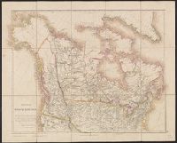
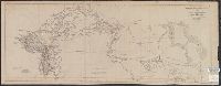
Beinecke Rare Book and Manuscript Library > British North America : by permission dedicated to the Honble. Hudsons Bay Company, containing the latest information which their documents furnish / by their obedient servant, J. Arrowsmith.
Creator:
Published / Created:
1834
Call Number:
73 1834
Container / Volume:
BRBL_00374
Image Count:
1
Resource Type:
Maps, Atlases & Globes
Found in:
Beinecke Rare Book and Manuscript Library > British North America / engraved by J. & C. Walker.
Creator:
Published / Created:
1834 February 15
Call Number:
73 1834A
Container / Volume:
BRBL_00374
Image Count:
1
Resource Type:
Maps, Atlases & Globes
Found in:
Beinecke Rare Book and Manuscript Library > Upper Canada &c [cartographic material] / by J. Arrowsmith.
Creator:
Published / Created:
Apr. 12 1838.
Call Number:
734 M769 1834
Container / Volume:
BRBL_00380
Image Count:
1
Resource Type:
Maps, Atlases & Globes
Found in:
Beinecke Rare Book and Manuscript Library > Montreal harbour : River St. Lawrence / surveyed by Captain H.W. Bayfield, 1834 ; J. & C. Walker, sculpt.
Creator:
Published / Created:
12 Septemr. 1776.
Call Number:
734 Q31 1776
Container / Volume:
BRBL_00380
Image Count:
1
Resource Type:
Maps, Atlases & Globes
Found in:
Beinecke Rare Book and Manuscript Library > Plan of the city and environs of Quebec, with its siege and blockade by the Americans : from the 8th of December 1775 to the 13th of May 1776 / Engraved by Wm. Faden.
Creator:
Published / Created:
1801
Call Number:
73 1801
Container / Volume:
BRBL_00374
Image Count:
1
Resource Type:
Maps, Atlases & Globes
Found in:
Beinecke Rare Book and Manuscript Library > A map of America between latitudes 40 and 70 north and longitudes 45 and 180 west exhibiting Mackenzie's track from Montreal to Fort Chipewyan & from thence to the north sea in 1789 & to the west Pacific Ocean in 1793.
Published / Created:
1858
Call Number:
736 1858
Container / Volume:
BRBL_00382
Image Count:
1
Resource Type:
Maps, Atlases & Globes
Found in:
Beinecke Rare Book and Manuscript Library > Copy of Sketch shewing the Region Explored by S.J. Dawson & his party, between Red River and the Great Saskatchewan.
Published / Created:
1858
Call Number:
736 R246 1858
Container / Volume:
BRBL_00382
Image Count:
1
Resource Type:
Maps, Atlases & Globes
Found in:
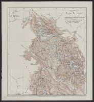
Beinecke Rare Book and Manuscript Library > Map of Part of the Valley of Red River north of 49th parallel : To accompany a report on the Canadian Red River Exploring Expedition / by H.Y. Hind.
Published / Created:
1859
Call Number:
739 1859
Container / Volume:
BRBL_00388
Image Count:
1
Resource Type:
Maps, Atlases & Globes
Found in:
Beinecke Rare Book and Manuscript Library > The Provinces of British Columbia & Vancouver Island with portions of the United States and Hudson's Bay Territories.
Published / Created:
1858
Call Number:
735 1858
Container / Volume:
BRBL_00382
Image Count:
1
Resource Type:
Maps, Atlases & Globes
Found in:
Beinecke Rare Book and Manuscript Library > Plan Showing proposed route from Lake Superior to Red River Settlement.
Creator:
Published / Created:
1859
Call Number:
739 1859A
Container / Volume:
BRBL_00388
Image Count:
1
Resource Type:
Maps, Atlases & Globes
Found in:
Beinecke Rare Book and Manuscript Library > Country between the Red River Settlement and the Rocky Mountains.
Published / Created:
[c1925].
Call Number:
739 1925
Container / Volume:
BRBL_00389
Image Count:
1
Resource Type:
Maps, Atlases & Globes
Found in:
Beinecke Rare Book and Manuscript Library > British Columbia.
Published / Created:
1903. +
Call Number:
739 R59 1902
Container / Volume:
BRBL_00390
Image Count:
1
Resource Type:
Maps, Atlases & Globes
Found in:
Beinecke Rare Book and Manuscript Library > Sketch map of the Canadian Rocky Mountains / by J. Norman Collie, F.R.S.
Creator:
Published / Created:
[1871]
Call Number:
7391 1871
Container / Volume:
BRBL_00394
Image Count:
1
Resource Type:
Maps, Atlases & Globes
Found in:
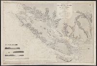
Beinecke Rare Book and Manuscript Library > Vancouver Island and adjacent shores of British Columbia / surveyed by G.H. Richards, assisted by R.C. Mayne ... [et al.], 1859-65 ; compiled and drawn for engraving by E.J. Powell ; engraved by Davies & Powell.
Creator:
Published / Created:
1787
Call Number:
1977 Folio 177
Image Count:
2
Resource Type:
Maps, Atlases & Globes
Found in:
Beinecke Rare Book and Manuscript Library > A map of the country between Albemarle Sound, and Lake Erie [cartographic material] : comprehending the whole of Virginia, Maryland, Delaware and Pensylvania, with parts of several other of the United States of America / engraved by S.J. Neele.
Creator:
Published / Created:
[1768]
Call Number:
1977 Folio 177
Image Count:
2
Resource Type:
Maps, Atlases & Globes
Found in:
Beinecke Rare Book and Manuscript Library > Martinico, one of the Caribbee Islands in the West Indies subject to the French / [cartographic material] / according to the observations of Mr. Houel engineer ; by Thos. Jefferys, geographer to His Royal Highness the Prince.
Creator:
Published / Created:
Jany. 1st, 1795.
Call Number:
1977 Folio 177
Image Count:
2
Resource Type:
Maps, Atlases & Globes
Found in:
Beinecke Rare Book and Manuscript Library > A map of China : with the surrounding states, correctly copied from Monsr. d'Anville : engraved for Monsr. de Paun's Philosophical dissertations on the Egyptians & Chinese.
Creator:
Published / Created:
Jany. 1st , 1793.
Call Number:
1977 Folio 177
Image Count:
2
Resource Type:
Maps, Atlases & Globes
Found in:
Beinecke Rare Book and Manuscript Library > A new map of France divided into eighty three departments according to the decree of the National Assembly in 1790.
Creator:
Published / Created:
[1783?]
Call Number:
1977 Folio 177
Image Count:
4
Resource Type:
Maps, Atlases & Globes
Found in:
Beinecke Rare Book and Manuscript Library > England and Ireland : containing all the cities, boroughs, markettowns & principal villages : with the coast of France from Calais to Brest delineated and engraved from actual surveys / by Richard William Seale.
Creator:
Published / Created:
[1759]
Call Number:
1977 Folio 177
Image Count:
2
Resource Type:
Maps, Atlases & Globes
Found in:
Beinecke Rare Book and Manuscript Library > A map of the King of Great Britain's Dominions in Germany, or, The Electorate of Brunswick-Lunenburg with its dependencies [cartographic material] : containing the Dutchies of Lunenburg, Calenberg, Grunbenhagen, Lauenburg, Bremen & Verden, and the countie
Creator:
Published / Created:
1746
Call Number:
2002 Folio 94
Image Count:
24
Resource Type:
Maps, Atlases & Globes
Found in:
Beinecke Rare Book and Manuscript Library > A plan of the cities of London and Westminster, and borough of Southwark, with the contiguous buildings / from an actual survey, taken by John Rocque, land-surveyor, and engraved by John Pine ...
Branch:v1.60.98 ,Deployed:2024-05-08T09:24:35-04:00