Skip to search
Skip to main content
Skip to first result
Search
You Searched For
Resource Type
Maps, Atlases & Globes
Publication Place
London :
New Search
Search Results
Published / Created:
1845
Call Number:
75 1845C
Container / Volume:
BRBL_00399
Image Count:
2
Resource Type:
Maps, Atlases & Globes
Found in:
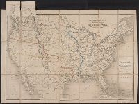
Beinecke Rare Book and Manuscript Library > The United States & The Relative Position of the Oregon & Texas.
Published / Created:
1845
Call Number:
75 1845C
Container / Volume:
BRBL_00399
Image Count:
2
Resource Type:
Maps, Atlases & Globes
Found in:
Beinecke Rare Book and Manuscript Library > The United States & The Relative Position of the Oregon & Texas.
Published / Created:
May 2nd, 1870.
Call Number:
75 1870C
Container / Volume:
BRBL_00404
Image Count:
2
Resource Type:
Maps, Atlases & Globes
Found in:
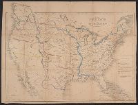
Beinecke Rare Book and Manuscript Library > Stanford's map of the United States and part of the Dominion of Canada.
Published / Created:
1784
Call Number:
762 1784
Container / Volume:
BRBL_00450
Image Count:
2
Resource Type:
Maps, Atlases & Globes
Found in:
Beinecke Rare Book and Manuscript Library > A topographical map of the state of New Hampshire surveyed under the direction of Samuel Holland Esq. ...
Published / Created:
1847
Call Number:
26 1847
Container / Volume:
BRBL_00022
Image Count:
3
Resource Type:
Maps, Atlases & Globes
Found in:
Beinecke Rare Book and Manuscript Library > Detailed Map of Dr. Ludwig Leichhardts Route in Australia from Moreton Bay to Port Essington (upwards of 3,000 miles ... 1844 & 1845) ... By John Arrowsmith 1847.
Creator:
Published / Created:
1800
Call Number:
32 L84 1800C
Container / Volume:
BRBL_00049
Image Count:
3
Resource Type:
Maps, Atlases & Globes
Found in:
Beinecke Rare Book and Manuscript Library > Bowles's one-sheet plan of the cities of London and Westminster with the borough of Southwark : comprehending their outskirts and extent of the Thames from Chelsea to Deptford : exhibiting also the new buildings, roads and other alterations.
Published / Created:
1822
Call Number:
3231 1822
Container / Volume:
BRBL_00063
Image Count:
3
Resource Type:
Maps, Atlases & Globes
Found in:
Beinecke Rare Book and Manuscript Library > Map of the County of Somerset ... by C. & I. Greenwood. Engraved by Neele & Son. To the Nobility, Clergy, and Gentry of Somersetshire, this map of the County ...
Creator:
Published / Created:
1879
Call Number:
27cea 1883
Container / Volume:
BRBL_00023D
Image Count:
3
Resource Type:
Maps, Atlases & Globes
Found in:
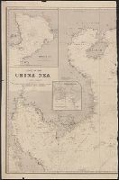
Beinecke Rare Book and Manuscript Library > Chart of the China Sea, in two parts.
Published / Created:
1760
Call Number:
36hc M66 1756
Container / Volume:
BRBL_00134
Image Count:
3
Resource Type:
Maps, Atlases & Globes
Found in:
Beinecke Rare Book and Manuscript Library > To Prince Ferdinand of Brunswich, this plan of the battle of Thonhausen ... by William Roy, captain of engineers, & assistant quatermaster general of the British forces. Surveyed & drawn by Capt. William Roy. Engraved by Thos: Major.
Published / Created:
[1827?]
Call Number:
735 1827
Container / Volume:
BRBL_00382
Image Count:
3
Resource Type:
Maps, Atlases & Globes
Found in:
Beinecke Rare Book and Manuscript Library > A map of the Province of Upper Canada and the adjacent territories in North American compiled by James G. Chewett ...
Published / Created:
1796
Call Number:
755cea 1796
Container / Volume:
BRBL_00441
Image Count:
3
Resource Type:
Maps, Atlases & Globes
Found in:
Beinecke Rare Book and Manuscript Library > To His Excellency General George Washington, President of the United States of North America, This Chart Including the Navigation from the Gulf of Florida to Philadelphia, Is respectfully dedicated ... by ... John Hamilton Moore.
Published / Created:
[ca. 1789]
Call Number:
6555cea 1789
Container / Volume:
BRBL_00708
Image Count:
3
Resource Type:
Maps, Atlases & Globes
Found in:
Beinecke Rare Book and Manuscript Library > A New Survey of that part of the Coast of Africa comprised between Cape Verga and Cape Formoso, including chiefly the Windward and Gold Coasts in which the Latitudes of all the Principal Places are determined by Actual observations, the bearings and cours
Creator:
Published / Created:
10 June 1775.
Call Number:
774 1775
Container / Volume:
BRBL_00730
Image Count:
3
Resource Type:
Maps, Atlases & Globes
Found in:
Beinecke Rare Book and Manuscript Library > A map of Pennsylvania exhibiting not only the improved parts of that Province, but also its extensive frontiers: Laid down from actual surveys, and chiefly from the late map of W. Scull published in 1770; and humbly inscribed to the Honorable Thomas Penn
Published / Created:
1779
Call Number:
771 1779A
Container / Volume:
BRBL_00477
Image Count:
3
Resource Type:
Maps, Atlases & Globes
Found in:
Beinecke Rare Book and Manuscript Library > A Chorographical map of the Province of New York ... Mayor General William Tryon, by Claude Joseph Sauthier Esqr.
Published / Created:
1816
Call Number:
59 1816
Container / Volume:
BRBL_00317
Image Count:
6
Resource Type:
Maps, Atlases & Globes
Found in:
Beinecke Rare Book and Manuscript Library > To the Honble. the court of directors of the East India Company this improved map of India ... / A. Arrowsmith.
Creator:
Published / Created:
1851
Call Number:
273 1851
Container / Volume:
BRBL_00023A
Image Count:
1
Resource Type:
Maps, Atlases & Globes
Found in:
Beinecke Rare Book and Manuscript Library > To the subscribers to the Borneo Church Mission Institution, this map of Borneo : constructed principally from that of Baron Melvill de Carnbee and the unpublished Admiralty surveys / Augustus Petermann.
Published / Created:
1813
Call Number:
27 1813
Container / Volume:
BRBL_00023A
Image Count:
1
Resource Type:
Maps, Atlases & Globes
Found in:
Beinecke Rare Book and Manuscript Library > East India Isles. Neele Sculpt. Strand.
Published / Created:
1811
Call Number:
27 1811
Container / Volume:
BRBL_00023A
Image Count:
1
Resource Type:
Maps, Atlases & Globes
Found in:
Beinecke Rare Book and Manuscript Library > A New Map of the East India Isles ... John Cary, Engraver.
Published / Created:
1801
Call Number:
27 1801
Container / Volume:
BRBL_00023A
Image Count:
1
Resource Type:
Maps, Atlases & Globes
Found in:
Beinecke Rare Book and Manuscript Library > A New Map of the East India Isles. From the Latest Authorities. By John Cary, Engraver.
Published / Created:
1787
Call Number:
30 1787
Container / Volume:
BRBL_00029
Image Count:
1
Resource Type:
Maps, Atlases & Globes
Found in:
Beinecke Rare Book and Manuscript Library > Europe divided into its Empires, Kingdoms, States, Republics, etc. By Thos. Kitchin ...
Creator:
Published / Created:
June 1st, 1855 [i.e. 1911?]
Call Number:
261cea T636 1855
Container / Volume:
BRBL_00022
Image Count:
1
Resource Type:
Maps, Atlases & Globes
Found in:
Beinecke Rare Book and Manuscript Library > Australia, Torres Strait, western channels / surveyed by Captain O. Stanley, Lieuts. C.B. Yule, J. Dayman, H.G. Simpson, Mr. O'Bree Master's Assistant, H.M.S. Rattlesnake ; J. & C. Walker, sculpt.
Creator:
Published / Created:
[1860]
Call Number:
18 1870
Image Count:
1
Resource Type:
Maps, Atlases & Globes
Found in:
Beinecke Rare Book and Manuscript Library > North circumpolar regions ; Vancouver Island ; Kamtschatka.
Published / Created:
March 1880.
Call Number:
11 1600
Container / Volume:
BRBL_00002
Image Count:
1
Resource Type:
Maps, Atlases & Globes
Found in:
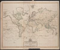
Beinecke Rare Book and Manuscript Library > [World map].
Published / Created:
March 1880.
Call Number:
11 1600
Image Count:
1
Resource Type:
Maps, Atlases & Globes
Found in:
Beinecke Rare Book and Manuscript Library > [World map].
Published / Created:
1818
Call Number:
18bh 1818
Container / Volume:
BRBL_00013
Image Count:
1
Resource Type:
Maps, Atlases & Globes
Found in:
Beinecke Rare Book and Manuscript Library > Map of the Arctic Regions. Circumpolar Map no. II (Geographical Discoveries made since 1818 in Red).
Published / Created:
1818
Call Number:
18bh 1818
Container / Volume:
BRBL_00013
Image Count:
1
Resource Type:
Maps, Atlases & Globes
Found in:
Beinecke Rare Book and Manuscript Library > Map of the Arctic Regions. Circumpolar Map no. II (Geographical Discoveries made since 1818 in Red).
Creator:
Published / Created:
1700
Call Number:
11 1700
Container / Volume:
BRBL_00004
Image Count:
1
Resource Type:
Maps, Atlases & Globes
Found in:
Beinecke Rare Book and Manuscript Library > Nova & accuratissima totius terrarum orbis tabula nautica, variationum magneticarum index juxta observationes anno. 1700 ... / per Edm: Halley ; I Harris sculp. = A new and correct sea chart of the whole world shewing the variations of the compass as they
Published / Created:
1783
Call Number:
11 1783
Container / Volume:
BRBL_00006
Image Count:
1
Resource Type:
Maps, Atlases & Globes
Found in:
Beinecke Rare Book and Manuscript Library > Northern Hemisphere - Southern Hemisphere.
Published / Created:
1788
Call Number:
13 1788
Container / Volume:
BRBL_00011
Image Count:
1
Resource Type:
Maps, Atlases & Globes
Found in:
Beinecke Rare Book and Manuscript Library > Eastern Hemisphere.
Published / Created:
1817
Call Number:
215 1815
Container / Volume:
BRBL_00015
Image Count:
1
Resource Type:
Maps, Atlases & Globes
Found in:
Beinecke Rare Book and Manuscript Library > This Geographical Plan of The Island & Ports of Saint Helena is Dedicated by Permifsion to Field Marshal His Rl. Highnefs The Duke of Kent and Strathearn By Lieu. R.P. Read. Engd. by R. Kirkwood.
Published / Created:
1794
Call Number:
11 1794A
Container / Volume:
BRBL_00006
Image Count:
1
Resource Type:
Maps, Atlases & Globes
Found in:
Beinecke Rare Book and Manuscript Library > A New Chart of the World ... with the tracks of the British Circumnavigators Bryon, Wallis, Carteret and Cook, &c.
Published / Created:
1815
Call Number:
2121 1815
Image Count:
1
Resource Type:
Maps, Atlases & Globes
Found in:
Beinecke Rare Book and Manuscript Library > The Maderas and Canary Islands ... by Don Thomas Lopes.
Published / Created:
[1761]
Call Number:
23 1761
Container / Volume:
BRBL_00018
Image Count:
1
Resource Type:
Maps, Atlases & Globes
Found in:
Beinecke Rare Book and Manuscript Library > A map of the discoveries made by the Russians on the north west coast of America. Published by the Royal Academy of Sciences at Petersburg.
Published / Created:
1794
Call Number:
23 1794B
Container / Volume:
BRBL_00019
Image Count:
1
Resource Type:
Maps, Atlases & Globes
Found in:
Beinecke Rare Book and Manuscript Library > Chart of the N.W. coast of America and the N.E. coast of Asia, explored in the years 1778 and 1779. Prepared by Lieut. Hen[r]y Roberts under ... Capt. Cook. Engraved by W. Palmer ... 2nd edition.
Published / Created:
[1850?]
Call Number:
23 1850
Container / Volume:
BRBL_00020
Image Count:
1
Resource Type:
Maps, Atlases & Globes
Found in:
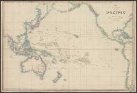
Beinecke Rare Book and Manuscript Library > The Basin of the Pacific by Jas. Wyld.
Published / Created:
1855
Call Number:
26cea 1843
Container / Volume:
BRBL_00023
Image Count:
1
Resource Type:
Maps, Atlases & Globes
Found in:
Beinecke Rare Book and Manuscript Library > Australia, East Coast Sheet XVIII. Cape Tribulation to Cape Flattery and the Barrier Reefs, by Capt. O. Stanley, Lieuts. C.B. Yule, J. Dayman, H.G. Simpson, and Mr. Obree, Masters assistant, H.M.S. Rattlesnake. ... Engraved by J. & C. Walker, London, 1843
Creator:
Published / Created:
[1851?]
Call Number:
23 1851
Container / Volume:
BRBL_00020
Image Count:
1
Resource Type:
Maps, Atlases & Globes
Found in:
Beinecke Rare Book and Manuscript Library > The basin of the Pacific / Jas. Wyld.
Published / Created:
1794
Call Number:
23 1808
Container / Volume:
BRBL_00020
Image Count:
1
Resource Type:
Maps, Atlases & Globes
Found in:
Beinecke Rare Book and Manuscript Library > Chart of the N.W. coast of America and the N.E. coast of Asia, explored in the years 1778 and 1779. Prepared by Lieut. Henry Roberts ... Engraved by W. Palmer ...
Creator:
Published / Created:
1784
Call Number:
23 1784
Container / Volume:
BRBL_00019
Image Count:
1
Resource Type:
Maps, Atlases & Globes
Found in:
Beinecke Rare Book and Manuscript Library > Chart of the N.W. coast of America and the N.E. coast of Asia, explored in the years 1778 and 1779 / prepared by Lieut. Heny. Roberts, under the immediate inspection of Capt. Cook ; engraved by W. Palmer.
Creator:
Published / Created:
[1856?-186-?]
Call Number:
23cea 1856
Collection Title:
Pacific Ocean / Hydrographic Office ; Engraved by J. & C. Walker.
Container / Volume:
BRBL_00021
Image Count:
1
Resource Type:
Maps, Atlases & Globes
Found in:
Beinecke Rare Book and Manuscript Library > Sandwich Islands to New Caledonia.
Published / Created:
1855
Call Number:
26cea 1843A
Container / Volume:
BRBL_00023
Image Count:
1
Resource Type:
Maps, Atlases & Globes
Found in:
Beinecke Rare Book and Manuscript Library > Australia, East Coast Sheet XX. Cape Sidmouth to Cape Grenville and the Barrier Reefs, surveyed by Capt. F. Blackwood, Lieut. C.B. Yule, Mr. F.I. Evans, Master, M.D ... Engraved by J. & C. Walker, London 1843.
Creator:
Published / Created:
[1866?]
Call Number:
23cea J328 1861
Image Count:
1
Resource Type:
Maps, Atlases & Globes
Found in:
Beinecke Rare Book and Manuscript Library > Western part of the Java Sea : from Lucipara I. to Sunda Strait and Batavia, corrected to 1861 / engraved by J. & C. Walker.
Creator:
Published / Created:
Aug. 16th. 1852 [i.e. 1865]
Call Number:
26cea 1851B
Container / Volume:
BRBL_00023
Image Count:
1
Resource Type:
Maps, Atlases & Globes
Found in:
Beinecke Rare Book and Manuscript Library > Australia east coast. Sheet II, Barriga Point to Jervis Bay / from a running survey by Captn. J. Lort Stokes ... 1851 ; engraved by J. & C. Walker.
Creator:
Published / Created:
[1853]
Call Number:
26 1852
Container / Volume:
BRBL_00022
Image Count:
1
Resource Type:
Maps, Atlases & Globes
Found in:
Beinecke Rare Book and Manuscript Library > Map of South Australia, New South Wales, Van Diemens Land, and settled parts of Australia [cartographic material] / respectfully dedicated to Major Sir T.L. Mitchell Kt. D.C.L. F.G.S. &c Surveyor General of New South Wales by ... James Wyld.
Creator:
Published / Created:
Aug. 16th. 1852 [i.e. 1862]
Call Number:
26cea 1851D
Container / Volume:
BRBL_00023
Image Count:
1
Resource Type:
Maps, Atlases & Globes
Found in:
Beinecke Rare Book and Manuscript Library > Australia east coast. Sheet IV, Broken Bay to Sugarloaf Point / from a running survey by Captn. J. Lort Stokes ... 1851 ; engraved by J. & C. Walker.
Creator:
Published / Created:
Aug. 16th 1852 [i.e. 1865]
Call Number:
26cea 1851C
Container / Volume:
BRBL_00023
Image Count:
1
Resource Type:
Maps, Atlases & Globes
Found in:
Beinecke Rare Book and Manuscript Library > Australia east coast. Sheet III, Jervis Bay to Broken Bay / from a running survey by Captn. J. Lort Stokes ... 1851.
Creator:
Published / Created:
Decr. 12th 1860.
Call Number:
26cea 1860
Container / Volume:
BRBL_00023
Image Count:
1
Resource Type:
Maps, Atlases & Globes
Found in:
Beinecke Rare Book and Manuscript Library > Australia, Coral Sea and Great Barrier Reefs shewing the inner and outer routes to Torres Strait. Sheet 2 : from the surveys of Captains Blackwood, Owen Stanley, and Yule, R.N., 1842-50 : the outer detached reef's from Captains Flinders and Denham, Royal
Published / Created:
1915
Call Number:
11hc 1915G
Container / Volume:
BRBL_00010B
Image Count:
1
Resource Type:
Maps, Atlases & Globes
Found in:
Beinecke Rare Book and Manuscript Library > Maps to illustrate the paper by Hilaire Belloc on the geography of the war : [in the Geographical Journal, January 1915.]
Creator:
Published / Created:
[1917?]
Call Number:
11hc 1917O
Container / Volume:
BRBL_00010E
Image Count:
1
Resource Type:
Maps, Atlases & Globes
Found in:
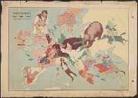
Beinecke Rare Book and Manuscript Library > The lesson of the war map.
Published / Created:
[1917?]
Call Number:
11hc 1916A
Container / Volume:
BRBL_00010C
Image Count:
1
Resource Type:
Maps, Atlases & Globes
Found in:
Beinecke Rare Book and Manuscript Library > Subject nationalities of the German alliance : from the Allies' peace terms as stated in their reply to President Wilson's note of 19th Dec. 1916 : [Eurasia].
Creator:
Published / Created:
[1918?]
Call Number:
11hcf 1919D
Container / Volume:
BRBL_00010W
Image Count:
1
Resource Type:
Maps, Atlases & Globes
Found in:
Beinecke Rare Book and Manuscript Library > The Daily Telegraph war map of eastern Europe (no. 5) / by Alexander Gross ; produced by "Geographia" Ltd.
Creator:
Published / Created:
1941
Call Number:
11hd 1941
Image Count:
1
Resource Type:
Maps, Atlases & Globes
Found in:
Beinecke Rare Book and Manuscript Library > Daily Telegraph war map of the Russian Front [cartographic material] / London Geographical Institute.
Creator:
Published / Created:
1916
Call Number:
11hcf 1919E-9
Container / Volume:
BRBL_00010ZA
Image Count:
1
Resource Type:
Maps, Atlases & Globes
Found in:
Beinecke Rare Book and Manuscript Library > Krakau : North M 34. / compiled at the Royal Geographical Society under the direction of the Geographical Section; drawn and printed by Ordnance Survey.
Creator:
Published / Created:
[1941?]
Call Number:
11hd 1939B
Image Count:
1
Resource Type:
Maps, Atlases & Globes
Found in:
Beinecke Rare Book and Manuscript Library > Daily Express war map [cartographic material] / the London Geographical Institute KCL.
Creator:
Published / Created:
1915
Call Number:
11hcf 1919E-5
Container / Volume:
BRBL_00010ZA
Image Count:
1
Resource Type:
Maps, Atlases & Globes
Found in:
Beinecke Rare Book and Manuscript Library > (Vienna) Wien : North M 33. / compiled at the Royal Geographical Society under the direction of the Geographical Section ; drawn and printed by Ordnance Survey.
Creator:
Published / Created:
1915
Call Number:
11hcf 1919E-27
Container / Volume:
BRBL_00010ZA
Image Count:
1
Resource Type:
Maps, Atlases & Globes
Found in:
Beinecke Rare Book and Manuscript Library > Jugoslovenska zemlja = The Jugoslav territory = Le territoire Iougoslave : Map of Jugoslav territory / by Dr. Niko Županić ; Issued for the Jugoslav community in London.
Creator:
Published / Created:
1915
Call Number:
11hcf 1919E-18
Container / Volume:
BRBL_00010Z
Image Count:
1
Resource Type:
Maps, Atlases & Globes
Found in:
Beinecke Rare Book and Manuscript Library > Jitomir : North M 35. / compiled at the Royal Geographical Society under the direction of the Geographical Section; drawn and printed by Ordnance Survey.
Creator:
Published / Created:
1918
Call Number:
11hcf 1919E-14
Image Count:
1
Resource Type:
Maps, Atlases & Globes
Found in:
Beinecke Rare Book and Manuscript Library > Bucuresti : North L 35. / compiled at the Royal Geographical Society under the direction of the Geographical Section; drawn and printed by Ordnance Survey.
Creator:
Published / Created:
1918
Call Number:
11hcf 1919E-20
Container / Volume:
BRBL_00010ZA
Image Count:
1
Resource Type:
Maps, Atlases & Globes
Found in:
Beinecke Rare Book and Manuscript Library > Buda Pest : North L 34. / compiled at the Royal Geographical Society under the direction of the Geographical Section; drawn and printed by Ordnance Survey.
Creator:
Published / Created:
1918
Call Number:
11hcf 1919E-6
Container / Volume:
BRBL_00010ZA
Image Count:
1
Resource Type:
Maps, Atlases & Globes
Found in:
Beinecke Rare Book and Manuscript Library > (Vienna) Wien : North M 33. / compiled at the Royal Geographical Society under the direction of the Geographical Section ; drawn and printed by Ordnance Survey.
Creator:
Published / Created:
1915
Call Number:
11hcf 1919E-19
Container / Volume:
BRBL_00010Z
Image Count:
1
Resource Type:
Maps, Atlases & Globes
Found in:
Beinecke Rare Book and Manuscript Library > Buda Pest : North L 34. / compiled at the Royal Geographical Society under the direction of the Geographical Section; drawn and printed by Ordnance Survey.
Creator:
Published / Created:
1915
Call Number:
11hcf 1919E-7
Container / Volume:
BRBL_00010ZA
Image Count:
1
Resource Type:
Maps, Atlases & Globes
Found in:
Beinecke Rare Book and Manuscript Library > Sofiya : North K 34. / compiled at the Royal Geographical Society under the direction of the Geographical Section ; drawn and printed by Ordnance Survey.
Creator:
Published / Created:
1918
Call Number:
11hcf 1919E-8
Container / Volume:
BRBL_00010ZA
Image Count:
1
Resource Type:
Maps, Atlases & Globes
Found in:
Beinecke Rare Book and Manuscript Library > Sofiya : North K 34. / compiled at the Royal Geographical Society under the direction of the Geographical Section; drawn and printed by Ordnance Survey.
Creator:
Published / Created:
1915
Call Number:
11hcf 1919E-5
Container / Volume:
BRBL_00010ZA
Image Count:
1
Resource Type:
Maps, Atlases & Globes
Found in:
Beinecke Rare Book and Manuscript Library > (Vienna) Wien : North M 33. / compiled at the Royal Geographical Society under the direction of the Geographical Section ; drawn and printed by Ordnance Survey.
Creator:
Published / Created:
1916
Call Number:
11hcf 1919E-9
Container / Volume:
BRBL_00010ZA
Image Count:
1
Resource Type:
Maps, Atlases & Globes
Found in:
Beinecke Rare Book and Manuscript Library > Krakau : North M 34. / compiled at the Royal Geographical Society under the direction of the Geographical Section; drawn and printed by Ordnance Survey.
Published / Created:
1843
Call Number:
304 1843
Container / Volume:
BRBL_00033
Image Count:
1
Resource Type:
Maps, Atlases & Globes
Found in:
Beinecke Rare Book and Manuscript Library > Index map to the Handbook for Travelers on the continent. J. & C. Walker sculpt.
Published / Created:
1794
Call Number:
303cea 1794
Container / Volume:
BRBL_00033
Image Count:
1
Resource Type:
Maps, Atlases & Globes
Found in:
Beinecke Rare Book and Manuscript Library > A New and Correct chart of the Gulf of Finland ... Published by command of the Empress of all the Russias.
Published / Created:
1860
Call Number:
30 1860
Container / Volume:
BRBL_00032
Image Count:
1
Resource Type:
Maps, Atlases & Globes
Found in:
Beinecke Rare Book and Manuscript Library > L'Europe en 1860.
Creator:
Published / Created:
[1900]
Call Number:
30 1900
Container / Volume:
BRBL_00032
Image Count:
1
Resource Type:
Maps, Atlases & Globes
Found in:
Beinecke Rare Book and Manuscript Library > John Bull and his friends : a serio-comic map of Europe ... 1900 / by Fred. W. Rose ; Matt. B. Hewerdine from a sketch by Fred. W. Rose.
Published / Created:
[c1925]
Call Number:
304ed 1925
Container / Volume:
BRBL_00034B
Image Count:
1
Resource Type:
Maps, Atlases & Globes
Found in:
Beinecke Rare Book and Manuscript Library > Central Europe Ethnographical.
Published / Created:
1866
Call Number:
304 1866
Container / Volume:
BRBL_00033
Image Count:
1
Resource Type:
Maps, Atlases & Globes
Found in:
Beinecke Rare Book and Manuscript Library > A Map of the Germanic Confederation as it existed in June, 1866 and of Central Europe.
Creator:
Published / Created:
1914
Call Number:
30 1914E
Container / Volume:
BRBL_00032A
Image Count:
1
Resource Type:
Maps, Atlases & Globes
Found in:
Beinecke Rare Book and Manuscript Library > European revue : kill that eagle / produced by "Geographia" Ltd. ; [drawn by] J.H.A.
Creator:
Published / Created:
1945
Call Number:
23 1944
Container / Volume:
BRBL_00020
Image Count:
1
Resource Type:
Maps, Atlases & Globes
Found in:
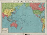
Beinecke Rare Book and Manuscript Library > Philips' war map of the Pacific.
Published / Created:
[1874?]
Call Number:
30 1874A
Container / Volume:
BRBL_00032
Image Count:
1
Resource Type:
Maps, Atlases & Globes
Found in:
Beinecke Rare Book and Manuscript Library > Cruchley's map of Europe shewing the political divisions and all railways, cities, towns &c.
Published / Created:
1746
Call Number:
307cea 1746
Container / Volume:
BRBL_00036
Image Count:
1
Resource Type:
Maps, Atlases & Globes
Found in:
Beinecke Rare Book and Manuscript Library > A Chart of the English Channel, the Bay of Biscay, with part of the Ocean and Mediterranean ... By T. Kitchin.
Published / Created:
[1671?]
Call Number:
307cea 1671
Container / Volume:
BRBL_00036
Image Count:
1
Resource Type:
Maps, Atlases & Globes
Found in:
Beinecke Rare Book and Manuscript Library > A new mapp of the sea coasts of England, France, and Holland ... Described by John Seller.
Published / Created:
1918
Call Number:
304fd 1818
Container / Volume:
BRBL_00034B
Image Count:
1
Resource Type:
Maps, Atlases & Globes
Found in:
Beinecke Rare Book and Manuscript Library > Central & South Eastern Europe to illustrate Vienna Congress Treaty.
Creator:
Published / Created:
[1916?]
Call Number:
30ed 1916
Container / Volume:
BRBL_00037B
Image Count:
1
Resource Type:
Maps, Atlases & Globes
Found in:
Beinecke Rare Book and Manuscript Library > Subject nationalities of the German alliance.
Published / Created:
1811
Call Number:
319 1811
Container / Volume:
BRBL_00040
Image Count:
1
Resource Type:
Maps, Atlases & Globes
Found in:
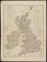
Beinecke Rare Book and Manuscript Library > A New map of the British Isles ... By John Cary, Engraver.
Published / Created:
[1940]
Call Number:
30gm 1940
Container / Volume:
BRBL_00038
Image Count:
1
Resource Type:
Maps, Atlases & Globes
Found in:
Beinecke Rare Book and Manuscript Library > Central Europe -- Transport Map.
Published / Created:
1788
Call Number:
319 1788
Container / Volume:
BRBL_00040
Image Count:
1
Resource Type:
Maps, Atlases & Globes
Found in:
Beinecke Rare Book and Manuscript Library > A compleat map of the British Isles ...
Published / Created:
1845
Call Number:
32 1845
Container / Volume:
BRBL_00045
Image Count:
1
Resource Type:
Maps, Atlases & Globes
Found in:
Beinecke Rare Book and Manuscript Library > Betts's new map of England & Wales ...
Published / Created:
1831
Call Number:
32 1831
Container / Volume:
BRBL_00045
Image Count:
1
Resource Type:
Maps, Atlases & Globes
Found in:
Beinecke Rare Book and Manuscript Library > Cruchley's new travelling map and itinerary comprising the whole of England ...
Published / Created:
1786
Call Number:
32 1786
Container / Volume:
BRBL_00044
Image Count:
1
Resource Type:
Maps, Atlases & Globes
Found in:
Beinecke Rare Book and Manuscript Library > Itineraire de la Grande Bretagne.
Published / Created:
1823
Call Number:
32 1823
Container / Volume:
BRBL_00045
Image Count:
1
Resource Type:
Maps, Atlases & Globes
Found in:
Beinecke Rare Book and Manuscript Library > New and Improved map of England and Wales including the principal part of Scotland ... by W.R. Gardner, Engraved by W.R. Gardner.
Published / Created:
1828
Call Number:
32 1828
Container / Volume:
BRBL_00045
Image Count:
1
Resource Type:
Maps, Atlases & Globes
Found in:
Beinecke Rare Book and Manuscript Library > Cary's ... map of England and Wales with part of Scotland ... John Cary.
Published / Created:
1791
Call Number:
32 1791
Container / Volume:
BRBL_00044
Image Count:
1
Resource Type:
Maps, Atlases & Globes
Found in:
Beinecke Rare Book and Manuscript Library > Bowles's correct guide through England & Wales ...
Creator:
Published / Created:
[1671?]
Call Number:
319cea 1671
Container / Volume:
BRBL_00042
Image Count:
1
Resource Type:
Maps, Atlases & Globes
Found in:
Beinecke Rare Book and Manuscript Library > A chart of ye narrow seas / newly corrected by John Seller, hydrographer to the kings most excellent majestie.
Published / Created:
1807
Call Number:
32 1807
Container / Volume:
BRBL_00044
Image Count:
1
Resource Type:
Maps, Atlases & Globes
Found in:
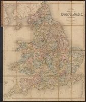
Beinecke Rare Book and Manuscript Library > A new map of England ... By John Cary, Engraver.
Published / Created:
1811
Call Number:
32 1811A
Container / Volume:
BRBL_00044
Image Count:
1
Resource Type:
Maps, Atlases & Globes
Found in:
Beinecke Rare Book and Manuscript Library > A new map of England ... by John Cary, Engraver.
Published / Created:
1830
Call Number:
32 1830
Container / Volume:
BRBL_00045
Image Count:
1
Resource Type:
Maps, Atlases & Globes
Found in:
Beinecke Rare Book and Manuscript Library > Cruchley's improved Geographical Companion throughout England & Wales including part of Scotland ...
Creator:
Published / Created:
Augt. 2nd, 1798.
Call Number:
32 1798
Container / Volume:
BRBL_00044
Image Count:
1
Resource Type:
Maps, Atlases & Globes
Found in:
Beinecke Rare Book and Manuscript Library > Wallis's new and correct map of the post roads of England and Wales.
Published / Created:
[1855?]
Call Number:
3191gm 1855
Container / Volume:
BRBL_00041
Image Count:
1
Resource Type:
Maps, Atlases & Globes
Found in:
Beinecke Rare Book and Manuscript Library > Wyld's A map of England, Wales, & Scotland describing all the direct and principal cross roads of Great Britain, with the distances measured between the market towns and from London: Likewise the Great Rivers and Navigable Canals and Railroads.
Published / Created:
1831
Call Number:
3191gmb 1831
Container / Volume:
BRBL_00041
Image Count:
1
Resource Type:
Maps, Atlases & Globes
Found in:
Beinecke Rare Book and Manuscript Library > The Official Travelling Map of England & Wales with part of Scotland ... by James Bingley, Engraver.
Published / Created:
[1890]
Call Number:
3191gm 1890
Container / Volume:
BRBL_00041
Image Count:
1
Resource Type:
Maps, Atlases & Globes
Found in:
Beinecke Rare Book and Manuscript Library > Road & Railway map of England, Wales and Scotland.
Published / Created:
[1845?]
Call Number:
3191 1845
Container / Volume:
BRBL_00041
Image Count:
1
Resource Type:
Maps, Atlases & Globes
Found in:
Beinecke Rare Book and Manuscript Library > A map of England, Wales, & Scotland ...
Creator:
Published / Created:
1858
Call Number:
32 1858
Container / Volume:
BRBL_00045
Image Count:
1
Resource Type:
Maps, Atlases & Globes
Found in:
Beinecke Rare Book and Manuscript Library > England / by J. Arrowsmith.
Published / Created:
[1719?]
Call Number:
32 1719
Container / Volume:
BRBL_00043
Image Count:
1
Resource Type:
Maps, Atlases & Globes
Found in:
Beinecke Rare Book and Manuscript Library > A new and correct map of England and Wales now called South Britain ...
Published / Created:
1720
Call Number:
32 L84 1720
Container / Volume:
BRBL_00048
Image Count:
1
Resource Type:
Maps, Atlases & Globes
Found in:
Beinecke Rare Book and Manuscript Library > A new map of London ... 1720 Revised by Ino. Senex. S. Parker Delin. et sculpt.
Branch:v1.60.98 ,Deployed:2024-04-24T10:14:36-04:00