Search
You Searched For
Search Results
- Published / Created:
- 1806
- Call Number:
- 38 1806
- Container / Volume:
- BRBL_00154
- Image Count:
- 1
- Resource Type:
- Maps, Atlases & Globes
- Found in:
- Beinecke Rare Book and Manuscript Library > A new map of France ... division into Provinces as previous to the Revolution ... by John Cary, Engraver.
- Published / Created:
- 1811
- Call Number:
- 38 1811
- Container / Volume:
- BRBL_00154
- Image Count:
- 1
- Resource Type:
- Maps, Atlases & Globes
- Found in:
- Beinecke Rare Book and Manuscript Library > A new map of France ... divison into provinces as previous to the revolution ... John Cary, Engraver.
- Published / Created:
- 1794
- Call Number:
- 38 1794A
- Container / Volume:
- BRBL_00153
- Image Count:
- 1
- Resource Type:
- Maps, Atlases & Globes
- Found in:
- Beinecke Rare Book and Manuscript Library > A new map of France ... in 1790.
- Published / Created:
- 1793
- Call Number:
- 38 1793B
- Container / Volume:
- BRBL_00153
- Image Count:
- 1
- Resource Type:
- Maps, Atlases & Globes
- Found in:
- Beinecke Rare Book and Manuscript Library > A new map of France ... into 83 departments ... all the Post & Cross Roads ... by John Andrews.
- Published / Created:
- 1799
- Call Number:
- 38 1799A
- Container / Volume:
- BRBL_00154
- Image Count:
- 1
- Resource Type:
- Maps, Atlases & Globes
- Found in:
- Beinecke Rare Book and Manuscript Library > A new map of France divided into departments as decreed by the National Assembly, 1790 ... John Cary, Engraver.
- Creator:
- Sayer, Robert, 1725-1794
- Published / Created:
- Jany. 1st , 1793.
- Call Number:
- 1977 Folio 177
- Image Count:
- 2
- Resource Type:
- Maps, Atlases & Globes
- Found in:
- Beinecke Rare Book and Manuscript Library > A new map of France divided into eighty three departments according to the decree of the National Assembly in 1790.
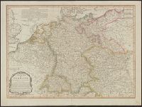
- Published / Created:
- 1805
- Call Number:
- 36 1805A
- Container / Volume:
- BRBL_00119
- Image Count:
- 1
- Resource Type:
- Maps, Atlases & Globes
- Found in:
- Beinecke Rare Book and Manuscript Library > A new map of Germany divided into its circles ...
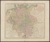
- Published / Created:
- 1799
- Call Number:
- 36 1799
- Container / Volume:
- BRBL_00119
- Image Count:
- 1
- Resource Type:
- Maps, Atlases & Globes
- Found in:
- Beinecke Rare Book and Manuscript Library > A new map of Germany divided into its circles ... with the Kingdom of Bohemia etc ... John Cary, Engraver.
- Creator:
- Cary, John, ca. 1754-1835
- Published / Created:
- April 28, 1811.
- Call Number:
- 36 1811
- Container / Volume:
- BRBL_00119
- Image Count:
- 1
- Resource Type:
- Maps, Atlases & Globes
- Found in:
- Beinecke Rare Book and Manuscript Library > A new map of Germany, divided into its circles : viz. the upper and lower Rhine, Swabia, Austria, Bavaria, upper and lower Saxony, Franconia and Westphalia, with the Kingdom of Bohemia &c. From the latest authorities / by John Cary, engraver, 1811.
- Published / Created:
- 1811
- Call Number:
- 59 1811A
- Container / Volume:
- BRBL_00316
- Image Count:
- 1
- Resource Type:
- Maps, Atlases & Globes
- Found in:
- Beinecke Rare Book and Manuscript Library > A new map of Hindoostan ... By John Cary, Engraver.
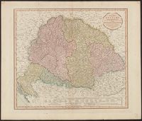
- Published / Created:
- 1811
- Call Number:
- 43 1811
- Container / Volume:
- BRBL_00250
- Image Count:
- 1
- Resource Type:
- Maps, Atlases & Globes
- Found in:
- Beinecke Rare Book and Manuscript Library > A new map of Hungary ... / by John Cary, engraver.
- Published / Created:
- 1799
- Call Number:
- 327 1799
- Container / Volume:
- BRBL_00073
- Image Count:
- 1
- Resource Type:
- Maps, Atlases & Globes
- Found in:
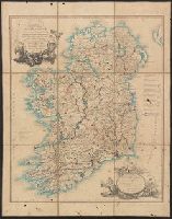
- Beinecke Rare Book and Manuscript Library > A new map of Ireland ... by John Cary, Engraver.
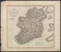
- Published / Created:
- 1811
- Call Number:
- 327 1811
- Container / Volume:
- BRBL_00073
- Image Count:
- 1
- Resource Type:
- Maps, Atlases & Globes
- Found in:
- Beinecke Rare Book and Manuscript Library > A new map of Ireland ... by John Cary, Engraver.
- Published / Created:
- 1793
- Call Number:
- 327 1793
- Container / Volume:
- BRBL_00072
- Image Count:
- 1
- Resource Type:
- Maps, Atlases & Globes
- Found in:
- Beinecke Rare Book and Manuscript Library > A new map of Ireland ... distances between the Towns & Stages, marked in miles and furlongs ... by Alexander Taylor ... Royal Engineers.
- Published / Created:
- 1799
- Call Number:
- 40 1799
- Container / Volume:
- BRBL_00198
- Image Count:
- 1
- Resource Type:
- Maps, Atlases & Globes
- Found in:
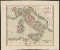
- Beinecke Rare Book and Manuscript Library > A new map of Italy ... / by John Cary, engraver.
- Published / Created:
- [ca. 1760]
- Call Number:
- 40 1780C
- Container / Volume:
- BRBL_00198
- Image Count:
- 2
- Resource Type:
- Maps, Atlases & Globes
- Found in:
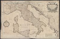
- Beinecke Rare Book and Manuscript Library > A new map of Italy : distinguishing all the sovereignties in it whether states, kingdoms, dutchies, principalities, republicks &c. with the post roads, & many remarks not extant in any map, according to the newest and most exact observations.
- Creator:
- Kitchin, Thomas, d. 1784
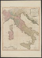
- Published / Created:
- 1794
- Call Number:
- 40 1794
- Container / Volume:
- BRBL_00198
- Image Count:
- 1
- Resource Type:
- Maps, Atlases & Globes
- Found in:
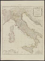
- Beinecke Rare Book and Manuscript Library > A new map of Italy with the islands of Sicily, Sardinia & Corsica / from Monsr. d'Anville: to which have been added the post roads and several other improvements.
- Published / Created:
- 1790
- Call Number:
- 40 1790
- Container / Volume:
- BRBL_00198
- Image Count:
- 1
- Resource Type:
- Maps, Atlases & Globes
- Found in:
- Beinecke Rare Book and Manuscript Library > A new map of Italy, with the islands of Sicily, Sardinia & Corsica / from Monsr. d'Anville ...
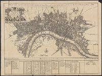
- Published / Created:
- 1720
- Call Number:
- 32 L84 1720
- Container / Volume:
- BRBL_00048
- Image Count:
- 1
- Resource Type:
- Maps, Atlases & Globes
- Found in:
- Beinecke Rare Book and Manuscript Library > A new map of London ... 1720 Revised by Ino. Senex. S. Parker Delin. et sculpt.
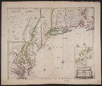
- Published / Created:
- [1690?]
- Call Number:
- 755 1690
- Container / Volume:
- BRBL_00424
- Image Count:
- 1
- Resource Type:
- Maps, Atlases & Globes
- Found in:
- Beinecke Rare Book and Manuscript Library > A new map of New England, New York, New Jarsey, Pensilvania, Maryland and Virginia.
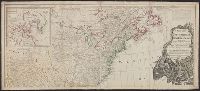
- Creator:
- Sayer, Robert, 1725-1794
- Published / Created:
- [between 1750 and 1769?]
- Call Number:
- 71 1760C
- Container / Volume:
- BRBL_00364
- Image Count:
- 1
- Resource Type:
- Maps, Atlases & Globes
- Found in:
- Beinecke Rare Book and Manuscript Library > A new map of North America : with the British, French, Spanish, Dutch & Danish dominions on that great continent; and the West India Islands / done from the latest geographers, with great improvements from the Sieurs d'Anville & Robert.
- Creator:
- Pownall, Thomas, 1722-1805
- Published / Created:
- 1794 May 12
- Call Number:
- 71 1794
- Container / Volume:
- BRBL_00367
- Image Count:
- 2
- Resource Type:
- Maps, Atlases & Globes
- Found in:
- Beinecke Rare Book and Manuscript Library > A new map of North America with the West India Islands : divided according to the preliminary articles of peace, signed at Versailles, 20 Jan. 1783, wherein are particularly distinguished the United States, and the several provinces, governments &ca which
- Creator:
- Pownall, Thomas, 1722-1805
- Published / Created:
- 1794 May 12
- Call Number:
- 71 1794
- Container / Volume:
- BRBL_00367
- Image Count:
- 1
- Resource Type:
- Maps, Atlases & Globes
- Found in:
- Beinecke Rare Book and Manuscript Library > A new map of North America with the West India Islands : divided according to the preliminary articles of peace, signed at Versailles, 20 Jan. 1783, wherein are particularly distinguished the United States, and the several provinces, governments &ca which
- Published / Created:
- 1783
- Call Number:
- 71 1783P
- Container / Volume:
- BRBL_00726
- Image Count:
- 2
- Resource Type:
- Maps, Atlases & Globes
- Found in:
- Beinecke Rare Book and Manuscript Library > A new map of North America, with the West India islands ... laid down according to the latest surveys, and corrected from the original materials, of Goverr. Pownall.
- Published / Created:
- 1786
- Call Number:
- 755 1786
- Container / Volume:
- BRBL_00435
- Image Count:
- 1
- Resource Type:
- Maps, Atlases & Globes
- Found in:
- Beinecke Rare Book and Manuscript Library > A new map of Nova Scotia and Cape Breton Island with the adjacent parts of New England and Canada ...
- Creator:
- Cary, John, ca. 1754-1835
- Published / Created:
- April 28 1811.
- Call Number:
- 732 1811
- Container / Volume:
- BRBL_00376A
- Image Count:
- 1
- Resource Type:
- Maps, Atlases & Globes
- Found in:
- Beinecke Rare Book and Manuscript Library > A new map of Nova Scotia, Newfoundland &c., from the latest authorities / by John Cary, engraver.
- Creator:
- Jefferys, Thomas, -1771
- Published / Created:
- 15 June 1775.
- Call Number:
- 732 1775
- Container / Volume:
- BRBL_00727
- Image Count:
- 1
- Resource Type:
- Maps, Atlases & Globes
- Found in:
- Beinecke Rare Book and Manuscript Library > A new map of Nova Scotia, and Cape Breton Island : with the adjacent parts of New England and Canada, composed from a great number of actual surveys; and other materials regulated by many new astronomical observations of the longitude as well as latitude
- Creator:
- Lodge, John, -1796
- Published / Created:
- 31st July 1785.
- Call Number:
- 732 1785
- Container / Volume:
- BRBL_00376A
- Image Count:
- 1
- Resource Type:
- Maps, Atlases & Globes
- Found in:
- Beinecke Rare Book and Manuscript Library > A new map of Nova Scotia, and Cape Britain [cartographic material] : With the adjacent parts of New England and Canada, from the latest authorities / J. Lodge sc.
- Published / Created:
- 1811
- Call Number:
- 534 1811A
- Container / Volume:
- BRBL_00289
- Image Count:
- 1
- Resource Type:
- Maps, Atlases & Globes
- Found in:
- Beinecke Rare Book and Manuscript Library > A new map of Persia ... By John Cary, Engraver.
- Creator:
- Cary, John, approximately 1754-1835, cartographer
- Published / Created:
- Augst. 1. 1799.
- Call Number:
- 401 1799
- Container / Volume:
- BRBL_00233
- Image Count:
- 1
- Resource Type:
- Maps, Atlases & Globes
- Found in:
- Beinecke Rare Book and Manuscript Library > A new map of Piedmont, the duchies of Savoy and Milan, and the republic of Genoa, with their subdivisions : from the latest authorities / by John Cary.
- Published / Created:
- 1811
- Call Number:
- 356 1772-1811
- Container / Volume:
- BRBL_00113
- Image Count:
- 1
- Resource Type:
- Maps, Atlases & Globes
- Found in:
- Beinecke Rare Book and Manuscript Library > A new map of Poland and the Grand Duchy of Lithuania ... between Austria, Russia, and Prussia in 1772, 1793, & 1795 ... By John Cary, Engraver. 1811.
- Published / Created:
- 1811
- Call Number:
- 326 1811
- Container / Volume:
- BRBL_00070
- Image Count:
- 2
- Resource Type:
- Maps, Atlases & Globes
- Found in:
- Beinecke Rare Book and Manuscript Library > A new map of Scotland ... by John Cary, Engraver.
- Published / Created:
- 1793
- Call Number:
- 407 1793
- Container / Volume:
- BRBL_00237
- Image Count:
- 1
- Resource Type:
- Maps, Atlases & Globes
- Found in:
- Beinecke Rare Book and Manuscript Library > A new map of Sicily the First, or the kingdom of Naples : drawn with several additions, from Zannoni's map published by order of the King of the Two Sicilies.
- Published / Created:
- 1799
- Call Number:
- 407 1799
- Container / Volume:
- BRBL_00237
- Image Count:
- 1
- Resource Type:
- Maps, Atlases & Globes
- Found in:
- Beinecke Rare Book and Manuscript Library > A new map of Sicily the First, or the kingdom of Naples : drawn with several additions, from Zannoni's map published by order of the King of the Two Sicilies.
- Published / Created:
- 1794
- Call Number:
- 90 1794A
- Container / Volume:
- BRBL_00731
- Image Count:
- 2
- Resource Type:
- Maps, Atlases & Globes
- Found in:
- Beinecke Rare Book and Manuscript Library > A new map of South America ... from Mr. d'Anville ...
- Published / Created:
- 1794
- Call Number:
- 90 1794A
- Container / Volume:
- BRBL_00731
- Image Count:
- 2
- Resource Type:
- Maps, Atlases & Globes
- Found in:
- Beinecke Rare Book and Manuscript Library > A new map of South America ... from Mr. d'Anville ...
- Published / Created:
- 1820
- Call Number:
- 329 1820
- Container / Volume:
- BRBL_00074
- Image Count:
- 1
- Resource Type:
- Maps, Atlases & Globes
- Found in:
- Beinecke Rare Book and Manuscript Library > A new map of South Wales ... Thomas Dix Surveyor ...
- Published / Created:
- 1811
- Call Number:
- 39 1811
- Container / Volume:
- BRBL_00186
- Image Count:
- 1
- Resource Type:
- Maps, Atlases & Globes
- Found in:
- Beinecke Rare Book and Manuscript Library > A new map of Spain and Portugal ... By John Cary, Engraver.
- Published / Created:
- [1852?]
- Call Number:
- 34 1852
- Container / Volume:
- BRBL_00091
- Image Count:
- 1
- Resource Type:
- Maps, Atlases & Globes
- Found in:
- Beinecke Rare Book and Manuscript Library > A new map of Sweden and Norway [cartographic material].
- Published / Created:
- 1811
- Call Number:
- 34 1811
- Container / Volume:
- BRBL_00091
- Image Count:
- 1
- Resource Type:
- Maps, Atlases & Globes
- Found in:
- Beinecke Rare Book and Manuscript Library > A new map of Sweden, Denmark and Norway ... John Cary, Engraver.
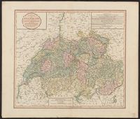
- Published / Created:
- 1811
- Call Number:
- 37 1811
- Image Count:
- 1
- Resource Type:
- Maps, Atlases & Globes
- Found in:
- Beinecke Rare Book and Manuscript Library > A new map of Swisserland ... By John Cary, Engraver.
- Published / Created:
- 1794
- Call Number:
- 37 1794
- Image Count:
- 1
- Resource Type:
- Maps, Atlases & Globes
- Found in:
- Beinecke Rare Book and Manuscript Library > A new map of Switzerland ... Thirteen Cantons with their Allies & their subjects.
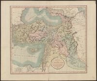
- Published / Created:
- 1811
- Call Number:
- 501 1811
- Container / Volume:
- BRBL_00276
- Image Count:
- 1
- Resource Type:
- Maps, Atlases & Globes
- Found in:
- Beinecke Rare Book and Manuscript Library > A new map of Turkey in Asia ... By John Cary, Engraver.
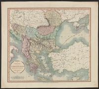
- Published / Created:
- 1812
- Call Number:
- 491 1812
- Container / Volume:
- BRBL_00269
- Image Count:
- 1
- Resource Type:
- Maps, Atlases & Globes
- Found in:
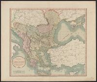
- Beinecke Rare Book and Manuscript Library > A new map of Turkey in Europe ... By John Carey, Engraver.
- Creator:
- Cary, John, ca. 1754-1835
- Published / Created:
- 1801
- Call Number:
- 491 1801
- Container / Volume:
- BRBL_00269
- Image Count:
- 1
- Resource Type:
- Maps, Atlases & Globes
- Found in:
- Beinecke Rare Book and Manuscript Library > A new map of Turkey in Europe, divided into its provinces, from the best authorities / by John Cary, engraver.
- Creator:
- Cary, John, ca. 1754-1835
- Published / Created:
- Dec. 1st 1807.
- Call Number:
- 73 1807
- Container / Volume:
- BRBL_00374
- Image Count:
- 1
- Resource Type:
- Maps, Atlases & Globes
- Found in:
- Beinecke Rare Book and Manuscript Library > A new map of Upper & Lower Canada / from the latest authorities by John Cary, engraver.
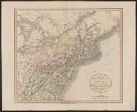
- Published / Created:
- Sept. 1. 1806.
- Call Number:
- 759 1806
- Container / Volume:
- BRBL_00728
- Image Count:
- 1
- Resource Type:
- Maps, Atlases & Globes
- Found in:
- Beinecke Rare Book and Manuscript Library > A new map of part of the United States of North America ... / by John Cary, engraver, 1806.
- Published / Created:
- June 1st. 1805.
- Call Number:
- 75 1805
- Container / Volume:
- BRBL_00727
- Image Count:
- 1
- Resource Type:
- Maps, Atlases & Globes
- Found in:
- Beinecke Rare Book and Manuscript Library > A new map of part of the United States of North America ... / by John Cary, engraver.
- Published / Created:
- 1806
- Call Number:
- 755 1806A
- Container / Volume:
- BRBL_00438
- Image Count:
- 1
- Resource Type:
- Maps, Atlases & Globes
- Found in:
- Beinecke Rare Book and Manuscript Library > A new map of part of the United States of North America ... by John Cary, Engraver.
- Published / Created:
- 1819
- Call Number:
- 755 1819
- Container / Volume:
- BRBL_00439
- Image Count:
- 1
- Resource Type:
- Maps, Atlases & Globes
- Found in:
- Beinecke Rare Book and Manuscript Library > A new map of part of the United States, exhibiting the North West, Michigan, Indiana, and Illinois territory the States of Kentucky, Ohio, Virginia, Maryland and Pennsylvania ... John Cary, Engraver.