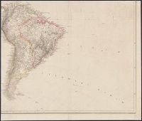
Date inferred from Stevens and Tree's Comparative cartography, which lists two issues, date, Date on map: 4th September 1804., Includes ornate title cartouche with American plants and animals, engraved by W. & G. Cooke., and Relief shown by hachures and shading.
Publisher:
A. Arrowsmith, No. 10 Soho Square,
Subject (Geographic):
America--Maps
Subject (Name):
W. & G. Cooke, West, W., engraver, and Wilson, H., engraver
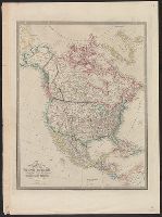
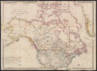
In lower margin: London: Published 1 Jan. 1795 by A. Arrowsmith, No. 10 Soho Square ... additions to 1802., Includes notes., and Relief shown by hachures.
Appears in Wyld's New general atlas. London, 1854. Cf. Phillips, Maps of America, p. 607., In upper right margin: 36., Relief shown by hachures., and Yale's copy stamped on verso: Yale University Library, Karpinski-Von Wieser Map Collection.
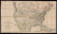
Date beneath publisher statement: March 1st 1827., Includes notes., Relief shown by hachures., Some sheets: Published by Jas. Wyld (successor to W. Faden, and Stevens and Tree describe the various issues of this map in Tooley's Mapping of America, p. 91., no. 63.
Includes inset of Jamaica., Relief shown by hachures., and Yale's copy with portion of a cover pasted on backing, showing advertisements for Betts maps.
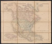
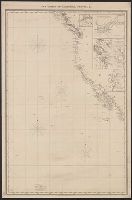
Includes insets of "Victoria Harbour, Vancouver Island," [Map of Mouth of Columbia River], "The harbour of San Francisco / surveyed by Captn. F.W. Beechey, 1828," and "Guaymas Harbour (Gulf of California)." and Relief shown by hachures. Depths shown by soundings.
"Longit. west from Ferro I.", "Printed for John Bowles at the Black Horse in Cornhill & Carington Bowles in St. Pauls Church yard, London.", and Differs from other copy in coloration. Only boundaries are colored, emphasis is on showing the internal boundaries o
Publisher:
Printed for John Bowles,
Subject (Geographic):
NorthAmerica--Maps--Early works to
Subject (Name):
Bowles, Carington, 1724-1793, Bowles, John, 1701-1779, and Palairet, Jean, 1697-1774