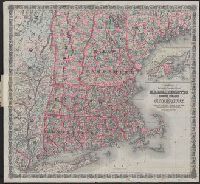
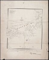
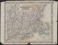
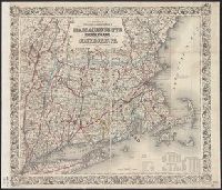
Massachusetts, Rhode Island, and Connecticut and Railroad & township map of Massachusetts, Rhode Island, and Connecticut
Description:
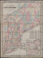
"Entered according to Act of Congress in the Year 1860 by J.H. Colton in the Clerks Office of the District Court for the Southern District of New York.", Inset: British Provinces. Scale [ca. 1:1,850,000]., Prime meridians: Greenwich and Washington, D.C., and Rel
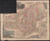
Includes statistical charts: Population of the United States (by state and territory, 1790-1860) -- Ratio of slaves to total population -- Positions of forts., Insets: Map of the great railroad routes fr, Prime meridian: Greenwich., and Relief shown by hachures.
"Entered according to Act of Congress in the Year 1864 by A.J, From Johnson's new illustrated family atlas [New York : Johnson and Ward, 1866], plates 23-24., Includes legend., Meridians: Greenwich and Washington., and Shows railroads, counties, cities and towns.
Publisher:
Johnson and Ward,
Subject (Geographic):
NewEngland--Maps
Subject (Name):
Johnson and Ward and Johnson, A. J. (Alvin Jewett), 1827-1884. Johnson's new illustrated family atlas
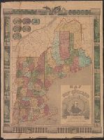
"Entered according to Act of Congress in the Year 1863 by J.H. Colton in the Clerks Office of the District Court for the Southern District of New York.", "Printed by D. Mc. Lellan, 26, and Includes tables for each state of population, farms, and manufacturing.
"Entered according to Act of Congress in the Year 1863 by J.H. Colton in the Clerks Office of the District Court for the Southern District of New York.", "Printed by D. Mc. Lellan, 26, and Includes tables for each state of population, farms, and manufacturing.