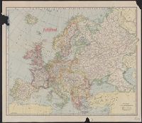
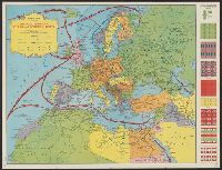
Indicates "Furthest advance of the German Army", and "Battle line May 10th, 1918" overprinted in red., Relief shown by spot heights., and Shows railways, canals, aircraft depots, wireless stations, forts, naval arsenals and boundaries.
Publisher:
C.S. Hammond,
Subject (Geographic):
Europe--Maps
Subject (Topic):
World War, 1914-1918--Campaigns--Europe--Maps and World War, 1914-1918--Campaigns--Western Front--Maps
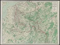
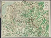
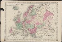
Central Europe. and Cook's tours in central Europe.
Description:
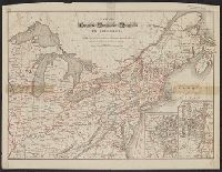
Covers Benelux, eastern France, Switzerland, southern Germany, Austria, and Italy., Inset: Part of south Italy and Sicily., On verso: Map of Cook's tours in Scotland & England.--Map of Cook's tours in Ireland., and Shows railroads, "Railways over which Cook's ti
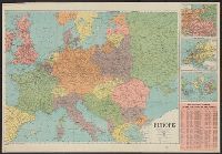
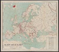
Includes table showing area and populations of the European powers., Indicates fortified towns, military headquarters, naval stations, railroads; concentric circl, Inset of location map of the world with Europe highlighted in red., and Prime meridian: Greenwich.
Publisher:
General Drafting Co.,
Subject (Geographic):
Europe--Maps
Subject (Topic):
World War, 1914-1918--Europe--Maps and World War, 1914-1918--Maps