
Search


Limit your search
- Public485
- cartographic✖[remove]485
- G.W. & C.B. Colton & Co35
- C.S. Hammond & Company19
- J.H. Colton & Co18
- Johnson, A. J. (Alvin Jewett), 1827-188415
- Colton, G. Woolworth (George Woolworth), 1827-190112
- Colton, J. H. (Joseph Hutchins), 1800-189310
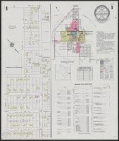
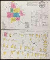
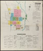
- Sanborn Map Company9
- American Geographical Society of New York7
- Rand McNally and Company7
- General Drafting Company6
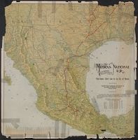
- Railroads--United States--Maps11
- Railroads--West (U.S.)--Maps9
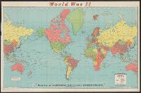
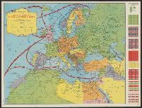
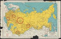
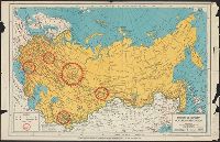
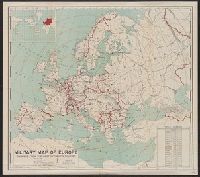
- World War, 1939-1945--Maps7
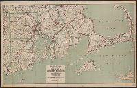
- Roads--Massachusetts--Berkshire Hills--Maps6
- Railroads--Massachusetts--Berkshire Hills--Maps5
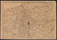
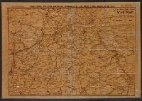
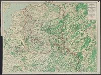
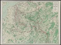
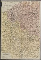
- World War, 1914-1918--Campaigns--Western Front--Maps5
- World War, 1939-1945--Campaigns--Pacific Ocean5
- Crimean War, 1853-1856--Maps4
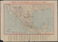
- Mexican War, 1846-1848--Maps4
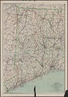
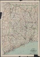
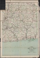
- Railroads--Connecticut--Maps4