Search
You Searched For
Search Results
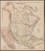
- Creator:
- Smith, J. Calvin (John Calvin)
- Published / Created:
- 1850
- Call Number:
- 71 1850A
- Container / Volume:
- BRBL_00370
- Image Count:
- 1
- Resource Type:
- Maps, Atlases & Globes
- Subject (Geographic):
- North America--Maps
- Found in:
- Beinecke Rare Book and Manuscript Library > Map of North America / by J. Calvin Smith.
- Creator:
- Smith, J. Calvin (John Calvin)
- Published / Created:
- 1851
- Call Number:
- 71 1851A
- Container / Volume:
- BRBL_00370
- Image Count:
- 1
- Resource Type:
- Maps, Atlases & Globes
- Subject (Geographic):
- North America--Maps
- Found in:
- Beinecke Rare Book and Manuscript Library > Map of North America / by J. Calvin Smith.
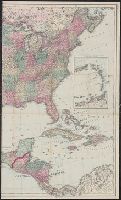
- Creator:
- Colton, G. Woolworth (George Woolworth), 1827-1901
- Published / Created:
- 1854
- Call Number:
- 71 1854B
- Container / Volume:
- BRBL_00371
- Image Count:
- 2
- Resource Type:
- Maps, Atlases & Globes
- Subject (Geographic):
- North America--Maps
- Found in:
- Beinecke Rare Book and Manuscript Library > Map of the United States of America, the British provinces, Mexico, the West Indies, and Central America, with part of New Granada and Venezuela / map drawn by Geo. W. Colton ; engraved by John M. Atwood ; border desig'd. & eng'd. by W.S. Barnard.
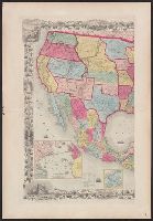
- Creator:
- Atwood, John M., b. ca. 1818
- Published / Created:
- 1851
- Call Number:
- 75 1851B
- Container / Volume:
- BRBL_00400
- Image Count:
- 1
- Resource Type:
- Maps, Atlases & Globes
- Subject (Geographic):
- North America--Maps
- Found in:
- Beinecke Rare Book and Manuscript Library > Map of the United States, Canada, Mexico, Central America, and the West India Islands : with a portion of Venezuela & New Granada; showing the routes overland and by the Isthmus to California & Oregon, also the new boundaries of California, Utah, & New Me
- Creator:
- G.W. & C.B. Colton & Co
- Published / Created:
- 1870
- Call Number:
- 80 1870
- Container / Volume:
- BRBL_00535
- Image Count:
- 1
- Resource Type:
- Maps, Atlases & Globes
- Subject (Topic):
- Indians of North America--Maps
- Found in:
- Beinecke Rare Book and Manuscript Library > Colton's map of the states and territories west of the Mississippi River to the Pacific Ocean : showing the overland routes, projected rail road lines, &c.
- Creator:
- G.W. & C.B. Colton & Co
- Published / Created:
- 1870
- Call Number:
- 80 1881
- Container / Volume:
- BRBL_00536
- Image Count:
- 1
- Resource Type:
- Maps, Atlases & Globes
- Subject (Topic):
- Indians of North America--Maps
- Found in:
- Beinecke Rare Book and Manuscript Library > Colton's map of the states and territories west of the Mississippi River to the Pacific Ocean : showing the overland routes, projected rail road lines, &c.
- Published / Created:
- 1850
- Call Number:
- 754gme 1850
- Container / Volume:
- BRBL_00419
- Image Count:
- 1
- Resource Type:
- Maps, Atlases & Globes
- Subject (Geographic):
- Great Lakes (North America)--Maps
- Found in:
- Beinecke Rare Book and Manuscript Library > [Railroads of the Lake States, from Great Lakes to Ohio River]
- Creator:
- G.W. & C.B. Colton & Co
- Published / Created:
- 1869
- Call Number:
- 75 1869A
- Container / Volume:
- BRBL_00404
- Image Count:
- 2
- Resource Type:
- Maps, Atlases & Globes
- Subject (Geographic):
- North America--Maps
- Found in:
- Beinecke Rare Book and Manuscript Library > Colton's map of the United States of America, the British provinces, Mexico and the West Indies : showing the country from the Atlantic to the Pacific Ocean.
- Creator:
- Rosa, R
- Published / Created:
- 1868, c1864.
- Call Number:
- 75 1868B
- Container / Volume:
- BRBL_00404
- Image Count:
- 2
- Resource Type:
- Maps, Atlases & Globes
- Subject (Geographic):
- North America--Maps
- Found in:
- Beinecke Rare Book and Manuscript Library > The American continent : topographical and railroad map of the United States, British possessions, West Indies, Mexico, and Central America / compiled from the best authorities by R. Rosa, late Col. 46th Regiment N.Y.V. ; Haasis & Lubrecht, publishers, Li
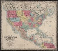
- Creator:
- Atwood, John M., b. ca. 1818
- Published / Created:
- 1849
- Call Number:
- 71 1849B
- Container / Volume:
- BRBL_00370
- Image Count:
- 1
- Resource Type:
- Maps, Atlases & Globes
- Subject (Geographic):
- North America--Maps
- Found in:
- Beinecke Rare Book and Manuscript Library > Map of the United States, the British provinces, Mexico &c.