Search
You Searched For
Search Results
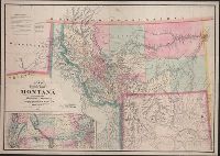
- Creator:
- De Lacy, W. W. (Walter Washington), 1819-1892
- Published / Created:
- 1870
- Call Number:
- 831 1870
- Container / Volume:
- BRBL_00579
- Image Count:
- 1
- Resource Type:
- Maps, Atlases & Globes
- Description:
- :7,200,000]. Shows area from Lake Michigan to the
- Publisher:
- Colton & Co.,
- Subject (Geographic):
- Montana--Maps, Wyoming--Maps, and Yellowstone National Park Region--Maps
- Subject (Name):
- G.W. & C.B. Colton & Co and United States. Surveyor General
- Subject (Topic):
- Indian reservations--Montana--Maps and Mines and mineral resources--Montana--Maps
- Found in:
- Beinecke Rare Book and Manuscript Library > Map of the territory of Montana with portions of the adjoining territories / compiled and drawn by W.W. De Lacy of the Surveyor General's Office, Helena, M.T. ; engraved, printed and published by G.W. & C.B. Colton & Co.