Skip to search
Skip to main content
Skip to first result
Search
You Searched For
Extent of Digitization
Completely digitized
Format
cartographic
Language
English
Publication Place
Philadelphia :
New Search
Search Results
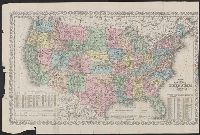
Published / Created:
1861
Call Number:
75 1861N
Container / Volume:
BRBL_00402
Image Count:
1
Resource Type:
Maps, Atlases & Globes
Description:
Borders of states tinted by hand. and Insets: Gold region of California, 1:365,000 ; District of Columbia, 1:250,000.
Publisher:
Charles Desilver,
Subject (Geographic):
United States--Maps
Found in:
Beinecke Rare Book and Manuscript Library > A new map of the United States of America / by J.H. Young.
Creator:
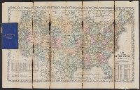
Published / Created:
[1864]
Call Number:
75 1864B
Container / Volume:
BRBL_00403
Image Count:
1
Resource Type:
Maps, Atlases & Globes
Description:
"Entered according to Act of Congress in the year 186[4?] by Charles Desilver in the clerks office of the D, Also shows proposed western railroad routes., Copy 1: Sheet measures 47 x 70 cm., Prime meridians Washington and Greenwich., and Relief shown by hachures.
Publisher:
Charles Desilver,
Subject (Geographic):
United States--Maps
Subject (Name):
Desilver, Charles, Hazzard, J. L, and Yeager, E. (Edward)
Subject (Topic):
Railroads--United States--Maps
Found in:
Beinecke Rare Book and Manuscript Library > A new map of the United States of America [cartographic material] / by J.H. Young ; engraved by J.L. Hazzard & E. Yeager.
Creator:
Published / Created:
[1864]
Call Number:
75 1864B
Container / Volume:
BRBL_00403
Image Count:
2
Resource Type:
Maps, Atlases & Globes
Description:
"Entered according to Act of Congress in the year 186[4?] by Charles Desilver in the clerks office of the District Court of the Eastern District of Pe, Includes note and population tables., Prime meridians Washington and Greenwich., and Relief shown by hachures.
Publisher:
Charles Desilver,
Subject (Geographic):
United States--Maps
Subject (Name):
Desilver, Charles, Hazzard, J. L, and Yeager, E. (Edward)
Subject (Topic):
Railroads--United States--Maps
Found in:
Beinecke Rare Book and Manuscript Library > A new map of the United States of America [cartographic material] / by J.H. Young ; engraved by J.L. Hazzard & E. Yeager.
Creator:
Published / Created:
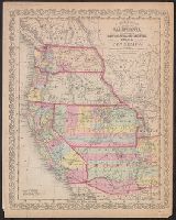
[1856]
Call Number:
80 1856C
Container / Volume:
BRBL_00534
Image Count:
1
Resource Type:
Maps, Atlases & Globes
Description:
"Entered according to act of Congress in the year 1856 by Charles Desilver in the clerks office of the district court of the eastern district of Pennsylvania."
Publisher:
Charles Desilver,
Subject (Geographic):
West (U.S.)--Maps
Found in:
Beinecke Rare Book and Manuscript Library > A new map of the state of California, the territories of Oregon, Washington, Utah & New Mexico.
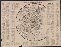
Published / Created:
1918
Call Number:
774 P53 1918
Container / Volume:
BRBL_00500
Image Count:
2
Resource Type:
Maps, Atlases & Globes
Description:
Round map with legend showing 150 mile diam. around Philadelphia. and Text detailing driving distances between cities and travel stops enroute.
Publisher:
George D. Proud ,
Subject (Geographic):
Philadelphia (Pennsylvania)--Maps and Wilmington (Delaware)--Maps
Found in:
Beinecke Rare Book and Manuscript Library > All roads lead to Hotel DuPont, Wilmington, Del.
Published / Created:
1795
Call Number:
30 1795
Container / Volume:
BRBL_00030
Image Count:
1
Resource Type:
Maps, Atlases & Globes
Description:
From Carey's American Edition of Guthrie's Geography Improved.
Publisher:
Mathew Carey,
Subject (Geographic):
Europe--Maps--Early works to 1800
Found in:
Beinecke Rare Book and Manuscript Library > An accurate map of Europe from the best authorities. Engrav'd by S. Hill, Boston.
Published / Created:
1909
Call Number:
774gmb P53 1909
Container / Volume:
BRBL_00501A
Image Count:
1
Resource Type:
Maps, Atlases & Globes
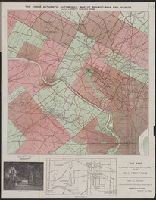
Description:
"The Firs, the location of which is shown near the centre of this map, is a rest home for a few selected nervous and convalescing patients..." and Covers attached to verso. Not digitized.
Publisher:
Abbot Howland Chase ,
Subject (Geographic):
Philadelphia (Pennsylvania)--Maps
Found in:
Beinecke Rare Book and Manuscript Library > Authentic automobile map of Philadelphia and vicinity.
Published / Created:
1876
Call Number:
774 P53 1876
Container / Volume:
BRBL_00500
Image Count:
1
Resource Type:
Maps, Atlases & Globes
Publisher:
John P. Hunt, publisher ,
Subject (Geographic):
Philadelphia (Pennsylvania)--Maps
Found in:
Beinecke Rare Book and Manuscript Library > Centennial memento map of Philadelphia.
Published / Created:
1900
Call Number:
801 C39 1900
Container / Volume:
BRBL_00541
Image Count:
1
Resource Type:
Maps, Atlases & Globes
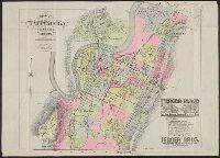
Description:
"Ferger Place. The most attractive residence park in the South" advertisement in bottom right corner.
Publisher:
G.M. Hopkins,
Subject (Geographic):
Chattanooga (Tenn.)--Maps
Found in:
Beinecke Rare Book and Manuscript Library > City of Chattanooga, Tennessee and vicinity.
Branch:v1.61.6 ,Deployed:2024-06-12T09:55:31-04:00