Skip to search
Skip to main content
Skip to first result
Search
You Searched For
Extent of Digitization
Completely digitized
Access
Public
Language
English
Publication Place
Southampton :
New Search
Search Results
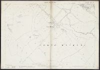
Creator:
Published / Created:
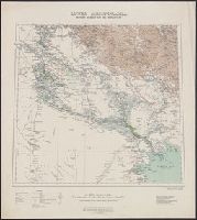
1919
Call Number:
533 1919
Container / Volume:
BRBL_00287
Image Count:
1
Resource Type:
Maps, Atlases & Globes
Alternative Title:
Geographical Section, General Staff ; 2563 and GSGS (Series) ; 2563.
Description:
"Lithographed ... 1907. Additions ... 1916. Railways revised ... 1919."
Publisher:
War Office of the Geographical Section, General Staff,
Subject (Geographic):
Iraq--Maps
Found in:
Beinecke Rare Book and Manuscript Library > Lower Mesopotamia, between Baghdad and the Persian Gulf [cartographic material].
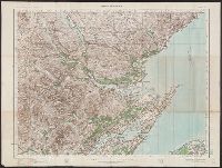
Creator:
Published / Created:
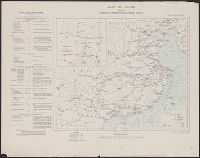
1913
Call Number:
56 1913
Container / Volume:
BRBL_00296
Image Count:
1
Resource Type:
Maps, Atlases & Globes
Alternative Title:
G.S.G.S. ; No. 2361 and GSGS (Series) ; 2361.
Description:
Includes text on railways in margin. and Insets: Sketch map of Manchuria -- Sketch map showing railway connections around Peking.
Publisher:
War Office,
Subject (Geographic):
China--Maps
Subject (Topic):
Railroads--China--Manchuria--Maps, Railroads--China--Maps, Telegraph lines--China--Manchuria--Maps, and Telegraph lines--China--Maps
Found in:
Beinecke Rare Book and Manuscript Library > Map of China [cartographic material] : shewing railways, telegraphs and treaty ports.
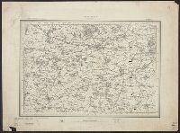
Creator:
Published / Created:
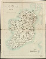
[1886-1892]
Call Number:
3218 1887
Container / Volume:
BRBL_00058
Image Count:
6
Resource Type:
Maps, Atlases & Globes
Description:
Abingdon --, Aylesbury --, Buckingham --, Henley on Thames., Maps dated between 1886 and 1892., Oxford --, Relief shown by spot heights., Sheet 219:, Sheet 236:, Sheet 237:, Sheet 238:, Sheet 253:, Sheet 254:, and Thame --
Publisher:
Ordnance Survey,
Subject (Geographic):
England--Maps
Found in:
Beinecke Rare Book and Manuscript Library > Ordnance Survey of England / engraved and published at the Ordnance Survey Office.
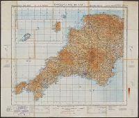
Creator:
Published / Created:
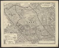
1940-
Call Number:
32 1940
Container / Volume:
BRBL_00745
Image Count:
1
Resource Type:
Maps, Atlases & Globes
Alternative Title:
England & Wales, G.S.G.S. ; no. 3957, and GSGS (Series) ; 3957.
Description:
Imperfect: all sheets but "England, south west ... war revision" wanting., Includes diagram of adjacent sheets., Relief shown by contours and spot heights. Depths shown by isolines., and Some maps identified as Military edition; some sheets identified as War revision 1940.
Publisher:
Ordnance Survey,
Subject (Geographic):
England--Maps and Wales--Maps
Found in:
Beinecke Rare Book and Manuscript Library > Ordnance Survey of Great Britain [cartographic material] : England & Wales.
Branch:v1.61.8 ,Deployed:2024-06-20T11:14:46-04:00