Search
You Searched For
Search Results
- Creator:
- Great Britain. Ordnance Survey
- Published / Created:
- 1901
- Call Number:
- 217 1899B
- Image Count:
- 6
- Resource Type:
- Maps, Atlases & Globes
- Found in:
- Beinecke Rare Book and Manuscript Library > Islands of Bermuda [cartographic material] / surveyed and contoured in 1898-9 by Lieut. A.J. Savage, R.E. ; heliozincographed and published at the Ordnance Survey Office.
- Published / Created:
- 1918
- Call Number:
- 32gma 1918
- Container / Volume:
- BRBL_00076
- Image Count:
- 2
- Resource Type:
- Maps, Atlases & Globes
- Found in:
- Beinecke Rare Book and Manuscript Library > Map showing controlled canals in England & Wales.
- Published / Created:
- 1857-1867.
- Call Number:
- 326 1867
- Container / Volume:
- BRBL_00070
- Image Count:
- 2
- Resource Type:
- Maps, Atlases & Globes
- Found in:
- Beinecke Rare Book and Manuscript Library > [Edinburgh to Kirkinthllock]
- Creator:
- Great Britain. Ordnance Survey
- Published / Created:
- 1913
- Call Number:
- 634 P37 1913
- Container / Volume:
- BRBL_00336
- Image Count:
- 2
- Resource Type:
- Maps, Atlases & Globes
- Found in:
- Beinecke Rare Book and Manuscript Library > Africa 1:63 360. Pemba Island [cartographic material] / drawn and printed at the Ordnance Survey Office, Southampton, 1913.
- Creator:
- Great Britain. War Office. General Staff. Geographical Section
- Published / Created:
- 1919
- Call Number:
- 533 1919
- Container / Volume:
- BRBL_00287
- Image Count:
- 1
- Resource Type:
- Maps, Atlases & Globes
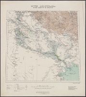
- Found in:
- Beinecke Rare Book and Manuscript Library > Lower Mesopotamia, between Baghdad and the Persian Gulf [cartographic material].
- Creator:
- Great Britain. Ordnance Survey
- Published / Created:
- 1913
- Call Number:
- 56 1913
- Container / Volume:
- BRBL_00296
- Image Count:
- 1
- Resource Type:
- Maps, Atlases & Globes
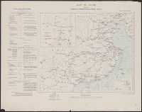
- Found in:
- Beinecke Rare Book and Manuscript Library > Map of China [cartographic material] : shewing railways, telegraphs and treaty ports.
- Creator:
- Great Britain. Ordnance Survey
- Published / Created:
- 1940-
- Call Number:
- 32 1940
- Container / Volume:
- BRBL_00745
- Image Count:
- 1
- Resource Type:
- Maps, Atlases & Globes
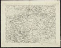
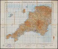
- Found in:
- Beinecke Rare Book and Manuscript Library > Ordnance Survey of Great Britain [cartographic material] : England & Wales.
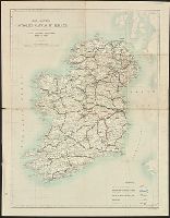
- Creator:
- Ordnance Survey of Ireland
- Published / Created:
- 1913
- Call Number:
- 327 K55 1913
- Container / Volume:
- BRBL_00073
- Image Count:
- 1
- Resource Type:
- Maps, Atlases & Globes
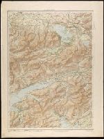
- Found in:
- Beinecke Rare Book and Manuscript Library > Killarney district.
- Creator:
- Great Britain. War Office. General Staff. Geographical Section
- Published / Created:
- 1901
- Call Number:
- 6415 1902
- Container / Volume:
- BRBL_00338
- Image Count:
- 1
- Resource Type:
- Maps, Atlases & Globes
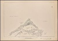
- Found in:
- Beinecke Rare Book and Manuscript Library > Africa 1:250 000. British Central Africa. Blantyre. Sheet III-P [cartographic material].
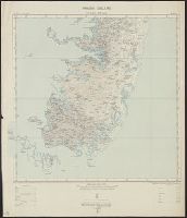
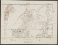
- Published / Created:
- 1900
- Call Number:
- 32 Ox1 1900
- Container / Volume:
- BRBL_00053
- Image Count:
- 6
- Resource Type:
- Maps, Atlases & Globes
- Found in:
- Beinecke Rare Book and Manuscript Library > Oxfordshire Second Edition 1899.