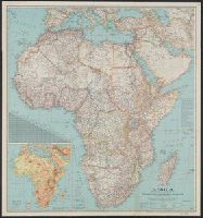
National Geographic Society (U.S.). Cartographic Section
Published / Created:
c1943.
Call Number:
60 1943
Container / Volume:
BRBL_00329
Image Count:
1
Resource Type:
Maps, Atlases & Globes
Description:
"International boundaries as of Sept. 1, 1939.", Includes a chart of airline distances., Inset: Relief. Scale 562 miles to 1 inch., Issued with the National Geographic magazine, v. 83, no. 2, February 1943., and Relief shown by hachures and spot heights.
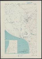
Great Britain. Royal Air Force. Central Interpretation Unit
Published / Created:
1943
Call Number:
475 1944
Container / Volume:
BRBL_00262
Image Count:
1
Resource Type:
Maps, Atlases & Globes
Alternative Title:
Geographical Section, General Staff ; no. 4415, GSGS (Series) ; 4415., and Vlonë (Valona) city plan
Description:
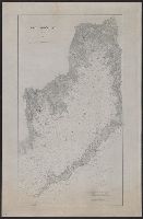
"1-44.", "1943.", "First G.S.G.S. edition, 1943.", "Ground information supplied by I.S.T.D.", "War Office 1943.", Inset: [Krionero]., Military grid., and Relief shown by contours, land form drawings, and one spot height.
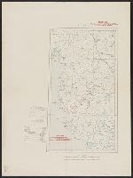
"War Office, November 1918." and Red overprint: At head of map, "Map No.1, Portion of sheets Sofiya & Athenai. International Map 1:1,000,000"; on body of map, reference chart showing land claims corresponding to lines on map; at bottom left margin, "Geographi
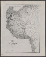
United States. Office of Strategic Services. Research and Analysis Branch
Published / Created:
1943
Call Number:
652gm 1943
Container / Volume:
BRBL_00343
Image Count:
1
Resource Type:
Maps, Atlases & Globes
Description:
"Map no. 1114 1 M, "This map includes only the main roads compiled from 1940 official road maps (1:1,000,000) and special reports in the Office of Strategic Service s.", and Shows road conditions, railroad gauges, and year-round and seasonally navigable rivers.
Publisher:
OSS,
Subject (Topic):
Railroads--Congo (Democratic Republic)--Maps, Roads--Congo (Democratic Republic)--Maps, and Waterways--Congo (Democratic Republic)--Maps