Skip to search
Skip to main content
Skip to first result
Search
You Searched For
Extent of Digitization
Completely digitized
Language
English
Subject (Name)
United States. Army Map Service
Publication Place
Washington, D.C. :
New Search
Search Results
Creator:
Published / Created:
1944
Call Number:
50 1945I
Container / Volume:
BRBL_00273
Image Count:
2
Resource Type:
Maps, Atlases & Globes
Description:
Cloth map., Includes text., Relief shown by gradient tints, contours, and spot heights., and Text in English and 6 other languages.
Publisher:
Amy Map Service,
Subject (Geographic):
Kunming Region (China)--Maps
Subject (Name):
United States. Aeronautical Chart Service, United States. Army Air Forces, and United States. Army Map Service
Subject (Topic):
Military maps
Found in:
Beinecke Rare Book and Manuscript Library > AAF cloth chart. No. 133, Kun-Ming, Yunnan, China to Chabua, Assam, India Forces / prepared under the direction of the Commanding General, Army Air Forces, for the Aeronautical Chart Service, by the U.S. Coast and Geodetic Survey, Washington, D.C., Januar
Creator:
Published / Created:
1943
Call Number:
475 1944
Container / Volume:
BRBL_00262
Image Count:
1
Resource Type:
Maps, Atlases & Globes
Alternative Title:
Geographical Section, General Staff ; no. 4415, GSGS (Series) ; 4415., and Vlonë (Valona) city plan
Description:
"1-44.", "1943.", "First G.S.G.S. edition, 1943.", "Ground information supplied by I.S.T.D.", "War Office 1943.", Inset: [Krionero]., Military grid., and Relief shown by contours, land form drawings, and one spot height.
Publisher:
Army Map Service, U.S. Army,
Subject (Geographic):
Vlorë (Albania)--Maps
Subject (Name):
United States. Army Map Service
Found in:
Beinecke Rare Book and Manuscript Library > Albania 1:10,000. Vlonë (Valona) city plan / compiled and drawn by C.I.U. 1943 [cartographic material].
Creator:
Published / Created:
1943
Call Number:
409 C17 1943
Container / Volume:
BRBL_00240
Image Count:
1
Resource Type:
Maps, Atlases & Globes
Alternative Title:
Geographical Section, General Staff ; no. 4378, GSGS (Series) ; 4378., and Sardinia
Description:
"8-43.", "Form lines from air photographs at intervals of 20 metres.", "From C.I.U. plan of March 1943.", and Military grid.
Publisher:
Army Map Service, U.S. Army,
Subject (Geographic):
Carbonia (Italy)--Maps
Subject (Name):
United States. Army Map Service
Found in:
Beinecke Rare Book and Manuscript Library > Carbonia [cartographic material] / photolithographed by War Office, 1943.
Creator:
Published / Created:
1942
Call Number:
67 F31 1942
Container / Volume:
BRBL_00348
Image Count:
1
Resource Type:
Maps, Atlases & Globes
Alternative Title:
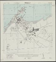
GSGS (Series) ; 4241., Morocco 1:10,000, and Morocco 10 000.
Description:
"Reference" is index to points of interest. Important streets are named., Map included on index map to G.S.G.S. 4241., and Military grid.
Publisher:
Army Map Service, U.S. Army,
Subject (Geographic):
Mohammedia (Morocco)--Maps
Subject (Name):
Great Britain. War Office. General Staff. Geographical Section and United States. Army Map Service
Found in:
Beinecke Rare Book and Manuscript Library > Fedhala, city plan / prepared under the direction of the chief of engineers, U.S. Army.
Creator:
Published / Created:
1945
Call Number:
5681 1945
Container / Volume:
BRBL_00300
Image Count:
2
Resource Type:
Maps, Atlases & Globes
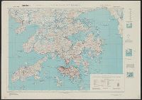
Alternative Title:
GSGS (Series), Hong Kong and Lema Islands, Hong Kong and Lema Islands., and Hong Kong and New territory.
Description:
"7-45.", "8-45.", "Reproduced under the direction of the Chief of Engineers by the Army Map Service (AM), U.S. Army ... 1945, from Kodalines of GSGS Second Edition 1945...", and North sheet. Hong Kong and New territory -- South sheet. Hong Kong and Lema Islands.
Publisher:
Army Map Service, U.S. Army,
Subject (Geographic):
Hong Kong (China)--Maps and New Territories (China)--Maps
Subject (Name):
United States. Army Map Service
Found in:
Beinecke Rare Book and Manuscript Library > Hong Kong and New territory.
Creator:
Published / Created:
1943
Call Number:
40 V65 1943
Image Count:
1
Resource Type:
Maps, Atlases & Globes
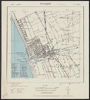
Alternative Title:
GSGS (Series) ; 4380., Provisional G.S.G.S. ; 4380, and Viareggio city plan
Description:
"4-43.", "Copied from Italy 1:25,000 map 104-1 S.E.", "First edition 1943.", Important streets and buildings are named., Includes index to some buildings., and Military grid (brown).
Publisher:
Army Map Service, U.S. Army,
Subject (Geographic):
Viareggio (Italy)--Maps
Subject (Name):
United States. Army Map Service
Found in:
Beinecke Rare Book and Manuscript Library > Italy 1:10,000. Viareggio city plan / prepared under the direction of the Chief of Engineers, U.S. Army, Washington, D.C [cartographic material].
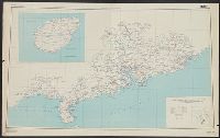
Creator:
Published / Created:
1945
Call Number:
5634gm 1945
Container / Volume:
BRBL_00299
Image Count:
1
Resource Type:
Maps, Atlases & Globes
Alternative Title:
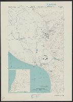
China Road Map 1:1,000,000, Series (Standard map series designation system) ; 301., and Series ; 301
Description:
"2-45.", "Compiled in 1944, from large-scale Chinese maps. Road classification based on Intelligence Reports, 1944.", "Kwangtung, China" in bottom right corner., Includes inset map indexed to political divisions and glossary., and Relief shown by altitude tints,
Publisher:
Army Map Service,
Subject (Geographic):
Guangdong Sheng (China)--Maps
Subject (Name):
United States. Army Map Service
Found in:
Beinecke Rare Book and Manuscript Library > Kwangtung Province / prepared under the direction of the Chief of Engineers, by the Army Map Service.
Branch:v1.61.6 ,Deployed:2024-06-12T09:55:33-04:00