Search
You Searched For
Search Results
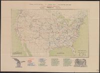
- Creator:
- National Highways Association
- Published / Created:
- 1913
- Call Number:
- 75gmb 1915B
- Container / Volume:
- BRBL_00411
- Image Count:
- 1
- Resource Type:
- Maps, Atlases & Globes
- Subject (Topic):
- Highway planning--United States--Maps
- Found in:
- Beinecke Rare Book and Manuscript Library > National highways system -- fifty thousand miles -- main trunk and link lines proposed by the National Highways Association / National Highways Association.
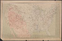
- Published / Created:
- 1909
- Call Number:
- 75cfe 1909
- Container / Volume:
- BRBL_00409
- Image Count:
- 1
- Resource Type:
- Maps, Atlases & Globes
- Subject (Geographic):
- United States--Maps
- Found in:
- Beinecke Rare Book and Manuscript Library > United States, Contour Map.
- Published / Created:
- 1919
- Call Number:
- 75gmb AL14 1919
- Container / Volume:
- BRBL_00411
- Image Count:
- 1
- Resource Type:
- Maps, Atlases & Globes
- Subject (Topic):
- Roads--United States--Maps
- Found in:
- Beinecke Rare Book and Manuscript Library > Map of the Albert Pike Highway : showing every city, town, village and hamlet throughout its entire length / proposed by the Albert Pike Highway Association.
- Published / Created:
- 1915
- Call Number:
- 75gmb 1915
- Container / Volume:
- BRBL_00411
- Image Count:
- 1
- Resource Type:
- Maps, Atlases & Globes
- Subject (Topic):
- Roads--United States--Maps
- Found in:
- Beinecke Rare Book and Manuscript Library > National highways map of the United States showing one hundred thousand miles of national highways proposed by the National Highways Association / John C. Mulford, chief cartographer ; published under direction of the National Highways Association.
- Creator:
- United States. Army Map Service
- Published / Created:
- 1945
- Call Number:
- 5634gm 1945
- Container / Volume:
- BRBL_00299
- Image Count:
- 1
- Resource Type:
- Maps, Atlases & Globes
- Subject (Name):
- United States. Army Map Service
- Found in:
- Beinecke Rare Book and Manuscript Library > Kwangtung Province / prepared under the direction of the Chief of Engineers, by the Army Map Service.
- Creator:
- Great Britain. Royal Air Force. Central Interpretation Unit
- Published / Created:
- 1943
- Call Number:
- 475 1944
- Container / Volume:
- BRBL_00262
- Image Count:
- 1
- Resource Type:
- Maps, Atlases & Globes
- Subject (Name):
- United States. Army Map Service
- Found in:
- Beinecke Rare Book and Manuscript Library > Albania 1:10,000. Vlonë (Valona) city plan / compiled and drawn by C.I.U. 1943 [cartographic material].
- Creator:
- Great Britain. War Office. General Staff. Geographical Section
- Published / Created:
- 1943
- Call Number:
- 409 C17 1943
- Container / Volume:
- BRBL_00240
- Image Count:
- 1
- Resource Type:
- Maps, Atlases & Globes
- Subject (Name):
- United States. Army Map Service
- Found in:
- Beinecke Rare Book and Manuscript Library > Carbonia [cartographic material] / photolithographed by War Office, 1943.
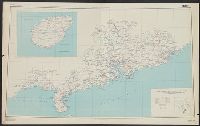
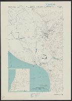
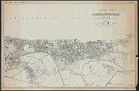
- Creator:
- Egypt. Maṣlaḥat al-Misāḥah
- Published / Created:
- 1942
- Call Number:
- 61 1943B
- Container / Volume:
- BRBL_00331
- Image Count:
- 1
- Resource Type:
- Maps, Atlases & Globes
- Subject (Name):
- United States. Army Map Service
- Found in:
- Beinecke Rare Book and Manuscript Library > General map of Alexandria.
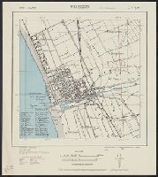
- Creator:
- United States. Army. Corps of Engineers
- Published / Created:
- 1943
- Call Number:
- 40 V65 1943
- Image Count:
- 1
- Resource Type:
- Maps, Atlases & Globes
- Subject (Name):
- United States. Army Map Service
- Found in:
- Beinecke Rare Book and Manuscript Library > Italy 1:10,000. Viareggio city plan / prepared under the direction of the Chief of Engineers, U.S. Army, Washington, D.C [cartographic material].
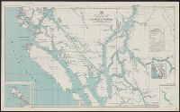
- Creator:
- British Columbia. Dept. of Lands
- Published / Created:
- 1943
- Call Number:
- 739 G86 1943
- Container / Volume:
- BRBL_00389
- Image Count:
- 1
- Resource Type:
- Maps, Atlases & Globes
- Subject (Name):
- United States. Army Map Service
- Found in:
- Beinecke Rare Book and Manuscript Library > Preliminary map, Grenville Channel, 1924 / British Columbia Department of Lands.