Copper River and adjacent territory, Geological Survey (U.S.). Report, Public resolution ; no. 25, 55th Congress, 3d session., and Its Report, Public resolution ; no. 25, 55th Congress, 3d session
Description:
Contour interval approximately 250 feet., Imperfect: Upper portion of map wanting. Dimensions 35 x 50 cm., and Relief shown by form lines, hachures, and spot heights.
Publisher:
The Survey,
Subject (Geographic):
Alaska--Maps, Chugach Mountains (Alaska)--Maps, and Copper River Region (Alaska)--Maps
Subject (Name):
Abercrombie, W. R.--(William Ralph),--b. 1857, Lowe, P. G, Mahlo, Emil, and Schrader, Frank C. (Frank Charles), 1860-1944
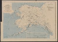
"Index map showing areas covered by topographic maps, August 1913"., "Recent survey publications" text on verso., Includes inset of the Aleutian Islands and chart of "Maps of Alaska for sale by U.S. Geological Survey.", and Relief shown by hachures and spot heights.
"The base is a copy of a part of chart T of the U.S. Coast and Geodetic Survey, edition of June 1897.", Insets: Trails from tide water to the headwaters of the Yukon River, Alaska--The Klondike gold region, Canada., Published January, 1898., and Relief shown by hachures and spot heights.
Subject (Geographic):
Alaska--Maps
Subject (Name):
U.S. Coast and Geodetic Survey
Subject (Topic):
Coal mines and mining--Alaska--Maps, Gold mines and mining--Alaska--Maps, Mail steamers--Alaska--Maps, and Trails--Alaska--Maps