Skip to search
Skip to main content
Skip to first result
Search
You Searched For
Date
-
"North America--Maps"
Repository
Beinecke Rare Book and Manuscript Library
Language
English
Creator
Jefferys, Thomas, d. 1771
New Search
Search Results
Creator:
Published / Created:
1758
Call Number:
2003 Folio 85
Image Count:
1
Alternative Title:
Middle British colonies
Description:
LC Maps of North America , 1750-1789,
Publisher:
Sold by T. Jefferys
Subject (Geographic):
North America -- Maps -- Early works to
Subject (Topic):
British -- America -- Maps -- Early works to 1800
Found in:
Beinecke Rare Book and Manuscript Library > A general map of the middle British colonies in America: viz. Virginia, Maryland, Delaware, Pensilvania, New-Jersey, New-York, Connecticut and Rhode-Island : of Aquanishuonigy the country of the confederate Indians comprehending Aquanishuonigy proper, the
Creator:
Published / Created:
1762]
Call Number:
71 1762
Container / Volume:
BRBL_00364
Image Count:
3
Resource Type:
Maps, Atlases & Globes
Description:
"Longitude w. from London.", "Plate III. The dominions ceded by France & Spain to Great Britain are colored with a feint red.", Accompanied by 2 leaves intended to be hinged to the margin as overlays to North America: Plate I. Clai, and Relief shown pictorially.
Subject (Geographic):
North America --Maps --Early works to
Subject (Topic):
World maps--Early works to 1800
Found in:
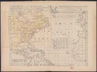
Beinecke Rare Book and Manuscript Library > Chart of the Atlantic Ocean, with the British, French, & Spanish settlements in North America, and the West Indies, as also on the coast of Africa / by Thos. Jefferys, geographer to His Majesty.
Creator:
Published / Created:
May 1755.
Call Number:
755 1755B
Container / Volume:
BRBL_00427
Image Count:
1
Resource Type:
Maps, Atlases & Globes
Description:
"Published according to Act by Tho[ma]s Jefferys, geographer to His Royal Highness, the Prince of Wales, near Charing Cross.", Covers the east coast from Labrador to northern Florida, and the interior as far west as the Mississippi Valley., and Includes decorat
Publisher:
Thos. Jefferys,
Subject (Geographic):
North America --Maps --Early works to
Subject (Name):
Anville, Jean Baptiste Bourguignon d', 1697-1782
Found in:
Beinecke Rare Book and Manuscript Library > North America from the French of Mr. D'Anville : improved with the back settlements of Virginia and course of Ohio : illustrated with geographical and historical remarks.
Branch:v1.61.6 ,Deployed:2024-06-12T09:55:31-04:00