Search
You Searched For
Search Results
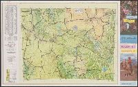
- Creator:
- Rand McNally and Company
- Published / Created:
- 1955]
- Call Number:
- 833gmb 1955
- Container / Volume:
- BRBL_00586
- Image Count:
- 2
- Resource Type:
- Maps, Atlases & Globes
- Found in:
- Beinecke Rare Book and Manuscript Library > Wyoming highway map, 1955 / Wyoming State Highway Commission ; prepared by Rand McNally & Co.
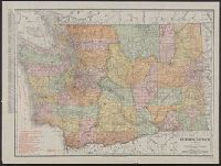
- Creator:
- Rand McNally and Company
- Published / Created:
- [1903?]
- Call Number:
- 847gme 1903
- Container / Volume:
- BRBL_00629
- Image Count:
- 2
- Resource Type:
- Maps, Atlases & Globes
- Found in:
- Beinecke Rare Book and Manuscript Library > Wonderful Washington : "the Evergreen State" / Rand McNally & Co., printers & engravers.
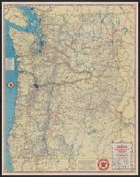
- Creator:
- Rand McNally and Company
- Published / Created:
- 1911
- Call Number:
- 847 1911
- Container / Volume:
- BRBL_00625
- Image Count:
- 1
- Resource Type:
- Maps, Atlases & Globes
- Found in:
- Beinecke Rare Book and Manuscript Library > Washington.
- Creator:
- Rand McNally and Company
- Published / Created:
- [1933]
- Call Number:
- 80gmb 1933A
- Container / Volume:
- BRBL_00538
- Image Count:
- 2
- Resource Type:
- Maps, Atlases & Globes
- Found in:
- Beinecke Rare Book and Manuscript Library > Washington, Oregon.
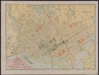
- Creator:
- Rand McNally and Company
- Published / Created:
- c1902.
- Call Number:
- 779 W27 1904A
- Container / Volume:
- BRBL_00505A
- Image Count:
- 1
- Resource Type:
- Maps, Atlases & Globes
- Found in:
- Beinecke Rare Book and Manuscript Library > Washington, D.C.
- Creator:
- Rand McNally and Company
- Published / Created:
- c1898.
- Call Number:
- 779 W27 1889
- Container / Volume:
- BRBL_00505A
- Image Count:
- 1
- Resource Type:
- Maps, Atlases & Globes
- Found in:
- Beinecke Rare Book and Manuscript Library > Washington, D.C.
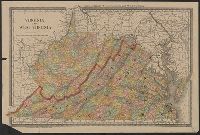
- Creator:
- Rand McNally and Company
- Published / Created:
- c1886.
- Call Number:
- 783 1886
- Container / Volume:
- BRBL_00509
- Image Count:
- 1
- Resource Type:
- Maps, Atlases & Globes
- Found in:
- Beinecke Rare Book and Manuscript Library > Virginia and West Virginia.
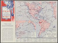
- Creator:
- Rand McNally and Company
Richfield Oil Corporation
United States. President (1817-1825 : Monroe). Monroe doctrine. Selections
- Published / Created:
- 1941?]
- Call Number:
- 11hd 1941S
- Image Count:
- 2
- Resource Type:
- Maps, Atlases & Globes
- Found in:
- Beinecke Rare Book and Manuscript Library > U.S. defense map and Western Hemisphere strategic bases [cartographic material] : army camps, forts, flying fields, air bases, naval bases, mileage distances and flying times between important points, Panama Canal defenses, U.S. Navy patrol areas, propose
- Creator:
- Rand McNally and Company
- Published / Created:
- c1917.
- Call Number:
- 11hc 1917H
- Container / Volume:
- BRBL_00010D
- Image Count:
- 1
- Resource Type:
- Maps, Atlases & Globes
- Found in:
- Beinecke Rare Book and Manuscript Library > The battle ground of liberty, where Americans are fighting for humanity and lasting peace: A large scale detail map of the western battle front in Europe showing in minute detail the geographic features of the region; cities, towns, villages, rivers, and
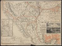
- Creator:
- Rand McNally and Company
- Published / Created:
- [1886?]
- Call Number:
- 80gme 1885A
- Container / Volume:
- BRBL_00539
- Image Count:
- 2
- Resource Type:
- Maps, Atlases & Globes
- Found in:
- Beinecke Rare Book and Manuscript Library > The Santa Fé route and connections : Missouri River to Pacific Coast & Mexico.