Search
You Searched For
Search Results
- Creator:
- United States Coast Survey
- Published / Created:
- 1869
- Call Number:
- 848 1869
- Container / Volume:
- BRBL_00630
- Image Count:
- 1
- Resource Type:
- Maps, Atlases & Globes
- Found in:
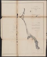
- Beinecke Rare Book and Manuscript Library > Alaska and adjoining territory / drawn by H. Lindenkohl.
- Creator:
- Peirce, Benjamin, 1809-1880
United States Coast Survey
- Published / Created:
- 1869
- Call Number:
- 846cea Or4 1869
- Container / Volume:
- BRBL_00623
- Image Count:
- 1
- Resource Type:
- Maps, Atlases & Globes
- Found in:
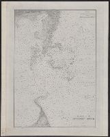
- Beinecke Rare Book and Manuscript Library > Cape Orford and reef, Oregon / U.S. Coast Survey, Benjamin Peirce, superintendant ; triangulation by A.W. Chase, sub-assistant in 1869 ; topography by A.M. Harrison, assist. and A.W. Chase, sub-assistant in 1851 & '69 ; hydrography by Commander J. Alden U
- Creator:
- United States Coast Survey
- Published / Created:
- 1883
- Call Number:
- 7645cea 1883
- Container / Volume:
- BRBL_00463
- Image Count:
- 1
- Resource Type:
- Maps, Atlases & Globes
- Found in:
- Beinecke Rare Book and Manuscript Library > Entrance to Nantucket Sound / United States Coast Survey.
- Creator:
- United States Coast Survey
- Published / Created:
- 1863
- Call Number:
- 75cea 1863
- Container / Volume:
- BRBL_00409
- Image Count:
- 2
- Resource Type:
- Maps, Atlases & Globes
- Found in:
- Beinecke Rare Book and Manuscript Library > Gulf coast of the United States, Key West to Rio Grande.
- Creator:
- United States Coast Survey
- Published / Created:
- 1883
- Call Number:
- 761CEB 1883
- Container / Volume:
- BRBL_00449
- Image Count:
- 1
- Resource Type:
- Maps, Atlases & Globes
- Found in:
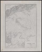
- Beinecke Rare Book and Manuscript Library > Gulf of Maine, current stations / United States Coast Survey.
- Creator:
- United States Coast Survey
- Published / Created:
- [ca. 1864]
- Call Number:
- 783hc 1864A
- Container / Volume:
- BRBL_00512
- Image Count:
- 1
- Resource Type:
- Maps, Atlases & Globes
- Found in:
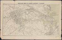
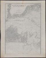
- Beinecke Rare Book and Manuscript Library > Middle Virginia and North Carolina / compiled at the U.S. Coast Survey Office, drawn by H. Lindenkohl ; Chas. G. Krebs, lith.
- Creator:
- United States Coast Survey
- Published / Created:
- [1865?]
- Call Number:
- 783 1865C
- Container / Volume:
- BRBL_00509
- Image Count:
- 1
- Resource Type:
- Maps, Atlases & Globes
- Found in:
- Beinecke Rare Book and Manuscript Library > Military map of south-eastern Virginia / compiled at the U.S. Coast Survey Office ; drawn by A. Lindenkohl.
- Creator:
- United States Coast Survey
- Published / Created:
- 1865
- Call Number:
- 807 1865
- Container / Volume:
- BRBL_00550
- Image Count:
- 6
- Resource Type:
- Maps, Atlases & Globes
- Found in:
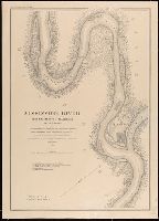
- Beinecke Rare Book and Manuscript Library > Mississippi River from Cairo Ill. to St. Marys Mo. in VI sheets. Reconnaissance for the use of the Mississippi Squadron under command of Acting Rear Admiral S.P. Lee, U.S.N. By the party of F.H. Gerdes, Assistant, assigned by A.D. Bache, Supdt. United Sta
- Creator:
- United States Coast Survey
- Published / Created:
- 1883
- Call Number:
- 7645cea 1883A
- Container / Volume:
- BRBL_00463
- Image Count:
- 1
- Resource Type:
- Maps, Atlases & Globes
- Found in:
- Beinecke Rare Book and Manuscript Library > Nantucket Sound Western Part / United States Coast Survey.
- Creator:
- United States Coast Survey
- Published / Created:
- 1883
- Call Number:
- 7645cea 1883B
- Container / Volume:
- BRBL_00463
- Image Count:
- 1
- Resource Type:
- Maps, Atlases & Globes
- Found in:
- Beinecke Rare Book and Manuscript Library > Nantucket and Vineyard Sounds : from Cross Rip to Nobska Point / United States Coast Survey.