Skip to search
Skip to main content
Skip to first result
Search
You Searched For
Extent of Digitization
Completely digitized
Language
English
Creator
United States. General Land Office
Search Results
Creator:
Published / Created:
1866
Call Number:
815fcm 1866
Container / Volume:
BRBL_00561
Image Count:
1
Resource Type:
Maps, Atlases & Globes
Description:
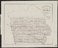
"No. 7."
Publisher:
U.S. General Land Office,
Subject (Geographic):
Iowa--Maps
Subject (Topic):
Mines and mineral resources--Iowa--Maps and Railroads--Iowa--Maps
Found in:
Beinecke Rare Book and Manuscript Library > Diagram of the public surveys in Iowa.
Creator:
Published / Created:
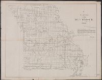
1850?]
Call Number:
816 1850
Container / Volume:
BRBL_00561
Image Count:
1
Resource Type:
Maps, Atlases & Globes
Alternative Title:
Senate executive document (United States. Congress. Senate) ; 31st Congress, 2nd session, no. 2.
Description:
"M. Lewis Clark, Surveyor General."
Publisher:
s.n.,
Subject (Geographic):
Missouri--Maps
Subject (Name):
Clark, M. Lewis
Found in:
Beinecke Rare Book and Manuscript Library > Diagram of the state of Missouri : accompanying report of 20th Novr. 1850 / Office of the Surveyor General for Illinois and Missouri, St. Louis, 20th Novr. 1850.
Creator:
Published / Created:
1879
Call Number:
826 1879
Container / Volume:
BRBL_00577
Image Count:
1
Resource Type:
Maps, Atlases & Globes
Description:
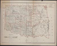
Includes dates of treaties with Indian nations.
Publisher:
General Land Office,
Subject (Geographic):
Indian Territory--Maps
Subject (Name):
Roeser, C. (Charles)
Found in:
Beinecke Rare Book and Manuscript Library > Indian Territory, 1879 / compiled from the official records of the General Land Office and other sources by C. Roeser, Principal Draughtsman.
Creator:
Published / Created:
1866
Call Number:
844fcm 1866
Container / Volume:
BRBL_00615
Image Count:
1
Resource Type:
Maps, Atlases & Globes
Alternative Title:
House executive document (United States. Congress. House) ; 38th Congress, 1st session, no. 1.
Description:
"House R. Ex. Doc. No. 1, 38th Cong., 1st Sess."
Publisher:
Department of the Interior, General Land Office,
Subject (Geographic):
California--Maps and California--Surveys--Maps
Subject (Name):
Bien, Julius, 1826-1909
Subject (Topic):
Land grants--California--Maps and Mines and mineral resources--California--Maps
Found in:
Beinecke Rare Book and Manuscript Library > Map of public surveys in California & Nevada : to accompany report of Commissioner of the General Land Office, 1866.
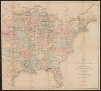
Creator:
Published / Created:
1864
Call Number:
75fcm 1864
Container / Volume:
BRBL_00410
Image Count:
1
Resource Type:
Maps, Atlases & Globes
Description:
Relief shown by hachures.
Publisher:
D. McClelland,
Subject (Geographic):
Canada--Boundaries--United States--Maps
Subject (Name):
Franks, Theodore, Hawes, James W. (James William), 1844-1918, and McClelland, D
Subject (Topic):
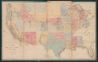
Public lands --United States and Public lands--United States--Maps.
Found in:
Beinecke Rare Book and Manuscript Library > Map of the Public Land States and territories [cartographic material] / constructed from the Public Surveys and other official sources in the General Land Office ; drawn by J.H. Hawes, principal draughtsman [and] T. Franks, assistant.
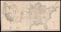
Creator:
Published / Created:
1866
Call Number:
75 1866
Container / Volume:
BRBL_00403
Image Count:
1
Resource Type:
Maps, Atlases & Globes
Description:
Also shows mine and mineral resources and Surveyor General and Land Office locations.
Publisher:
General Land Office,
Subject (Geographic):
United States--Surveys--Maps
Subject (Name):
Bien, Julius, 1826-1909 and Franks, Theodore
Subject (Topic):
Mines and mineral resources--United States--Maps
Found in:
Beinecke Rare Book and Manuscript Library > Map of the United States and territories : shewing the extent of public surveys and other details / constructed from the plats and official sources of the General Land Office, under the direction of Hon. Jos. S. Wilson, Commissioner, by Theodore Franks, d
Creator:
Published / Created:
[1868]
Call Number:
75 1868C
Container / Volume:
BRBL_00404
Image Count:
2
Resource Type:
Maps, Atlases & Globes
Description:
Also shows mine and mineral resources and Surveyor General and Land Office locations.
Publisher:
The Office,
Subject (Geographic):
United States--Surveys--Maps
Subject (Name):
Gorlinski, Joseph
Subject (Topic):
Mines and mineral resources--United States--Maps
Found in:
Beinecke Rare Book and Manuscript Library > Map of the United States and territories, showing the extent of public surveys and other details / constructed from the plats and official sources of the General Land Office, under the direction of the Hon. Jos. S. Wilson, commissioner, by Joseph Gorlinsk
Creator:
Published / Created:
1876
Call Number:
75 1876
Container / Volume:
BRBL_00405
Image Count:
6
Resource Type:
Maps, Atlases & Globes
Description:
Insets: Alaska and Aleutian Islands.
Publisher:
Photolith. and printed by J. Bien,
Subject (Name):
Bien, Julius, 1826-1909 and Roeser, C. (Charles)
Subject (Topic):
Canals--United States--Maps, Indian reservations--United States--Maps, Military reservations--United States--Maps, Railroad land grants--United States--Maps, Railroads--United States--Maps, and Surveying-
Found in:
Beinecke Rare Book and Manuscript Library > Map of the United States and territories, showing the extent of public surveys, Indian and military reservations, land grant R.R., rail roads, canals, and other details / compiled from the official surveys of the General Land Office, and other authentic s
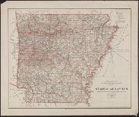
Creator:
Published / Created:
1901
Call Number:
818 1901
Container / Volume:
BRBL_00565
Image Count:
1
Resource Type:
Maps, Atlases & Globes
Description:
Prime meridians: Greenwich and Washington.
Publisher:
The Office,
Subject (Geographic):
Arkansas--Maps
Subject (Name):
Olney, E. B
Subject (Topic):
Railroads--Arkansas--Maps
Found in:
Beinecke Rare Book and Manuscript Library > Map of the state of Arkansas / compiled from the official records of the General Land Office and other sources under the direction of Harry King ; compiled and drawn by E.B. Olney ; lettered by Wm. Bauman, Jr.
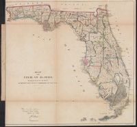
Creator:
Published / Created:
1866
Call Number:
792 1866
Container / Volume:
BRBL_00518
Image Count:
1
Resource Type:
Maps, Atlases & Globes
Description:
Imperfect.
Publisher:
General Land Office,
Subject (Geographic):
Florida--Maps and Florida--Maps--1866
Found in:
Beinecke Rare Book and Manuscript Library > Map of the state of Florida : showing the progress of the surveys accompanying [the] annual report of [the] Commissioner.
Branch:v1.68.6 ,Deployed:2025-07-02T08:09:34-04:00