Search
You Searched For
Search Results
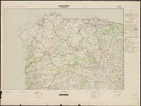
- Creator:
- Germany. Heer. Generalstab. Chef des Kriegskarten- und Vermessungswesens
- Published / Created:
- 1943-1944.
- Call Number:
- 39 1944A
- Container / Volume:
- BRBL_00188
- Image Count:
- 7
- Resource Type:
- Maps, Atlases & Globes
- Found in:
- Beinecke Rare Book and Manuscript Library > Spanien und Portugal 1:500 000 (Strassenkarte).
- Creator:
- Salway, Joseph.
- Published / Created:
- 1899-1903.
- Call Number:
- LTS 32 L84 1811/1903
- Image Count:
- 30
- Resource Type:
- Maps, Atlases & Globes
- Found in:
- Beinecke Rare Book and Manuscript Library > Plan of the road from Hyde Park Corner to Counter's Bridge / made for the Kensington Turnpike Trustees by their surveyor Joseph Salway in the year 1811.
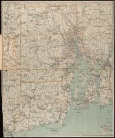
- Creator:
- C.S. Hammond & Company
- Published / Created:
- [1917].
- Call Number:
- 76gmb 1917
- Container / Volume:
- BRBL_00446
- Image Count:
- 1
- Resource Type:
- Maps, Atlases & Globes
- Found in:
- Beinecke Rare Book and Manuscript Library > Hammond's new road map of Rhode Island and southeastern Massachusetts.
- Published / Created:
- 1908
- Call Number:
- 763gmb 1908
- Container / Volume:
- BRBL_00452
- Image Count:
- 1
- Resource Type:
- Maps, Atlases & Globes
- Found in:
- Beinecke Rare Book and Manuscript Library > Automobile map of Vermont, South.
- Creator:
- Walker Lith. & Pub. Co
- Published / Created:
- 1912
- Call Number:
- 763 1912
- Container / Volume:
- BRBL_00452
- Image Count:
- 1
- Resource Type:
- Maps, Atlases & Globes
- Found in:
- Beinecke Rare Book and Manuscript Library > Road map of Vermont showing the selected highways, state roads, which are being improved and maintained under state supervision in accordance with Chapters 172 and 176 P.S. / Issued in connection with the Biennial Report of the State Highway Commissioner
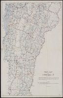
- Published / Created:
- 1897
- Call Number:
- 812gmb M648 1897
- Container / Volume:
- BRBL_00556
- Image Count:
- 1
- Resource Type:
- Maps, Atlases & Globes
- Found in:
- Beinecke Rare Book and Manuscript Library > Wright's map of Milwaukee.
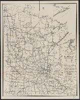
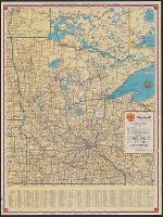
- Creator:
- Minnesota. Dept. of Highways
- Published / Created:
- [1946]
- Call Number:
- 814gmb 1946
- Container / Volume:
- BRBL_00559
- Image Count:
- 1
- Resource Type:
- Maps, Atlases & Globes
- Found in:
- Beinecke Rare Book and Manuscript Library > 1946 condition map of Minnesota trunk highways : showing national and state markings.
- Creator:
- American Automobile Association
- Published / Created:
- [1928?]
- Call Number:
- 815gmb 1928
- Container / Volume:
- BRBL_00561
- Image Count:
- 1
- Resource Type:
- Maps, Atlases & Globes
- Found in:
- Beinecke Rare Book and Manuscript Library > Official AAA road map, Iowa.
- Creator:
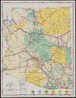
- Arizona. State Highway Commission
- Published / Created:
- 1946]
- Call Number:
- 842gmb 1946
- Container / Volume:
- BRBL_00600
- Image Count:
- 1
- Resource Type:
- Maps, Atlases & Globes
- Found in:
- Beinecke Rare Book and Manuscript Library > Road map of Arizona, 1946 / Arizona State Highway Commission.
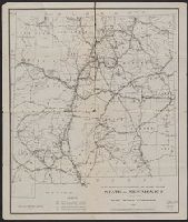
- Creator:
- New Mexico State Highway Commission
- Published / Created:
- 1918
- Call Number:
- 841gmb 1918
- Container / Volume:
- BRBL_00597
- Image Count:
- 1
- Resource Type:
- Maps, Atlases & Globes
- Found in:
- Beinecke Rare Book and Manuscript Library > Map showing condition of state roads, state of New Mexico / issued by State Highway Commission.
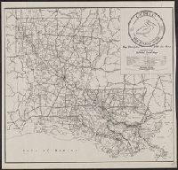
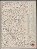
- Creator:
- Louisiana. Dept. of Highways
- Published / Created:
- 1945
- Call Number:
- 795gmb 1945
- Container / Volume:
- BRBL_00523
- Image Count:
- 1
- Resource Type:
- Maps, Atlases & Globes
- Found in:
- Beinecke Rare Book and Manuscript Library > 1945 road map : [Louisiana] / State of Louisiana, Department of Highways.
- Creator:
- National Highways Association
- Published / Created:
- 1916
- Call Number:
- 834gmb 1916
- Container / Volume:
- BRBL_00591
- Image Count:
- 1
- Resource Type:
- Maps, Atlases & Globes
- Found in:
- Beinecke Rare Book and Manuscript Library > National Highways preliminary map of the state of Colorado : showing thirty-five hundred miles of national highways / proposed by the National Highways Association.
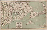
- Published / Created:
- 1917
- Call Number:
- 764gmb 1917
- Container / Volume:
- BRBL_00462
- Image Count:
- 1
- Resource Type:
- Maps, Atlases & Globes
- Found in:
- Beinecke Rare Book and Manuscript Library > Hammonds New road map of eastern Massachusetts and southern New Hampshire.
- Creator:
- C.S. Hammond & Company
- Published / Created:
- [1917].
- Call Number:
- 76gmb 1917
- Container / Volume:
- BRBL_00446
- Image Count:
- 1
- Resource Type:
- Maps, Atlases & Globes
- Found in:
- Beinecke Rare Book and Manuscript Library > Hammond's new road map of Rhode Island and southeastern Massachusetts.
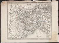
- Call Number:
- 401 1849B
- Container / Volume:
- BRBL_00233
- Image Count:
- 1
- Resource Type:
- Maps, Atlases & Globes
- Found in:
- Beinecke Rare Book and Manuscript Library > Carta postale del Piemonte, Savoja e Genovesato.
- Call Number:
- 403 1825
- Container / Volume:
- BRBL_00234
- Image Count:
- 1
- Resource Type:
- Maps, Atlases & Globes
- Found in:
- Beinecke Rare Book and Manuscript Library > Strassen Karte des Lombardisch-Venezianischen Koenigreiches. Gouvernement Venedig / C. Stein sc.
- Call Number:
- 402gm 1840
- Container / Volume:
- BRBL_00233A
- Image Count:
- 1
- Resource Type:
- Maps, Atlases & Globes
- Found in:
- Beinecke Rare Book and Manuscript Library > Strassen-Karte des Lombardisch-Venezianischen Koenigreiches. Gouvernement Lombardei.
- Published / Created:
- 1919
- Call Number:
- 811gmb 1919
- Container / Volume:
- BRBL_00554
- Image Count:
- 1
- Resource Type:
- Maps, Atlases & Globes
- Found in:
- Beinecke Rare Book and Manuscript Library > State of Michigan, Upper Peninsula as the trunk line system looked July 1, 1919 / prepared by State Highway Dept.
- Published / Created:
- 1919
- Call Number:
- 811gmb 1919A
- Container / Volume:
- BRBL_00554
- Image Count:
- 1
- Resource Type:
- Maps, Atlases & Globes
- Found in:
- Beinecke Rare Book and Manuscript Library > State of Michigan, Lower Peninsula as the trunk line system looked July 1, 1919 / prepared by State Highway Dept.
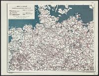
- Creator:
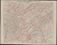
- United States. Office of Strategic Services. Research and Analysis Branch
- Published / Created:
- 1944
- Call Number:
- 36gmb 1944
- Container / Volume:
- BRBL_00130
- Image Count:
- 4
- Resource Type:
- Maps, Atlases & Globes
- Found in:
- Beinecke Rare Book and Manuscript Library > Germany, roads.
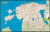
- Creator:
- Jān̦a sēta (Firm)
- Published / Created:
- 1993
- Call Number:
- 357gmb 1993
- Container / Volume:
- BRBL_00116
- Image Count:
- 2
- Resource Type:
- Maps, Atlases & Globes
- Found in:
- Beinecke Rare Book and Manuscript Library > Eesti 1:600 000 = Igaunija = Estonia : paved roads in Estonia = Estland = Estija / Jān̦a sēta ; karte sastādīta un izdota apgādā "Jān̦a sēta".
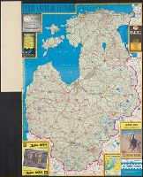
- Creator:
- Jān̦a sēta (Firm)
- Published / Created:
- 1993
- Call Number:
- 3565gmb 1993
- Container / Volume:
- BRBL_00116
- Image Count:
- 2
- Resource Type:
- Maps, Atlases & Globes
- Found in:
- Beinecke Rare Book and Manuscript Library > Baltijas valstis 1:700 000 : Latvija = Baltic States : paved roads in Baltics / Jān̦a sēta.
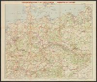
- Published / Created:
- [1940?]
- Call Number:
- 36gmb 1940
- Container / Volume:
- BRBL_00130
- Image Count:
- 2
- Resource Type:
- Maps, Atlases & Globes
- Found in:
- Beinecke Rare Book and Manuscript Library > Continental-Autokarte Deutschland : in einem Blatt.
- Creator:
- Cartes Taride (Firm)
- Published / Created:
- [1918?]
- Call Number:
- 3615 1918F
- Image Count:
- 2
- Resource Type:
- Maps, Atlases & Globes
- Found in:
- Beinecke Rare Book and Manuscript Library > Les Bords du Rhin [cartographic material] : (de Cologne à Mayence) / A. Taride, Éditeur.
- Creator:
- Cartes Taride (Firm)
- Published / Created:
- [1918?]
- Call Number:
- 3615 1918A
- Container / Volume:
- BRBL_00136
- Image Count:
- 2
- Resource Type:
- Maps, Atlases & Globes
- Found in:
- Beinecke Rare Book and Manuscript Library > Les Bords du Rhin [cartographic material] : (de Mayence à Stasbourg) / édité par les Cartes Taride.
- Creator:
- United States. Army Map Service
- Published / Created:
- 1945
- Call Number:
- 56 Sh18 1945A
- Container / Volume:
- BRBL_00297
- Image Count:
- 2
- Resource Type:
- Maps, Atlases & Globes
- Found in:
- Beinecke Rare Book and Manuscript Library > Plan of Shanghai.
- Creator:
- Taride, A
- Published / Created:
- [ca. 1920]
- Call Number:
- 685 1920
- Container / Volume:
- BRBL_00351
- Image Count:
- 2
- Resource Type:
- Maps, Atlases & Globes
- Found in:
- Beinecke Rare Book and Manuscript Library > Nouvelle Carte de la Tunisie.
- Creator:
- Automobile Association (Auckland)
- Published / Created:
- [1944?]
- Call Number:
- 267gmb B34 1947
- Container / Volume:
- BRBL_00023A
- Image Count:
- 2
- Resource Type:
- Maps, Atlases & Globes
- Found in:
- Beinecke Rare Book and Manuscript Library > The Bay of Islands, "The Northland", Auckland, New Zealand : its holiday attractions and historic associations, with access routes from the main arterial highways to Russell, Paihia, Waitangi and Kerikeri.
- Creator:
- New Mexico State Highway Commission
- Published / Created:
- 1918
- Call Number:
- 841gmb 1918
- Container / Volume:
- BRBL_00597
- Image Count:
- 1
- Resource Type:
- Maps, Atlases & Globes
- Found in:
- Beinecke Rare Book and Manuscript Library > Map showing condition of state roads, state of New Mexico / issued by State Highway Commission.
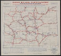
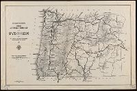
- Creator:
- Oregon State Highway Commission
- Published / Created:
- 1923
- Call Number:
- 846gmb 1923
- Container / Volume:
- BRBL_00624
- Image Count:
- 1
- Resource Type:
- Maps, Atlases & Globes
- Found in:
- Beinecke Rare Book and Manuscript Library > State Highway Department's official automobile road map of the state of Oregon showing all through trunk highways and main traveled roads, with mileages / Oregon State Highway Commission.
- Creator:
- Cartes Taride (Firm)
- Published / Created:
- [1909?]
- Call Number:
- 3615 1918D
- Container / Volume:
- BRBL_00136
- Image Count:
- 1
- Resource Type:
- Maps, Atlases & Globes
- Found in:
- Beinecke Rare Book and Manuscript Library > Les Bords du Rhin [cartographic material] : (de Cologne à Mayence) / A. Taride, Éditeur.
- Published / Created:
- [1910]
- Call Number:
- 36gmb 1910A
- Container / Volume:
- BRBL_00130
- Image Count:
- 1
- Resource Type:
- Maps, Atlases & Globes
- Found in:
- Beinecke Rare Book and Manuscript Library > Carte routière de l'Allemagne du Sud, Autriche, Tyrol (Grands itinéraires).
- Creator:
- Cartes Taride (Firm)
- Published / Created:
- [1909?]
- Call Number:
- 3615 1918E
- Container / Volume:
- BRBL_00136
- Image Count:
- 1
- Resource Type:
- Maps, Atlases & Globes
- Found in:
- Beinecke Rare Book and Manuscript Library > Les Bords du Rhin [cartographic material] : (de Cologne à Mayence) / A. Taride, Éditeur.
- Published / Created:
- [1925?]
- Call Number:
- 36gmb 1910
- Container / Volume:
- BRBL_00130
- Image Count:
- 1
- Resource Type:
- Maps, Atlases & Globes
- Found in:
- Beinecke Rare Book and Manuscript Library > Continental-Strassenkarte für Rad- und Kraftfahrer : Karte 35 Chemnitz.
- Creator:
- Cartes Taride (Firm)
- Published / Created:
- [1915?]
- Call Number:
- 3615 1918C
- Container / Volume:
- BRBL_00136
- Image Count:
- 1
- Resource Type:
- Maps, Atlases & Globes
- Found in:
- Beinecke Rare Book and Manuscript Library > Les Bords du Rhin [cartographic material] : (de Cologne à Mayence) / A. Taride, Éditeur.
- Creator:
- Cartes Taride (Firm)
- Published / Created:
- [1911?]
- Call Number:
- 3615 1918B
- Container / Volume:
- BRBL_00136
- Image Count:
- 1
- Resource Type:
- Maps, Atlases & Globes
- Found in:
- Beinecke Rare Book and Manuscript Library > Les Bords du Rhin [cartographic material] : (de Mayence à Stasbourg) / édité par les Cartes Taride.
- Creator:
- Cartes Taride (Firm)
- Published / Created:
- [191-]
- Call Number:
- 38 1915C
- Container / Volume:
- BRBL_00155
- Image Count:
- 1
- Resource Type:
- Maps, Atlases & Globes
- Found in:
- Beinecke Rare Book and Manuscript Library > Nouvelle carte de France, Belgique, Bords du Rhin, Suisse, etc. / A. Taride, éditeur.
- Creator:
- Taride, A
- Published / Created:
- [1907]
- Call Number:
- 38gmb P21 1907A
- Container / Volume:
- BRBL_00171
- Image Count:
- 1
- Resource Type:
- Maps, Atlases & Globes
- Found in:
- Beinecke Rare Book and Manuscript Library > Carte cycliste et automobile des environs de Paris : à l'échelle du 1/100.000e, sud-est / A. Taride, editeur.
- Creator:
- Taride, A
- Published / Created:
- [1907]
- Call Number:
- 38gmb P21 1907B
- Container / Volume:
- BRBL_00171
- Image Count:
- 1
- Resource Type:
- Maps, Atlases & Globes
- Found in:
- Beinecke Rare Book and Manuscript Library > Carte cycliste et automobile des environs de Paris : à l'échelle du 1/100.000e, sud-ouest / A. Taride, editeur.
- Creator:
- Taride, A
- Published / Created:
- 1909
- Call Number:
- 38gmb 1909
- Container / Volume:
- BRBL_00170
- Image Count:
- 1
- Resource Type:
- Maps, Atlases & Globes
- Found in:
- Beinecke Rare Book and Manuscript Library > Carte routière pour cyclistes & automobiles de l'est de la France : Franche-Comté - Jura - Suisse Française / A. Taride, Éditeur ; P. Bineteau del't.
- Creator:
- Oregon. State Highway Dept
- Published / Created:
- 1919
- Call Number:
- 846gmb 1919
- Container / Volume:
- BRBL_00624
- Image Count:
- 1
- Resource Type:
- Maps, Atlases & Globes
- Found in:
- Beinecke Rare Book and Manuscript Library > State Highway Department's official automobile road map of the state of Oregon showing all through trunk highways and main traveled roads, with mileages / Oregon State Highway Department.
- Creator:
- Oregon. State Highway Dept
- Published / Created:
- 1921
- Call Number:
- 846gmb 1921A
- Container / Volume:
- BRBL_00624
- Image Count:
- 1
- Resource Type:
- Maps, Atlases & Globes
- Found in:
- Beinecke Rare Book and Manuscript Library > State Highway Department's official automobile road map of the state of Oregon showing all through trunk highways and main traveled roads, with mileages / State Highway Department.
- Creator:
- Geo. H. Walker & Co
- Published / Created:
- ©1898 & 1905.
- Call Number:
- 765gmb 1905
- Container / Volume:
- BRBL_00464
- Image Count:
- 1
- Resource Type:
- Maps, Atlases & Globes
- Found in:
- Beinecke Rare Book and Manuscript Library > Road map of Rhode Island [cartographic material] : showing all the roads and points of interest, with the cycling roads distinguished by red lines.
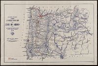
- Creator:
- Oregon State Highway Commission
- Published / Created:
- 1921
- Call Number:
- 846gmb 1921
- Container / Volume:
- BRBL_00624
- Image Count:
- 1
- Resource Type:
- Maps, Atlases & Globes
- Found in:
- Beinecke Rare Book and Manuscript Library > Map of state of Oregon showing main traveled roads / Oregon State Highway Commission.
- Call Number:
- 401 1830
- Container / Volume:
- BRBL_00233
- Image Count:
- 2
- Resource Type:
- Maps, Atlases & Globes
- Found in:
- Beinecke Rare Book and Manuscript Library > Carte routière des différents passages des Alpes et du Piémont = Carta postale dei diversi passaggi delle Alpi e del Piemonte.
- Creator:
- Gross, Herman W
- Published / Created:
- [19--?]
- Call Number:
- 816gmb Sa24 1946
- Container / Volume:
- BRBL_00564
- Image Count:
- 2
- Resource Type:
- Maps, Atlases & Globes
- Found in:
- Beinecke Rare Book and Manuscript Library > Map of Greater St. Louis and suburbs / H.W. Gross.
- Creator:
- H.M. Gousha Company
- Published / Created:
- 1940
- Call Number:
- 814gmb 1940
- Container / Volume:
- BRBL_00559
- Image Count:
- 2
- Resource Type:
- Maps, Atlases & Globes
- Found in:
- Beinecke Rare Book and Manuscript Library > Official road map of Minnesota / [prepared for] Shell.
- Creator:
- General Drafting Company, inc
- Published / Created:
- [1931]
- Call Number:
- 818gmb 1931
- Container / Volume:
- BRBL_00565
- Image Count:
- 2
- Resource Type:
- Maps, Atlases & Globes
- Found in:
- Beinecke Rare Book and Manuscript Library > Magnolia road map of Arkansas and Louisiana / General Drafting Co. Inc.
- Creator:
- Rand McNally and Company
- Published / Created:
- [1932?]
- Call Number:
- 816gmb 1932
- Container / Volume:
- BRBL_00564
- Image Count:
- 2
- Resource Type:
- Maps, Atlases & Globes
- Found in:
- Beinecke Rare Book and Manuscript Library > Texaco road map, Missouri.
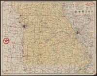
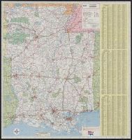
- Creator:
- Rand McNally and Company
- Published / Created:
- 1973
- Call Number:
- 818 1973
- Container / Volume:
- BRBL_00565
- Image Count:
- 2
- Resource Type:
- Maps, Atlases & Globes
- Found in:
- Beinecke Rare Book and Manuscript Library > Rand McNally map of Arkansas, Louisiana, Mississippi.