Skip to search
Skip to main content
Skip to first result
Search
You Searched For
Extent of Digitization
Completely digitized
Format
cartographic
Language
English
New Search
Search Results
Creator:
Published / Created:
1891]
Call Number:
38 P21 1898
Container / Volume:
BRBL_00164
Image Count:
1
Resource Type:
Maps, Atlases & Globes
Description:
1. Amsterdam -- 1A. Antwerp or Anvers -- 2. Berlin -- 3. Brussels -- 4. Map of Cologne -- 5. Constantinople -- 6. Plan of Dresden -- 7. Florence -- 8. Frankfort on Main -- 9. Geneva -- 10. Genoa -- 11. Ghent or Gand -- 12. Hague's Gravenhage, La Haye -- 1
Publisher:
Bradshaw,
Subject (Geographic):
Europe--Maps
Subject (Topic):
Cities and towns--Europe--Maps
Found in:
Beinecke Rare Book and Manuscript Library > [Plans of the major cities and towns of continental Europe] [cartographic material].
Creator:
Published / Created:
1891]
Call Number:
38 M35 1898
Container / Volume:
BRBL_00158
Image Count:
1
Resource Type:
Maps, Atlases & Globes
Description:
1. Amsterdam -- 1A. Antwerp or Anvers -- 2. Berlin -- 3. Brussels -- 4. Map of Cologne -- 5. Constantinople -- 6. Plan of Dresden -- 7. Florence -- 8. Frankfort on Main -- 9. Geneva -- 10. Genoa -- 11. Ghent or Gand -- 12. Hague's Gravenhage, La Haye -- 1
Publisher:
Bradshaw,
Subject (Geographic):
Europe--Maps
Subject (Topic):
Cities and towns--Europe--Maps
Found in:
Beinecke Rare Book and Manuscript Library > [Plans of the major cities and towns of continental Europe] [cartographic material].
Published / Created:
ca. 1794
Call Number:
2017 812
Image Count:
62
Abstract:
The military tract comprised 28 townships (1,680,000 acres) in New York State that was granted to soldiers of the War of American Revolution. This land included all or parts of present day Cayuga, Cortland, Onondaga, Oswego, Schuyler, Seneca, Tompkins, and Wayne counties. The names of the towns were given classical Greek and Roman names along a few honoring English authors.
Description:
Heavily annotated throughout by Elkanah Watson., Maps most likely date from 1793 to 1794., and Title devised by cataloger.
Subject (Geographic):
New York (State)--Maps--Early works to 1800. and New York (State)--Surveys--Early works to 1800.
Subject (Name):
Watson, Elkanah,--1758-1842--Ms. notes.
Subject (Topic):
Land subdivision--New York (State)--Early works to 1800.
Found in:
Beinecke Rare Book and Manuscript Library > [Plat book showing numbered lots of 27 townships of the (new) military tract in New York State].
Published / Created:
1915]
Call Number:
811gfc P831 1915
Container / Volume:
BRBL_00554
Image Count:
1
Resource Type:
Maps, Atlases & Globes
Publisher:
s.n.,
Subject (Geographic):
Michigan--Maps
Found in:
Beinecke Rare Book and Manuscript Library > [Portage Lake Mines].
Creator:
Published / Created:
between 1783 and 1799?]
Call Number:
71 1785C
Container / Volume:
BRBL_00366
Image Count:
2
Resource Type:
Maps, Atlases & Globes
Alternative Title:
Map of North America and the West Indies
Description:
An issue of the Pownall map of North America and the West Indies; appears similar to the 1783 and 1794 editions., Insets: A particular map of Baffin and Hudson's Bay -- The passage by land to California., Prime meridians: London and Ferro., and Relief shown pict
Publisher:
s.n.,
Subject (Geographic):
North America--Maps--Early works to 1800
Subject (Topic):
British--America--Maps--Early works to 1800
Found in:
Beinecke Rare Book and Manuscript Library > [Pownall's map of North America and the West Indies].
Published / Created:
1780?]
Call Number:
786 C38 1780
Container / Volume:
BRBL_00516
Image Count:
1
Resource Type:
Maps, Atlases & Globes
Publisher:
[W. Faden?,
Subject (Geographic):
Charleston (S.C.)--Maps--Early works to 1800
Found in:
Beinecke Rare Book and Manuscript Library > [Proof copy of a map of Charleston, South Carolina].
Published / Created:
1850
Call Number:
754gme 1850
Container / Volume:
BRBL_00419
Image Count:
1
Resource Type:
Maps, Atlases & Globes
Description:
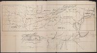
Shows geographic area bounded by the Mississippi, Missouri, Ohio, Allegheny and Cumberland Rivers and the Great Lakes.
Publisher:
Sarony and Major, lith.,
Subject (Geographic):
Great Lakes (North America)--Maps
Found in:
Beinecke Rare Book and Manuscript Library > [Railroads of the Lake States, from Great Lakes to Ohio River]
Published / Created:
186-]
Call Number:
754gme 1860B
Container / Volume:
BRBL_00420
Image Count:
1
Resource Type:
Maps, Atlases & Globes
Description:
Includes ancillary maps detailed connecting lines of Illinois Central RR, railways and ferries centering aorund Rock Island, Illinois, and profile map of bridge crossing Mississipp River between Davenport, Iowa and Rock Island, Illinois. and Shows railroad li
Publisher:
s.n.,
Subject (Geographic):
United States--Maps
Subject (Topic):
Railroads--United States--Maps
Found in:
Beinecke Rare Book and Manuscript Library > [Railroads of the Northern United States from Iowa to Boston, Massachusetts]
Published / Created:
1908
Call Number:
319gm 1908
Container / Volume:
BRBL_00042
Image Count:
1
Resource Type:
Maps, Atlases & Globes
Description:
"March '09".
Publisher:
American Express Co.,
Subject (Geographic):
British Isles--Maps
Found in:
Beinecke Rare Book and Manuscript Library > [Railway, steamship and highway routes in the British Isles].
Creator:
Published / Created:
1921
Call Number:
2651 R197 1921
Container / Volume:
BRBL_00023
Image Count:
1
Resource Type:
Maps, Atlases & Globes
Description:
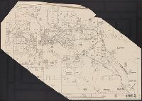
"420 B".
Publisher:
The Department,
Subject (Geographic):
Ravensthorpe (W.A.)--Maps
Found in:
Beinecke Rare Book and Manuscript Library > [Ravensthorpe].
Branch:v1.61.6 ,Deployed:2024-06-12T09:55:36-04:00