Search
You Searched For
Search Results
- Creator:
- Sanborn Map Company
- Published / Created:
- June, 1919.
- Call Number:
- 776 D75 1919
- Container / Volume:
- BRBL_00502
- Image Count:
- 15
- Resource Type:
- Maps, Atlases & Globes
- Found in:
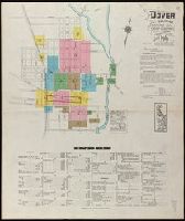
- Beinecke Rare Book and Manuscript Library > Dover, Kent County, Delaware.
- Creator:
- Sanborn Map Company
- Published / Created:
- Nov. 1919.
- Call Number:
- 776 M59 1919
- Container / Volume:
- BRBL_00502
- Image Count:
- 15
- Resource Type:
- Maps, Atlases & Globes
- Found in:
- Beinecke Rare Book and Manuscript Library > Milford, Kent and Sussex Co., Delaware.
- Creator:
- Pissina, Giuseppe Antonio
- Published / Created:
- [1786]
- Call Number:
- BrSides Double Folio 2018 103
- Image Count:
- 11
- Resource Type:
- Maps, Atlases & Globes
- Found in:
- Beinecke Rare Book and Manuscript Library > Tipo dimostrativo delle acque, cavi, edificij, e fondi cadenti rapporto alle loro colature sotto il contratto di transazione sequito fra l'illmo. Sig. Marchese Cusani Livellario delle acque di Lunico, ed uniti della misericordia unitamente a ssri. Carpane
- Creator:
- Sanborn Map Company
- Published / Created:
- August, 1915.
- Call Number:
- 766 Sm95 1915
- Container / Volume:
- BRBL_00502
- Image Count:
- 7
- Resource Type:
- Maps, Atlases & Globes
- Found in:
- Beinecke Rare Book and Manuscript Library > Smyrna, Kent County, Delaware.
- Creator:
- Sanborn Map Company
- Published / Created:
- October, 1919.
- Call Number:
- 776 G295 1919
- Container / Volume:
- BRBL_00502
- Image Count:
- 7
- Resource Type:
- Maps, Atlases & Globes
- Found in:
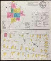
- Beinecke Rare Book and Manuscript Library > Georgetown, Sussex County, Delaware.
- Creator:
- Sanborn Map Company
- Published / Created:
- 1920
- Call Number:
- 783 P83 1920
- Container / Volume:
- BRBL_00510
- Image Count:
- 30
- Resource Type:
- Maps, Atlases & Globes
- Found in:
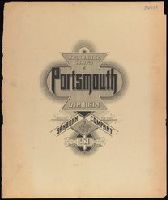
- Beinecke Rare Book and Manuscript Library > Insurance maps of Portsmouth, Virginia.
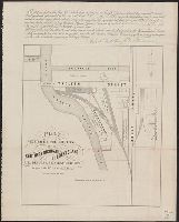
- Published / Created:
- 1860
- Call Number:
- 806gme C43 1860
- Container / Volume:
- BRBL_00549
- Image Count:
- 1
- Resource Type:
- Maps, Atlases & Globes
- Found in:
- Beinecke Rare Book and Manuscript Library > Plat exhibiting the location of the Southern Michigan and Rock Island R.R. depots and adjacent grounds. / lithographed by Ed Mendel.
- Creator:
- Howard, Joseph
- Published / Created:
- 1824
- Call Number:
- 804 D376 1824
- Image Count:
- 1
- Resource Type:
- Maps, Atlases & Globes
- Found in:
- Beinecke Rare Book and Manuscript Library > A map of the district of Delaware in Ohio / by Joseph Howard ; H. Platt sc.
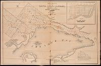
- Creator:
- Savigny, Hugh P
- Published / Created:
- [1870]
- Call Number:
- BrSides Double Folio 2018 101
- Image Count:
- 1
- Resource Type:
- Maps, Atlases & Globes
- Found in:
- Beinecke Rare Book and Manuscript Library > Plan of survey of the silver mining district, Thunder Bay, Lake Superior, Canada / compiled by Hugh P. Savigny, P.L.S.
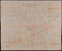
- Creator:
- Johnson, Thomas H., Cartographer
- Published / Created:
- 2nd Feby. 1877.
- Call Number:
- BrSides Double Folio 2018 97
- Image Count:
- 1
- Resource Type:
- Maps, Atlases & Globes
- Found in:
- Beinecke Rare Book and Manuscript Library > McIntyre / Thos. H. Johnson, Assistant Commissioner.