Search
You Searched For
Search Results
- Creator:
- Cooke & LeCount
- Published / Created:
- 1852
- Call Number:
- Zc72 852co
- Image Count:
- 3
- Resource Type:
- Maps, Atlases & Globes
- Found in:
- Beinecke Rare Book and Manuscript Library > A complete map of San Francisco : compiled from the original map from the latest surveys, containing all the latest extensions and improvements, new streets, alleys, places, wharfs, etc
- Creator:
- Adlum, John, 1759-1836
- Published / Created:
- [1791]
- Call Number:
- BrSides Folio 2009 68
- Image Count:
- 2
- Resource Type:
- Maps, Atlases & Globes
- Found in:
- Beinecke Rare Book and Manuscript Library > A map exhibiting a general view of the roads and inland navigation of Pennsylvania, and part of the adjacent states : respectfully inscribed to Thomas Mifflin, governor, and the General Assembly of the commonwealth of Pennsylvania / by John Adlum, and John Wallis
- Creator:
- Berry, William, fl. 1669-1708, creator
Sanson, Nicolas, 1600-1667
- Published / Created:
- 1680
- Call Number:
- 1973 Folio 10
- Image Count:
- 1
- Resource Type:
- Maps, Atlases & Globes
- Found in:
- Beinecke Rare Book and Manuscript Library > A mapp of all the world in two hemispheres in which are exactly described all the parts of the earth and seas
- Creator:
- Moll, Herman, d. 1732
- Published / Created:
- [after 1754]
- Call Number:
- 11 1728
- Container / Volume:
- BRBL_00680
- Image Count:
- 1
- Resource Type:
- Maps, Atlases & Globes
- Found in:
- Beinecke Rare Book and Manuscript Library > A new and correct map of the world laid down according to the newest discoveries and from the most exact observations / [cartographic material] / by Herman Moll, geographer.
- Published / Created:
- 1737
- Call Number:
- 11 1737
- Container / Volume:
- BRBL_00681
- Image Count:
- 1
- Resource Type:
- Maps, Atlases & Globes
- Found in:
- Beinecke Rare Book and Manuscript Library > A new and correct map of ye world [cartographic material] : laid down according to ye latest and best observations : to which is added several curious discourses on the tides, trade winds & monsoons ...
- Creator:
- Browne, Christopher, fl. 1684-1712, creator
- Published / Created:
- [169-?]
- Call Number:
- 1973 Folio 10
- Image Count:
- 1
- Resource Type:
- Maps, Atlases & Globes
- Found in:
- Beinecke Rare Book and Manuscript Library > A new chart of the sea coasts of France: together with the English Chanell describing ye severall harbors, sands, rocks, and anchoridges, etc. on the said coasts
- Creator:
- Browne, Christopher, fl. 1684-1712, bookseller
Morden, Robert, d. 1703, creator
Petty, William, Sir, 1623-1687
- Published / Created:
- [ca. 1700]
- Call Number:
- 1973 Folio 10
- Image Count:
- 1
- Resource Type:
- Maps, Atlases & Globes
- Found in:
- Beinecke Rare Book and Manuscript Library > A new map of Ireland
- Creator:
- Browne, Christopher, fl. 1684-1712, bookseller
Morden, Robert, d. 1703, creator
- Published / Created:
- [168-?]
- Call Number:
- 1973 Folio 10
- Image Count:
- 1
- Resource Type:
- Maps, Atlases & Globes
- Found in:
- Beinecke Rare Book and Manuscript Library > A new map of the estates of Savoy [and] Piedmont: with the countries adjacent
- Creator:
- Senex, John, d. 1740
- Published / Created:
- 1720]
- Call Number:
- 11 1720B
- Container / Volume:
- BRBL_00680
- Image Count:
- 1
- Resource Type:
- Maps, Atlases & Globes
- Found in:
- Beinecke Rare Book and Manuscript Library > A new map of the world [cartographic material] : from the latest observations / revised by I. Senex.
- Creator:
- Berry, William, fl. 1669-1708, creator
- Published / Created:
- [1689?]
- Call Number:
- 1973 Folio 10
- Image Count:
- 1
- Resource Type:
- Maps, Atlases & Globes
- Found in:
- Beinecke Rare Book and Manuscript Library > A new mapp of the kingdome of England and Wales: containing all the cities, market towns, with the roades from town to town, and the numbers of reputed miles between them, are given by inspection without scale or compass
- Creator:
- Browne, Christopher, fl. 1684-1712, bookseller
Morden, Robert, d. 1703, creator
Nicholls, Sutton, engraver
- Published / Created:
- [ca. 1700]
- Call Number:
- 1973 Folio 10
- Image Count:
- 1
- Resource Type:
- Maps, Atlases & Globes
- Found in:
- Beinecke Rare Book and Manuscript Library > A new mapp of the sea coasts of England, Scotland, and Ireland: with the adjacent coasts of France, Holand, Denmark & Norway, shewing the scituation and distance of the several ports, harbors, havens, creeks, sands &c
- Creator:
- Browne, Christopher, fl. 1684-1712
Fer, Nicolas de, 1646-1720, creator
- Published / Created:
- [1704?]
- Call Number:
- 1973 Folio 10
- Image Count:
- 1
- Resource Type:
- Maps, Atlases & Globes
- Found in:
- Beinecke Rare Book and Manuscript Library > A new mapp of the theatre of the warr in Flanders and on the Rhine: together with the Dutch and French frontiers and their conquests in the same
- Creator:
- Lotter, Tobias Conrad, 1717-1777
Seutter, Matthaeus, 1678-1756
- Published / Created:
- ca. 1750
- Call Number:
- 1973 Folio 30
- Collection Title:
- [Atlas factice of 32 maps and 1 distance table, produced by the Homann Erben firm]
- Image Count:
- 2
- Found in:
- Beinecke Rare Book and Manuscript Library > Accuratissima delineatio geographica dioecesis ac praefecturae Dresdensis [cartographic material] : cujus urbes, oppida et pagi, loca item contermina, et quae in singulis notatu digniora videntur exactiori methodo geometrice designata sistuntur / per Matt
- Creator:
- Blaeu, Joan, 1596-1673, creator
- Published / Created:
- [ca. 1690]
- Call Number:
- 1973 Folio 10
- Image Count:
- 1
- Resource Type:
- Maps, Atlases & Globes
- Found in:
- Beinecke Rare Book and Manuscript Library > Aethiopia inferior vel exterior: partes magis Septentrionales, quae hic desiderantur, vide in tabula Aethiopiae superioris
- Creator:
- Blaeu, Joan, 1596-1673, creator
- Published / Created:
- [ca. 1690?]
- Call Number:
- 1973 Folio 10
- Image Count:
- 1
- Resource Type:
- Maps, Atlases & Globes
- Found in:
- Beinecke Rare Book and Manuscript Library > Aethiopia superior vel interior, vulgo Abissinorum sive Presbiteri Ioannis imperium
- Creator:
- Berry, William, fl. 1669-1708, creator
Sanson, Nicolas, 1600-1667
- Published / Created:
- 1680
- Call Number:
- 1973 Folio 10
- Image Count:
- 1
- Resource Type:
- Maps, Atlases & Globes
- Found in:
- Beinecke Rare Book and Manuscript Library > Africa : divided according to the extent of its principall parts in which are distinguished one from the other the empires, monarchies, kingdoms, states and peoples, which at this time inhabite Africa
- Creator:
- Hase, Johann Matthias, 1684-1742
Homann Erben (Firm)
- Published / Created:
- [ca. 1737]
- Call Number:
- 1983 Folio 23
- Collection Title:
- [Atlas factice of 50 maps, primarily by Johann Baptist Homann and/or issued by the Homann Erben
- Image Count:
- 1
- Found in:
- Beinecke Rare Book and Manuscript Library > Africa secundum legitimas projectionis stereographicae regulas et juxta recentissimas relationes et observationes in subsidium vocatis quoque veterum Leonis Africani Nubiensis Geographi et aliorum monumentis et eleminatis fabulosis aliorum designationibus
- Creator:
- Hase, Johann Matthias, 1684-1742
Homann Erben (Firm)
- Published / Created:
- 1737
- Call Number:
- 1975 Folio 31
- Collection Title:
- [Atlas factice of 42 maps, produced by the Homann Erben firm]
- Image Count:
- 1
- Found in:
- Beinecke Rare Book and Manuscript Library > Africa secundum legitimas projectionis stereographicae regulas et juxta recentissimas relationes et observationes in subsidium vocatis quoque veterum Leonis Africani Nubiensis Geographi et aliorum monumentis et eleminatis fabulosis aliorum designationibus
- Creator:
- Hase, Johann Matthias, 1684-1742
Homann Erben (Firm)
- Published / Created:
- 1737
- Call Number:
- 1973 Folio 30
- Collection Title:
- [Atlas factice of 32 maps and 1 distance table, produced by the Homann Erben firm]
- Image Count:
- 2
- Found in:
- Beinecke Rare Book and Manuscript Library > Africa secundum legitimas projectionis stereographicae regulas et juxta recentissimas relationes et observationes in subsidium vocatis quoque veterum Leonis Africani Nubiensis Geographi et aliorum monumentis et eleminatis fabulosis aliorum designationibus
- Creator:
- Boehme, August Gottlieb, 1719-1797
Hase, Johann Matthias, 1684-1742
Homann Erben (Firm)
- Published / Created:
- MDCCXXXXVI [i.e., 1759]
- Call Number:
- 1983 Folio 23
- Collection Title:
- [Atlas factice of 50 maps, primarily by Johann Baptist Homann and/or issued by the Homann Erben
- Image Count:
- 1
- Found in:
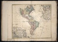
- Beinecke Rare Book and Manuscript Library > Americae mappa generalis : secundum legitimas projectionis stereographicae regulas, relationesque recentissimas et observationes sociorum Acad. reg. sc. quae Parisiis est aliorumque auctorum nec non secundum mentem D.I.M. Hasii ; M.P.P. in partes suas met