Search
You Searched For
Search Results
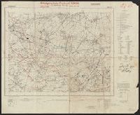
- Creator:
- Allied Forces
Great Britain. War Office. General Staff. Geographical Section
- Published / Created:
- 1943-
- Call Number:
- 11hd 1942D-44
- Image Count:
- 14
- Resource Type:
- Maps, Atlases & Globes
- Found in:
- Beinecke Rare Book and Manuscript Library > Central Europe 1:100,000.
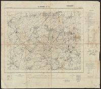
- Creator:
- Great Britain. Ordnance Survey
- Published / Created:
- 1920-21.
- Call Number:
- 32 1920B
- Container / Volume:
- BRBL_00745
- Image Count:
- 11
- Resource Type:
- Maps, Atlases & Globes
- Found in:
- Beinecke Rare Book and Manuscript Library > Ordnance Survey of Great Britain 1/4 inch to one mile.
- Creator:
- Great Britain. Ordnance Survey
- Published / Created:
- 1920-21.
- Call Number:
- 32 1920B
- Container / Volume:
- BRBL_00745
- Image Count:
- 7
- Resource Type:
- Maps, Atlases & Globes
- Found in:
- Beinecke Rare Book and Manuscript Library > Ordnance Survey of Great Britain 1/4 inch to one mile.
- Creator:
- United States. Mississippi River Commission
- Published / Created:
- 1879-
- Call Number:
- BrSides Double Folio 2018 85
- Image Count:
- 1
- Resource Type:
- Maps, Atlases & Globes
- Found in:
- Beinecke Rare Book and Manuscript Library > Survey of the Mississippi River / made under the direction of the Mississippi River Commission.
- Creator:
- Geological and Geographical Survey of the Territories (U.S.)
- Published / Created:
- [1877]
- Call Number:
- 833ca 1878AB
- Container / Volume:
- BRBL_00585
- Image Count:
- 1
- Resource Type:
- Maps, Atlases & Globes
- Found in:
- Beinecke Rare Book and Manuscript Library > Parts of western Wyoming, southeastern Idaho and northeastern Utah [cartographic material] / F.V. Hayden, U.S. geologist in charge ; Harry Gannett, M.E., topographical assistant ; Julius Bien, lith., New York.
- Creator:
- Geological Survey (U.S.)
- Published / Created:
- 1910
- Call Number:
- BrSides Double Folio 2019 84
- Image Count:
- 1
- Resource Type:
- Maps, Atlases & Globes
- Found in:
- Beinecke Rare Book and Manuscript Library > Colorado (Lake County), Leadville special map [cartographic material] / triangulation and topography by A.D. Wilson, chief topographer.
- Creator:
- Geological Survey (U.S.)
- Published / Created:
- 1906
- Call Number:
- BrSides Folio 2019 61
- Image Count:
- 1
- Resource Type:
- Maps, Atlases & Globes
- Found in:
- Beinecke Rare Book and Manuscript Library > Colorado, Central City special map [cartographic material] / U.S. Geological Survey ; E.M. Douglas, geographer ; Frank Tweedy, in charge of section ; topography by Pearson Chapman and D.F. Moor ; triangulation by Frank Tweedy.
- Published / Created:
- 1863
- Call Number:
- 783 C899 1863
- Container / Volume:
- BRBL_00510
- Image Count:
- 1
- Resource Type:
- Maps, Atlases & Globes
- Found in:
- Beinecke Rare Book and Manuscript Library > [Military and topographic map of region about Culpepper Courthouse, Va.].
- Call Number:
- 783 C899 1863B
- Container / Volume:
- BRBL_00510
- Image Count:
- 1
- Resource Type:
- Maps, Atlases & Globes
- Found in:
- Beinecke Rare Book and Manuscript Library > Military and topographic map of region about Culpepper Courthouse, Va.
- Creator:
- Geological Survey (U.S.)
- Published / Created:
- 1913
- Call Number:
- BrSides Double Folio 2019 127
- Image Count:
- 1
- Resource Type:
- Maps, Atlases & Globes
- Found in:
- Beinecke Rare Book and Manuscript Library > Leadville mining district [cartographic material] / U.S. Geological Survey ; R.B. Marshall, chief geographer ; Sledge Tatum, geographer in charge ; topography by E.P. Davis and S.E. Taylor ; control by R.B. Robertson, C.H. Semper, and S.E. Taylor.
- Creator:
- Wheeler, George M. (George Montague), 1842-1905
- Published / Created:
- 1876
- Call Number:
- 842 1876B
- Container / Volume:
- BRBL_00598
- Image Count:
- 1
- Resource Type:
- Maps, Atlases & Globes
- Found in:
- Beinecke Rare Book and Manuscript Library > U.S. geographical surveys west of the 100th meridian [cartographic material] : parts of eastern Arizona and western New Mexico, atlas sheet no. 76 / under the command of 1st. Lieut. Geo. M. Wheeler.
- Creator:
- Geographical Surveys West of the 100th Meridian (U.S.)
- Published / Created:
- 1879
- Call Number:
- 834 1879B
- Container / Volume:
- BRBL_00587
- Image Count:
- 1
- Resource Type:
- Maps, Atlases & Globes
- Found in:
- Beinecke Rare Book and Manuscript Library > Land classification map of part of south western Colorado [cartographic material] : atlas sheet No. 61 (D).
- Creator:
- Geographical Surveys West of the 100th Meridian (U.S.)
- Published / Created:
- 1879
- Call Number:
- 841 1879A
- Container / Volume:
- BRBL_00596
- Image Count:
- 1
- Resource Type:
- Maps, Atlases & Globes
- Found in:
- Beinecke Rare Book and Manuscript Library > U.S. geographical surveys west of the 100th meridian land classification map of part of southern New Mexico, atlas sheet no. 84 (B) [cartographic material] / under the command of 1st. Lieut. Geo. M. Wheeler, Corps of Engineer, U.S. Army.
- Creator:
- Geographical Surveys West of the 100th Meridian (U.S.)
- Published / Created:
- [1878]
- Call Number:
- 841 1878B
- Container / Volume:
- BRBL_00596
- Image Count:
- 1
- Resource Type:
- Maps, Atlases & Globes
- Found in:
- Beinecke Rare Book and Manuscript Library > U.S. geographical surveys west of the 100th meridian part of southern New Mexico, atlas sheet no. 84 (B) [cartographic material] / under the command of 1st. Lieut. Geo. M. Wheeler, Corps of Engineer, U.S. Army.
- Creator:
- Geographical Surveys West of the 100th Meridian (U.S.)
- Published / Created:
- [1876]
- Call Number:
- 842 1876C
- Container / Volume:
- BRBL_00598
- Image Count:
- 1
- Resource Type:
- Maps, Atlases & Globes
- Found in:
- Beinecke Rare Book and Manuscript Library > Parts of eastern and southeastern Arizona, western and southwestern New Mexico, Parts of eastern and southeastern Arizona, western and southwestern New Mexico / U.S. Geographical Surveys West of the 100th Meridian.
- Creator:
- Geographical Surveys West of the 100th Meridian (U.S.)
- Published / Created:
- 1876
- Call Number:
- 842 1876A
- Container / Volume:
- BRBL_00598
- Image Count:
- 1
- Resource Type:
- Maps, Atlases & Globes
- Found in:
- Beinecke Rare Book and Manuscript Library > Parts of Central and Western Arizona [cartographic material] : atlas sheet no. 75.
- Creator:
- Great Britain. Ordnance Survey
- Published / Created:
- 1940-
- Call Number:
- 32 1940
- Container / Volume:
- BRBL_00745
- Image Count:
- 1
- Resource Type:
- Maps, Atlases & Globes
- Found in:
- Beinecke Rare Book and Manuscript Library > Ordnance Survey of Great Britain [cartographic material] : England & Wales.
- Creator:
- Geological Survey (U.S.)
- Published / Created:
- 1917
- Call Number:
- BrSides Elephant Folio 2018 24
- Image Count:
- 2
- Resource Type:
- Maps, Atlases & Globes
- Found in:
- Beinecke Rare Book and Manuscript Library > Topographic map of the Island of Oahu [cartographic material] : city and county of Honolulu / surveyed 1909-1913 by the Engineer Troops, U.S. Army ; control by U.S. Coast and Geodetic Survey and Hawaiian Territorial Survey ; assembled and drawn by the U.S
- Creator:
- Egypt. Maṣlaḥat al-Misāḥah, cartographer, issuing body
- Published / Created:
- 1909-
- Call Number:
- 61 1909
- Container / Volume:
- BRBL_00764
- Image Count:
- 6
- Resource Type:
- Maps, Atlases & Globes
- Found in:
- Beinecke Rare Book and Manuscript Library > Egypt 1:1,000,000 / Survey of Egypt.
- Creator:
- Germany. Heer. Generalstab
- Published / Created:
- 1940
- Call Number:
- 11hd 1942D-54
- Container / Volume:
- BRBL_00010ZE
- Image Count:
- 1
- Resource Type:
- Maps, Atlases & Globes
- Found in:
- Beinecke Rare Book and Manuscript Library > Befestigungskarte Frankreich 1:25000 : St. Amand, Nr. 1-2, XXVI-5/1-2.
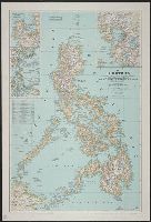
- Creator:
- Bouma, Donald G
Brehm, John J. B
Darley, James M. (James Morrison)
Holdstock, A. E
National Geographic Society (U.S.). Cartographic Division
- Published / Created:
- 1945
- Call Number:
- 28 1945
- Container / Volume:
- BRBL_00023E
- Image Count:
- 1
- Resource Type:
- Maps, Atlases & Globes
- Found in:
- Beinecke Rare Book and Manuscript Library > The Philippines / compiled and drawn in the Cartographic Section of the National Geographic Society ; James M. Darley, chief cartographer ; Apphia E. Holdstock & Donald G. Bouma, compilers ; relief by John J. Brehm.
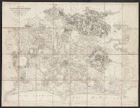
- Call Number:
- 406 1855
- Container / Volume:
- BRBL_00236
- Image Count:
- 1
- Resource Type:
- Maps, Atlases & Globes
- Found in:
- Beinecke Rare Book and Manuscript Library > Pianta Della Campagna Romana Nello Stato Antico e Moderno / To the Right Hon'ble Lord George John Warren Vernon ... this plate is respectfully dedicated by His Lordship's most obed't serv't Luigi Piale ; Domenico Feltrini scrisse ; Augusto Fornari incise,