
You Searched For
1 - 7 of 7
Search Results
- Published / Created:
- 1827?]
- Call Number:
- 8555 1827
- Container / Volume:
- BRBL_00642
- Image Count:
- 1
- Resource Type:
- Maps, Atlases & Globes
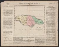
- Description:
- Drawn by J. Finlayson. P.E. Hamm, sc. and Text.
- Subject (Geographic):
- Jamaica--Maps
- Found in:
- Beinecke Rare Book and Manuscript Library > Geographical, Statistical, and Historical Map of Jamaica.
3.
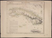
- Creator:
- Vandermaelen, Philippe, 1795-1869
- Published / Created:
- 1825]
- Call Number:
- 855 1825A
- Container / Volume:
- BRBL_00695
- Image Count:
- 1
- Resource Type:
- Maps, Atlases & Globes
- Description:
- Above neat line: Amér. sep. ... No. 67., Cross Collection no. 279., From Vandermaelen's Atlas universel de géographie physique, politique, statistique et minér, Hand col., Includes text: Ile de Cuba., and Relief shown by hachures.
- Publisher:
- Philippe Vandermaelen,
- Subject (Geographic):
- Bahamas--Maps, Cuba--Maps, and Jamaica--Maps
- Subject (Name):
- Ode, Henri and Vandermaelen, Philippe, 1795-1869. Atlas universel de géographie physique, politique, statistique et minéralogique
- Found in:
- Beinecke Rare Book and Manuscript Library > Ile de Cuba / [cartographic material] / dressée et dessinée par Ph. Vandermaelen ; lithographiée par H. Ode, septembre 1825 ; la lettre par Frs. Charles.

- Creator:
- John Thomson & Co
- Published / Created:
- 12 August 1814.
- Call Number:
- 8555 1814
- Container / Volume:
- BRBL_00642
- Image Count:
- 1
- Resource Type:
- Maps, Atlases & Globes
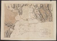
- Alternative Title:
- Harbours of Kingston and Port Royal
- Description:
- "Drawn & engraved for John Thomson & Co.'s New general atlas.", "T. Clerk, sculpt.", Relief shown by hacures and pictorially., Scale given in "statute miles 69 1/2 to a degree," and "sea leagues 20 in a degree.", and Sheet measures 53.7 x 69.6 cm. Label on verso: No. 62.
- Publisher:
- John Thomson & Co.],
- Subject (Geographic):
- Jamaica--Maps
- Subject (Name):
- Clerk, T. (Thomas), engraver and John Thomson & Co. New general atlas
- Subject (Topic):
- Harbors--Jamaica--Kingston--Maps and Harbors--Jamaica--Port Royal--Maps
- Found in:
- Beinecke Rare Book and Manuscript Library > Jamaica [cartographic material].
- Creator:
- John Thomson & Co
- Published / Created:
- 1814?]
- Call Number:
- 8555 1814A
- Container / Volume:
- BRBL_00695
- Image Count:
- 1
- Resource Type:
- Maps, Atlases & Globes
- Alternative Title:
- Harbours of Kingston and Port Royal
- Description:
- "T. Clerk, sculpt.", Cf. Kapp, K.S. Printed maps of Jamaica up to 1825, 145., Cross Collection no. 290., From John Thomson & Co.'s New general atlas., Imperfect: torn along fold, with no loss of text., Label: No. 62., Relief shown by hacures and pictorially., and Variant without publishing statement at bottom.
- Publisher:
- John Thomson & Co.,
- Subject (Geographic):
- Jamaica--Maps
- Subject (Name):
- Clerk, T. (Thomas), engraver and John Thomson & Co. New general atlas
- Subject (Topic):
- Harbors--Jamaica--Kingston--Maps and Harbors--Jamaica--Port Royal--Maps
- Found in:
- Beinecke Rare Book and Manuscript Library > Jamaica [cartographic material].
- Creator:
- Matthews-Northrup Company
- Published / Created:
- c1898.
- Call Number:
- 855 1898
- Container / Volume:
- BRBL_00641
- Image Count:
- 2
- Resource Type:
- Maps, Atlases & Globes
- Alternative Title:
- Map of Cuba, Jamaica, and Porto Rico
- Description:
- Cover title: Map of Cuba, Porto Rico, and Jamaica : with map of the Plant System of railway, steamer, and steamship lines and connections., Ill. and advertisement on verso., and Insets: Porto Rico.--West Indies.--Havana.--Matanzas.--Cienfuegos.--Santiago de Cuba.
- Publisher:
- Matthews-Northrup Co.,
- Subject (Geographic):
- Cuba--Maps, Jamaica--Maps, Puerto Rico--Maps, and West Indies--Maps
- Found in:
- Beinecke Rare Book and Manuscript Library > The Matthews-Northrup up-to-date map of Cuba, Jamaica, and Porto Rico : with general map of the West Indies.

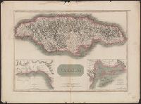
- Creator:
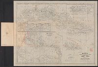
- Wyld, James, 1812-1887
- Published / Created:
- 1851
- Call Number:
- 8555 1851
- Container / Volume:
- BRBL_00642
- Image Count:
- 2
- Resource Type:
- Maps, Atlases & Globes
- Alternative Title:
- Jamaica
- Description:
- " ... published ... Feby. 28th, 1851.", Advertisement mounted on verso., Includes statistical data., and Relief shown by hachures and spot heights.
- Publisher:
- Published by J. Wyld,
- Subject (Geographic):
- Jamaica--Maps
- Found in:
- Beinecke Rare Book and Manuscript Library > The island of Jamaica / by James Wyld, geographer to the Queen and H.R.H. Prince Albert.