Search
You Searched For
Search Results
- Creator:
- Berry, William, fl. 1669-1708, creator
- Published / Created:
- [1689?]
- Call Number:
- 1973 Folio 10
- Image Count:
- 1
- Resource Type:
- Maps, Atlases & Globes
- Found in:
- Beinecke Rare Book and Manuscript Library > A new mapp of the kingdome of England and Wales: containing all the cities, market towns, with the roades from town to town, and the numbers of reputed miles between them, are given by inspection without scale or compass
- Creator:
- Browne, Christopher, fl. 1684-1712, bookseller
Lea, Philip, fl. 1683-1700
Morden, Robert, d. 1703, creator
- Published / Created:
- 1700
- Call Number:
- 1973 Folio 10
- Image Count:
- 1
- Resource Type:
- Maps, Atlases & Globes
- Found in:
- Beinecke Rare Book and Manuscript Library > This actuall survey of London, Westminster & Southwark is humbly dedicated to ye Ld. Mayor [and] Court of Aldermen by Ro. Morden, Phil. Lea, Chr. Browne
- Creator:
- Browne, Christopher, fl. 1684-1712, creator
- Published / Created:
- [169-?]
- Call Number:
- 1973 Folio 10
- Image Count:
- 1
- Resource Type:
- Maps, Atlases & Globes
- Found in:
- Beinecke Rare Book and Manuscript Library > A new chart of the sea coasts of France: together with the English Chanell describing ye severall harbors, sands, rocks, and anchoridges, etc. on the said coasts
- Creator:
- Visscher, Nicolaes, 1649-1702, creator
- Published / Created:
- [ca. 1689]
- Call Number:
- 1973 Folio 10
- Image Count:
- 1
- Resource Type:
- Maps, Atlases & Globes
- Found in:
- Beinecke Rare Book and Manuscript Library > Exactissima Regni Scotiae tabula tam in septentrionalem et meriodionalem quam in minores earundem provincias, insulasq[ue], ei undique praetensas accurate divisa
- Creator:
- Browne, Christopher, fl. 1684-1712, bookseller
Morden, Robert, d. 1703, creator
Petty, William, Sir, 1623-1687
- Published / Created:
- [ca. 1700]
- Call Number:
- 1973 Folio 10
- Image Count:
- 1
- Resource Type:
- Maps, Atlases & Globes
- Found in:
- Beinecke Rare Book and Manuscript Library > A new map of Ireland
- Creator:
- Browne, Christopher, fl. 1684-1712, creator
- Published / Created:
- [1704?]
- Call Number:
- 1973 Folio 10
- Image Count:
- 1
- Resource Type:
- Maps, Atlases & Globes
- Found in:
- Beinecke Rare Book and Manuscript Library > The war in Portugall and Spain: with the harbours of the Groyne, Vigo & Bayonna, Porto, Lisbon [and] St. Ubes, Cadiz, and a chart from England to the streights
- Creator:
- Berry, William, fl. 1669-1708, creator
Sanson, Nicolas, 1600-1667
- Published / Created:
- [1682]
- Call Number:
- 1973 Folio 10
- Image Count:
- 1
- Resource Type:
- Maps, Atlases & Globes
- Found in:
- Beinecke Rare Book and Manuscript Library > Spain divided into its severall kingdoms and principalities, according as they are comprehended under the crowns of Castile and Aragon, in the possession of his Catholick Majesty and under the crown of Portugal, in the possession of the king of Portugal
- Creator:
- Berry, William, fl. 1669-1708, creator
Sanson, Nicolas, 1600-1667
- Published / Created:
- [168-]
- Call Number:
- 1973 Folio 10
- Image Count:
- 1
- Resource Type:
- Maps, Atlases & Globes
- Found in:
- Beinecke Rare Book and Manuscript Library > Principality of Catalonia: in which are comprehended the counties of Rossillion and of Cerdagne divided into its severall vigueries or provost-ship
- Creator:
- Berry, William, fl. 1669-1708, creator
Sanson, Nicolas, 1600-1667
- Published / Created:
- [168-]
- Call Number:
- 1973 Folio 10
- Image Count:
- 1
- Resource Type:
- Maps, Atlases & Globes
- Found in:
- Beinecke Rare Book and Manuscript Library > The kingdom of France: distinguished according to the extent of all its provinces and conquests in Spain, Italy, Germany, Flanders, Artoise, Haynoult, Namur, and Luxembourg, provinces of the low countries
- Creator:
- La Feuille, Jacques de., creator
- Published / Created:
- [168-?]
- Call Number:
- 1973 Folio 10
- Image Count:
- 1
- Resource Type:
- Maps, Atlases & Globes
- Found in:
- Beinecke Rare Book and Manuscript Library > Lutetiae Parisiorum universae Galliae metropolis novissima [et] accuratissima
- Creator:
- Wit, Frederik de., creator
- Published / Created:
- [ca. 1700]
- Call Number:
- 1973 Folio 10
- Image Count:
- 1
- Resource Type:
- Maps, Atlases & Globes
- Found in:
- Beinecke Rare Book and Manuscript Library > Gouvernement General de Languedoc: divise en ses vint deux Diocesez
- Creator:
- Jaillot, Alexis Hubert, 1632?-1712
Sanson, Nicolas, 1600-1667, creator
- Published / Created:
- 1693
- Call Number:
- 1973 Folio 10
- Image Count:
- 1
- Resource Type:
- Maps, Atlases & Globes
- Found in:
- Beinecke Rare Book and Manuscript Library > La Suisse divisee en ses treze cantons, ses alliez [et] ses sujets
- Creator:
- Berry, William, fl. 1669-1708, creator
Sanson, Nicolas, 1600-1667
- Published / Created:
- 1682
- Call Number:
- 1973 Folio 10
- Image Count:
- 1
- Resource Type:
- Maps, Atlases & Globes
- Found in:
- Beinecke Rare Book and Manuscript Library > Italy: distinguished according to the extent of all the states, kingdoms, republicks, dukedoms, principalities etc. that doe at present divide it
- Creator:
- Browne, Christopher, fl. 1684-1712, bookseller
Morden, Robert, d. 1703, creator
- Published / Created:
- [168-?]
- Call Number:
- 1973 Folio 10
- Image Count:
- 1
- Resource Type:
- Maps, Atlases & Globes
- Found in:
- Beinecke Rare Book and Manuscript Library > A new map of the estates of Savoy [and] Piedmont: with the countries adjacent
- Creator:
- Browne, Christopher, fl. 1684-1712, bookseller
Jaillot, Alexis Hubert, 1632?-1712, creator
Morden, Robert, d. 1703, bookseller
- Published / Created:
- [ca. 1701]
- Call Number:
- 1973 Folio 10
- Image Count:
- 1
- Resource Type:
- Maps, Atlases & Globes
- Found in:
- Beinecke Rare Book and Manuscript Library > H. Jalliots map of the seat of war in Italy cont. ye duchyes of Milan, Mantua, Parma, etc. with the Venetian territoryes
- Creator:
- Wit, Frederik de., creator
- Published / Created:
- [ca. 1680]
- Call Number:
- 1973 Folio 10
- Image Count:
- 1
- Resource Type:
- Maps, Atlases & Globes
- Found in:
- Beinecke Rare Book and Manuscript Library > Status ecclesiasticus et magnus ducatus Thoscanae
- Creator:
- Browne, Christopher, fl. 1684-1712, creator
- Published / Created:
- [ca. 1700?]
- Call Number:
- 1973 Folio 10
- Image Count:
- 1
- Resource Type:
- Maps, Atlases & Globes
- Found in:
- Beinecke Rare Book and Manuscript Library > A new mapp of Rome shewing its antient and present scituation
- Creator:
- Wit, Frederik de., creator
- Published / Created:
- [1706?]
- Call Number:
- 1973 Folio 10
- Image Count:
- 1
- Resource Type:
- Maps, Atlases & Globes
- Found in:
- Beinecke Rare Book and Manuscript Library > Regnum Neapolis: in quo sunt Aprutium ulterius et citerius, Comitatus Molisius, Terra Laboris, Capitaniata Principatus ulterior et citerior, Terra Bariensis et Hidruntina, Basilicata, Calabria citerior et ulterior
- Creator:
- Berry, William, fl. 1669-1708, creator
- Published / Created:
- [ca. 1680]
- Call Number:
- 1973 Folio 10
- Image Count:
- 1
- Resource Type:
- Maps, Atlases & Globes
- Found in:
- Beinecke Rare Book and Manuscript Library > Mediterranean Sea divided into its principal parts or seas
- Creator:
- Berry, William, fl. 1669-1708, creator
Sanson, Nicolas, 1600-1667
- Published / Created:
- 1683
- Call Number:
- 1973 Folio 10
- Image Count:
- 1
- Resource Type:
- Maps, Atlases & Globes
- Found in:
- Beinecke Rare Book and Manuscript Library > The states of the empire of the Turks in Europe: subdivided according to ye extent of its governments
- Creator:
- Berry, William, fl. 1669-1708, creator
Sanson, Nicolas, 1600-1667
- Published / Created:
- [168-?]
- Call Number:
- 1973 Folio 10
- Image Count:
- 1
- Resource Type:
- Maps, Atlases & Globes
- Found in:
- Beinecke Rare Book and Manuscript Library > The kingdom of Hungary and the states that have been subject to it which are now the northern parts of Turkey in Europe
- Creator:
- Berry, William, fl. 1669-1708, creator
Sanson, Nicolas, 1600-1667
- Published / Created:
- [ca. 1686]
- Call Number:
- 1973 Folio 10
- Image Count:
- 1
- Resource Type:
- Maps, Atlases & Globes
- Found in:
- Beinecke Rare Book and Manuscript Library > The empire of Germany divided according to the extent of all the estates, principalities and soveraignities that are or have been comprehended under the name of Germany
- Creator:
- Berry, William, fl. 1669-1708, creator
Sanson, Nicolas, 1600-1667
- Published / Created:
- [ca. 1686]
- Call Number:
- 1973 Folio 10
- Image Count:
- 1
- Resource Type:
- Maps, Atlases & Globes
- Found in:
- Beinecke Rare Book and Manuscript Library > Part of the circle of Austria viz the Archdukedom of Austria, divided into the higher and lower
- Creator:
- Berry, William, fl. 1669-1708, creator
Sanson, Nicolas, 1600-1667
- Published / Created:
- 1688
- Call Number:
- 1973 Folio 10
- Image Count:
- 1
- Resource Type:
- Maps, Atlases & Globes
- Found in:
- Beinecke Rare Book and Manuscript Library > Part of the circle of Austria in which are the Dukedomes of Stiria, and Carinthia, of Carniola, and other heriditary countrys of the house of Austria
- Creator:
- Berry, William, fl. 1669-1708, creator
Sanson, Nicolas, 1600-1667
- Published / Created:
- [ca. 1686]
- Call Number:
- 1973 Folio 10
- Image Count:
- 1
- Resource Type:
- Maps, Atlases & Globes
- Found in:
- Beinecke Rare Book and Manuscript Library > The circle of Bavaria subdivided into all ye territories it's composed of
- Creator:
- Jaillot, Alexis Hubert, 1632?-1712
Sanson, Nicolas, 1600-1667, creator
- Published / Created:
- 1696
- Call Number:
- 1973 Folio 10
- Image Count:
- 1
- Resource Type:
- Maps, Atlases & Globes
- Found in:
- Beinecke Rare Book and Manuscript Library > Le cercle de Franconie : subdivise en tous les estats qui le composent
- Creator:
- Berry, William, fl. 1669-1708, creator
Sanson, Nicolas, 1600-1667
- Published / Created:
- [ca. 1686]
- Call Number:
- 1973 Folio 10
- Image Count:
- 1
- Resource Type:
- Maps, Atlases & Globes
- Found in:
- Beinecke Rare Book and Manuscript Library > The circle of Swabia subdivided into all the territories it's composed of
- Creator:
- Berry, William, fl. 1669-1708, creator
Sanson, Nicolas, 1600-1667
- Published / Created:
- 1689
- Call Number:
- 1973 Folio 10
- Image Count:
- 1
- Resource Type:
- Maps, Atlases & Globes
- Found in:
- Beinecke Rare Book and Manuscript Library > The circle and electorat of the Rhine : subdivided into all the states that it's composed off [sic]
- Creator:
- Berry, William, fl. 1669-1708, creator
- Published / Created:
- [ca. 1689]
- Call Number:
- 1973 Folio 10
- Image Count:
- 1
- Resource Type:
- Maps, Atlases & Globes
- Found in:
- Beinecke Rare Book and Manuscript Library > The course of the river Rhine : from its fountain to its runing into the sea in which is distinguish't all the estates and soveraignities which are upon it and about it
- Creator:
- Berry, William, fl. 1669-1708, creator
- Published / Created:
- [ca. 1689]
- Call Number:
- 1973 Folio 10
- Image Count:
- 1
- Resource Type:
- Maps, Atlases & Globes
- Found in:
- Beinecke Rare Book and Manuscript Library > The circle of Westphalia : divided into all it's states and soveranities
- Creator:
- Berry, William, fl. 1669-1708, creator
Sanson, Nicolas, 1600-1667
- Published / Created:
- [ca. 1684?]
- Call Number:
- 1973 Folio 10
- Image Count:
- 1
- Resource Type:
- Maps, Atlases & Globes
- Found in:
- Beinecke Rare Book and Manuscript Library > The dukedom and electorat of Brandenbourg: which is part of the circle of the higher Saxony, divided into its principall parts
- Creator:
- Berry, William, fl. 1669-1708, creator
Sanson, Nicolas, 1600-1667
- Published / Created:
- [ca. 1689?]
- Call Number:
- 1973 Folio 10
- Image Count:
- 1
- Resource Type:
- Maps, Atlases & Globes
- Found in:
- Beinecke Rare Book and Manuscript Library > The dukedom of Pomerania : divided into it's principall parts
- Creator:
- Wit, Frederik de., creator
- Published / Created:
- [ca. 1696]
- Call Number:
- 1973 Folio 10
- Image Count:
- 1
- Resource Type:
- Maps, Atlases & Globes
- Found in:
- Beinecke Rare Book and Manuscript Library > Ducatus Prussiae tam Polono Regiae quam Brandenburgo Ducalis : correcta descriptio et divisio Regiae scilicet in tres Palatinatus, et Ducalis in totidem circulos, cum utrius[que] subdivisione in tractus minores
- Creator:
- Valck, G. (Gerard), 1651 or 2-1726, creator
- Published / Created:
- [169-?]
- Call Number:
- 1973 Folio 10
- Image Count:
- 1
- Resource Type:
- Maps, Atlases & Globes
- Found in:
- Beinecke Rare Book and Manuscript Library > Tabula ducatuum Livoniae et Curlandiae: recentior incisa editaque
- Creator:
- Berry, William, fl. 1669-1708, creator
Burnford, Tho., engraver
Sanson, Nicolas, 1600-1667
- Published / Created:
- [ca. 1683]
- Call Number:
- 1973 Folio 10
- Image Count:
- 1
- Resource Type:
- Maps, Atlases & Globes
- Found in:
- Beinecke Rare Book and Manuscript Library > Poland : subdivided according to the extent of its severall palatinates
- Creator:
- Berry, William, fl. 1669-1708, creator
Sanson, Nicolas, 1600-1667
- Published / Created:
- 1682
- Call Number:
- 1973 Folio 10
- Image Count:
- 1
- Resource Type:
- Maps, Atlases & Globes
- Found in:
- Beinecke Rare Book and Manuscript Library > Russia Alba, or, Moscovia : divided according to the extent of the kingdoms, dukedoms, principalities, provinces, and peoples that are at present under the dominion of the Czar of Russia, known by the name of Great Duke of Moscovia
- Creator:
- Berry, William, fl. 1669-1708, creator
Sanson, Nicolas, 1600-1667
- Published / Created:
- 1684
- Call Number:
- 1973 Folio 10
- Image Count:
- 1
- Resource Type:
- Maps, Atlases & Globes
- Found in:
- Beinecke Rare Book and Manuscript Library > Scandinavia and its confines in which are the kingdoms of Sweden, Denmark, and Norway divided into their principall provinces
- Creator:
- Berry, William, fl. 1669-1708, creator
Sanson, Nicolas, 1600-1667
- Published / Created:
- [1684?]
- Call Number:
- 1973 Folio 10
- Image Count:
- 1
- Resource Type:
- Maps, Atlases & Globes
- Found in:
- Beinecke Rare Book and Manuscript Library > The kingdom of Denmark : subdivided into its principall provinces
- Creator:
- Berry, William, fl. 1669-1708, creator
Sanson, Nicolas, 1600-1667
- Published / Created:
- [1684?]
- Call Number:
- 1973 Folio 10
- Image Count:
- 1
- Resource Type:
- Maps, Atlases & Globes
- Found in:
- Beinecke Rare Book and Manuscript Library > The United Provinces of the Netherlands : with their conquests in Flanders, Brabant, Limbourg, and Liege, and the places they possessed upon the Rhine in the Dutchy of Cleve and in the Arch-Bishoprick and elector of Colen
- Creator:
- Gouwen, Gilliam van der
Visscher, Nicolaes, 1649-1702, creator
- Published / Created:
- [1690?]
- Call Number:
- 1973 Folio 10
- Image Count:
- 1
- Resource Type:
- Maps, Atlases & Globes
- Found in:
- Beinecke Rare Book and Manuscript Library > Hollandiae Comitatus in ejusdem subjacentes ditiones : una cum toto ultrjectino dominio, nec non maximus partibus Geldriae Ducatus, Frisiae Comitatus, aliarumq[ue] vicinarum provinciarum foederatarum
- Creator:
- Wit, Frederik de., creator
- Published / Created:
- [ca. 1680]
- Call Number:
- 1973 Folio 10
- Image Count:
- 1
- Resource Type:
- Maps, Atlases & Globes
- Found in:
- Beinecke Rare Book and Manuscript Library > Exactissima Amstelodami veteris et novissimi delineatio
- Creator:
- Browne, Christopher, fl. 1684-1712
Fer, Nicolas de, 1646-1720, creator
- Published / Created:
- [1704?]
- Call Number:
- 1973 Folio 10
- Image Count:
- 1
- Resource Type:
- Maps, Atlases & Globes
- Found in:
- Beinecke Rare Book and Manuscript Library > A new mapp of the theatre of the warr in Flanders and on the Rhine: together with the Dutch and French frontiers and their conquests in the same
- Creator:
- Schenk, Peter, 1660-1718 or 9, creator
- Published / Created:
- [1700?]
- Call Number:
- 1973 Folio 10
- Image Count:
- 1
- Resource Type:
- Maps, Atlases & Globes
- Found in:
- Beinecke Rare Book and Manuscript Library > Flandriae comitatus : in suastoparchias optime distinctus, una cum vicinis et finitimis
- Creator:
- Berry, William, fl. 1669-1708, creator
Sanson, Nicolas, 1600-1667
- Published / Created:
- 1680
- Call Number:
- 1973 Folio 10
- Image Count:
- 1
- Resource Type:
- Maps, Atlases & Globes
- Found in:
- Beinecke Rare Book and Manuscript Library > Asia divided into its principall regions in which may be seen the extent of the empires, monarchies, kingdoms and states which at present divide Asia
- Creator:
- Berry, William, fl. 1669-1708, creator
Sanson, Nicolas, 1600-1667
- Published / Created:
- [ca. 1689?]
- Call Number:
- 1973 Folio 10
- Image Count:
- 1
- Resource Type:
- Maps, Atlases & Globes
- Found in:
- Beinecke Rare Book and Manuscript Library > The empire of the great Turke [sic] in Europe, Asia, [and] Africa : divided into all its Beglerbeglicz or governments in which are also distinguished the states that are tributary to him
- Creator:
- Wit, Frederik de., creator
Witsen, Nicolaas, 1641-1717
- Published / Created:
- [1700?]
- Call Number:
- 1973 Folio 10
- Image Count:
- 1
- Resource Type:
- Maps, Atlases & Globes
- Found in:
- Beinecke Rare Book and Manuscript Library > Magnae Tartariae : magni Mogolis imperii, Iaponiae et Chinae : nova descriptio ex tabula ampliss viri D.N. Witsen pro majori parte aliis auctoribus excerpta et dita
- Creator:
- L'Huilier, Joannes, engraver
Wit, Frederik de., creator
- Published / Created:
- [1662]
- Call Number:
- 1973 Folio 10
- Image Count:
- 1
- Resource Type:
- Maps, Atlases & Globes
- Found in:
- Beinecke Rare Book and Manuscript Library > Tabula Indiae orientalis
- Creator:
- Wit, Frederik de., creator
- Published / Created:
- [1666?]
- Call Number:
- 1973 Folio 10
- Image Count:
- 1
- Resource Type:
- Maps, Atlases & Globes
- Found in:
- Beinecke Rare Book and Manuscript Library > Nova Persiae, Armeniae, Natoliae, et Arabiae descriptio
- Creator:
- Jansson, Jan, 1588-1664, creator
- Published / Created:
- [ca. 1657?]
- Call Number:
- 1973 Folio 10
- Image Count:
- 1
- Resource Type:
- Maps, Atlases & Globes
- Found in:
- Beinecke Rare Book and Manuscript Library > Syriae sive Soriae : nova et accurata descriptio
- Creator:
- Cordier, Louis, d. 1711, engraver
Jaillot, Alexis Hubert, 1632?-1712, creator
Sanson, Guillaume
- Published / Created:
- [ca. 1692]
- Call Number:
- 1973 Folio 10
- Image Count:
- 1
- Resource Type:
- Maps, Atlases & Globes
- Found in:
- Beinecke Rare Book and Manuscript Library > Iudea seu Terra Sancta quae Hebraeorum sive Israelitarum in suas duodecim tribus divisa : secretis ab invicem regnis Iuda et Israel expressis in super sex ultimi temporis ejusdem terrae provincijs
- Creator:
- Berry, William, fl. 1669-1708, creator
Sanson, Nicolas, 1600-1667
- Published / Created:
- 1680
- Call Number:
- 1973 Folio 10
- Image Count:
- 1
- Resource Type:
- Maps, Atlases & Globes
- Found in:
- Beinecke Rare Book and Manuscript Library > Africa : divided according to the extent of its principall parts in which are distinguished one from the other the empires, monarchies, kingdoms, states and peoples, which at this time inhabite Africa
- Creator:
- Blaeu, Joan, 1596-1673, creator
- Published / Created:
- [ca. 1670]
- Call Number:
- 1973 Folio 10
- Image Count:
- 1
- Resource Type:
- Maps, Atlases & Globes
- Found in:
- Beinecke Rare Book and Manuscript Library > Nova Aegypti tabula
- Creator:
- Blaeu, Joan, 1596-1673, creator
- Published / Created:
- [1662?]
- Call Number:
- 1973 Folio 10
- Image Count:
- 1
- Resource Type:
- Maps, Atlases & Globes
- Found in:
- Beinecke Rare Book and Manuscript Library > Nigritarum regio
- Creator:
- Blaeu, Joan, 1596-1673, creator
- Published / Created:
- [ca. 1690?]
- Call Number:
- 1973 Folio 10
- Image Count:
- 1
- Resource Type:
- Maps, Atlases & Globes
- Found in:
- Beinecke Rare Book and Manuscript Library > Aethiopia superior vel interior, vulgo Abissinorum sive Presbiteri Ioannis imperium
- Creator:
- Blaeu, Joan, 1596-1673, creator
- Published / Created:
- [ca. 1690]
- Call Number:
- 1973 Folio 10
- Image Count:
- 1
- Resource Type:
- Maps, Atlases & Globes
- Found in:
- Beinecke Rare Book and Manuscript Library > Aethiopia inferior vel exterior: partes magis Septentrionales, quae hic desiderantur, vide in tabula Aethiopiae superioris
- Creator:
- Lea, Philip, fl. 1683-1700, creator
- Published / Created:
- [1696]
- Call Number:
- 1973 Folio 10
- Image Count:
- 1
- Resource Type:
- Maps, Atlases & Globes
- Found in:
- Beinecke Rare Book and Manuscript Library > The principall islands in America belonging to the English empire viz Iamaica, Barbados, Antegoa, St. Christophers [and] Bermudos
- Creator:
- Berry, William, fl. 1669-1708, creator
Sanson, Nicolas, 1600-1667
- Published / Created:
- 1680
- Call Number:
- 1973 Folio 10
- Image Count:
- 1
- Resource Type:
- Maps, Atlases & Globes
- Found in:
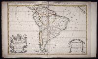
- Beinecke Rare Book and Manuscript Library > South America divided into its principall parts where are distinguished the severall states which belong to the Spanish, English, Portugals, and French
- Creator:
- Mortier, David
Mortier, Pierre
Sanson, Nicolas, 1600-1667, creator
- Published / Created:
- [1710]
- Call Number:
- 1973 Folio 10
- Image Count:
- 1
- Resource Type:
- Maps, Atlases & Globes
- Found in:
- Beinecke Rare Book and Manuscript Library > Teatre de la guerre en Flandre [et] Brabant, les pays conquis et le Bas-Rhein etc
- Published / Created:
- Undated
- Call Number:
- 1973 Folio 10
- Image Count:
- 1
- Resource Type:
- Maps, Atlases & Globes
- Found in:
- Beinecke Rare Book and Manuscript Library > A view of Prince Charles's passage over ye Rhine being a new and correct plan of that river from ye city of Maintz to Fort Louis
- Published / Created:
- 1847 February 22
- Call Number:
- WA MSS S-1882
- Image Count:
- 1
- Resource Type:
- Maps, Atlases & Globes
- Found in:
- Beinecke Rare Book and Manuscript Library > Map of San Francisco, Calif., 1847
- Creator:
- Kerby, E. R
- Published / Created:
- 1906 May
- Call Number:
- BrSides Zc41 906ke
- Image Count:
- 2
- Resource Type:
- Maps, Atlases & Globes
- Found in:
- Beinecke Rare Book and Manuscript Library > The Norman & Kerby map of Kiowa-Comanche Indian Reservations, Oklahoma opened for settlement 1906 : showing all lands allotted to Indians and leased for agricultrial purposes to date : carefully drawn and compiled from government survey plats and official information from U.S. Indian agent at Anadarko, Okla., and the U.S. Land Office at Lawton, Oklahoma / by E.R. Kerby
- Creator:
- Colorado Midland Railway Company
- Published / Created:
- undated
- Call Number:
- WA MSS S-1741 BrSides
- Collection Title:
- Colorado Midland Railway Company maps
- Container / Volume:
- Folder 2
- Image Count:
- 10
- Resource Type:
- Maps, Atlases & Globes
- Found in:
- Beinecke Rare Book and Manuscript Library > [Maps of Garfield County, Colorado]
- Creator:
- Colorado Midland Railway Company
- Published / Created:
- undated
- Call Number:
- WA MSS S-1741 BrSides
- Collection Title:
- Colorado Midland Railway Company maps
- Container / Volume:
- Folder 3
- Image Count:
- 15
- Resource Type:
- Maps, Atlases & Globes
- Found in:
- Beinecke Rare Book and Manuscript Library > [Maps of Lake County, Colorado]
- Creator:
- Colorado Midland Railway Company
- Published / Created:
- undated
- Call Number:
- WA MSS S-1741 BrSides
- Collection Title:
- Colorado Midland Railway Company maps
- Container / Volume:
- Folder 4
- Image Count:
- 11
- Resource Type:
- Maps, Atlases & Globes
- Found in:
- Beinecke Rare Book and Manuscript Library > [Maps of Park and Chaffee Counties, Colorado]
- Creator:
- Colorado Midland Railway Company
- Published / Created:
- undated
- Call Number:
- WA MSS S-1741 BrSides
- Collection Title:
- Colorado Midland Railway Company maps
- Container / Volume:
- Folder 5
- Image Count:
- 12
- Resource Type:
- Maps, Atlases & Globes
- Found in:
- Beinecke Rare Book and Manuscript Library > [Maps of Park and Chaffee Counties, Colorado]
- Creator:
- Colorado Midland Railway Company
- Published / Created:
- undated
- Call Number:
- WA MSS S-1741 BrSides
- Collection Title:
- Colorado Midland Railway Company maps
- Container / Volume:
- Folder 6
- Image Count:
- 13
- Resource Type:
- Maps, Atlases & Globes
- Found in:
- Beinecke Rare Book and Manuscript Library > [Maps of Park and Chaffee Counties, Colorado]
- Creator:
- Colorado Midland Railway Company
- Published / Created:
- undated
- Call Number:
- WA MSS S-1741 BrSides
- Collection Title:
- Colorado Midland Railway Company maps
- Container / Volume:
- Folder 7
- Image Count:
- 10
- Resource Type:
- Maps, Atlases & Globes
- Found in:
- Beinecke Rare Book and Manuscript Library > [Maps of Pitkin and Eagle Counties, Colorado]
- Creator:
- Colorado Midland Railway Company
- Published / Created:
- undated
- Call Number:
- WA MSS S-1741 BrSides
- Collection Title:
- Colorado Midland Railway Company maps
- Container / Volume:
- Folder 8
- Image Count:
- 11
- Resource Type:
- Maps, Atlases & Globes
- Found in:
- Beinecke Rare Book and Manuscript Library > [Maps of Pitkin and Eagle Counties, Colorado]
- Creator:
- Colorado Midland Railway Company
- Published / Created:
- undated
- Call Number:
- WA MSS S-1741 BrSides
- Collection Title:
- Colorado Midland Railway Company maps
- Container / Volume:
- Folder 9
- Image Count:
- 22
- Resource Type:
- Maps, Atlases & Globes
- Found in:
- Beinecke Rare Book and Manuscript Library > [Maps of Aspen Branch, Jerome Park Branch, Pitkin-Garfield Counties, Colorado]
- Creator:
- Colorado Midland Railway Company
- Published / Created:
- undated
- Call Number:
- WA MSS S-1741 BrSides
- Collection Title:
- Colorado Midland Railway Company maps
- Container / Volume:
- Folder 1
- Image Count:
- 8
- Resource Type:
- Maps, Atlases & Globes
- Found in:
- Beinecke Rare Book and Manuscript Library > [Maps of Garfield County, Colorado]
- Creator:
- Pine, John, 1690-1756
Rocque, John, d. 1762
Tinney, John
- Published / Created:
- 1746
- Call Number:
- 2002 Folio 94
- Image Count:
- 24
- Resource Type:
- Maps, Atlases & Globes
- Found in:
- Beinecke Rare Book and Manuscript Library > A plan of the cities of London and Westminster, and borough of Southwark, with the contiguous buildings / from an actual survey, taken by John Rocque, land-surveyor, and engraved by John Pine ...
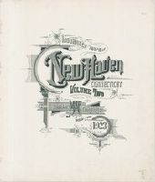
- Creator:
- Sanborn Map Company, issuing body
- Published / Created:
- 1924
- Call Number:
- 766 N46 1924
- Image Count:
- 92
- Resource Type:
- Maps, Atlases & Globes
- Found in:
- Beinecke Rare Book and Manuscript Library > Insurance maps of New Haven, Connecticut. Volume 2.
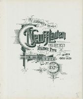
- Creator:
- Sanborn Map Company, issuing body
- Published / Created:
- 1924
- Call Number:
- 766 N46 1924
- Image Count:
- 55
- Resource Type:
- Maps, Atlases & Globes
- Found in:
- Beinecke Rare Book and Manuscript Library > Insurance maps of New Haven, Connecticut. Volume 5.
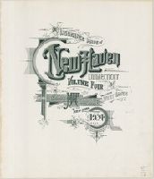
- Creator:
- Sanborn Map Company, issuing body
- Published / Created:
- 1924
- Call Number:
- 766 N46 1924
- Image Count:
- 92
- Resource Type:
- Maps, Atlases & Globes
- Found in:
- Beinecke Rare Book and Manuscript Library > Insurance maps of New Haven, Connecticut. Volume 4.
- Creator:
- Sanborn Map Company, issuing body
- Published / Created:
- 1924
- Call Number:
- 766 N46 1924
- Image Count:
- 82
- Resource Type:
- Maps, Atlases & Globes
- Found in:
- Beinecke Rare Book and Manuscript Library > Insurance maps of New Haven, Connecticut. Volume 3.