; Massachusetts as far north as Boston, including Cape
Alternative Title:
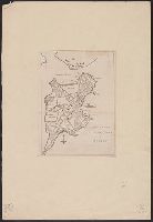
Colony of Rhode Island and Rhode Island
Description:
"London Magazine 1778"--Top margin., From The London Magazine (November 1778)., Publisher from bottom margin., Relief shown pictorially., and Sheet measures 21 x 28.4 cm. Inscription on verso: William Akers. Cross Collection no. 198.
Publisher:
Printed for R. Baldwin at the Rose, Pater Noster Row,
Subject (Geographic):
New England--Maps--Early works to 1800
Subject (Name):
Akers, William--Autograph and Baldwin, R. (Robert), 1737-1810
"Zu Ebelings Erdbeschreibung von Amerika.", Also shows county boundaries., Atlas plate: No. III., Place names in German and English., Prime meridians: Greenwich and Washington., Relief shown by hachures. Depths shown by soundings., and Sheet measures 51 x 70 cm. Franklin Collection no. 131 1796 3.
Publisher:
Bey Carl Ernst Bohn,
Subject (Geographic):
Massachusetts--Administrative and
Subject (Name):
Bohn, Carl Ernst, publisher, Ebeling, Christophe Daniel, 1741-1817. Erdbeschreibung und Geschichte von Amerika, and Schmidt, Paulus Christoph, engraver
Gentleman's magazine (London, England) and Plan of the town of Boston
Description:
"Charles Town in ruins" is indicated in the northern part of the map., By Robert Aitken; no engraver's signature., From: The gentleman's magazine, v. 45, Oct. 1775., Relief shown pictorially., and Shows streets, wharves, fortifications, and The Common.
Publisher:
Gentleman's magazine,
Subject (Geographic):
Boston (Mass.)--Buildings, structures, etc.--Maps--Early works to 1800 and Boston (Mass.)--Maps--Early works to 1800
From the Atlantic Neptune, Vol.3, ,,, the coast and harbours of New England ... From the surveys ... by Samuel Holland, Esq. Part II. Plate "9". and Stipple engraved sailing chart, land col. pale brown by hand, modified for individual holdings, cities red. Hi